Utah Breaking News, Sports and Weather


Latest News & Features
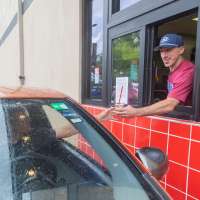
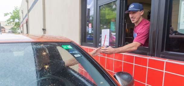
Celebrate Dad this Father's Day with these food deals
Emma Neff, Deseret News | Posted June 20 - 10:34 p.m. | Save Story
If you want stick with the same old Father's Day lineup, go ahead and buy him that tie, but if you want to be his favorite child, take him out to snag this weekend's food deals.

Horse-drawn carriage rides in New York on hold after teen tourist's death
Michael Casey, Associated Press | Posted June 20 - 9:47 p.m. | Save Story
Horse carriage rides in Central Park are on hold at least until Tuesday as safety protocols are reviewed after the a death of a young tourist who jumped from a runaway horse carriage.

Trump blames Reflecting Pool woes on vandalism
The Associated Press | Posted June 20 - 9:03 p.m. | Save Story
The paint is peeling from Washington's Reflecting Pool after the renovation ordered by President Donald Trump, and he is now alleging that someone damaged it intentionally.

'The Odyssey' just got an R rating. That's a much bigger deal than it sounds
John Clyde for KSL | Posted June 20 - 8:28 p.m. | Save Story
"The Odyssey" has received an R rating and that carries more than it may seem for Christopher Nolan's expensive epic.

Mike Lee pursuing bill to bolster fines on immigrants in the country illegally, their employers
Tim Vandenack, KSL | Posted June 20 - 7:03 p.m. | Save Story
Sen. Mike Lee is pursuing legislation to bolster the fines applicable to immigrants who enter the country illegally and their employers.
US and Iran to talk Sunday in Switzerland as Tehran says it closed Strait of Hormuz again
Kareem Chehayeb, Bassem Mroue, Seung Min Kim and Munir Ahmed, Associated Press | Updated June 20 - 6:52 p.m. | Save Story
U.S. and Iranian negotiators are on their way to discuss details of an interim agreement to halt the war, after Iran said it closed the Strait of Hormuz due to Israel's attacks in Lebanon.

Sandy firefighters urge hydration, reparation after heat injury rescue
Andrew Adams, KSL | Posted June 20 - 6:31 p.m. | Save Story
As temperatures soared into the 90s Friday causing a heat injury rescue, firefighters warned hikers to be prepared for summer weather, including proper hydration.

Norway imposes near ban on AI in elementary school
Terje Solsvik, Reuters | Posted June 20 - 5:30 p.m. | Save Story
Norway is imposing a near ban on the use of generative AI tools by elementary school pupils while also restricting their use in the education of older children to prevent a negative impact, the country's prime minister said.

St. George therapist shares healing journey through music, aims to help others
Arianne Brown, KSL | Posted June 20 - 5:03 p.m. | Save Story
St. George therapist, Cory Reese has navigated his own healing journey through creating music, and has turned that into helping others through his therapy practice.

Invest like a woman: Female investing habits examined
Peter Rosen, KSL | Posted June 20 - 4:17 p.m. | Save Story
If you're worrying about dark clouds lurking over the stock market and are unsure what to do, you might consider this advice: Invest like a woman.

Have You Seen This? Cute idea at the finish line ends in disaster
Grant Olsen for KSL | Posted June 20 - 3:32 p.m. | Save Story
The good news is that this couple escaped their tumble without any injuries. The bad news is the picture-perfect finale was ruined.

Utah DNR rejects recommendation to ban cougar trapping on public lands
Kevin Lind, Deseret News | Posted June 20 - 2:58 p.m. | Save Story
The Wildlife Board of Utah's Division of Natural Resources "unanimously rejected" a proposed change to cougar trapping rules during a meeting on Thursday.
Have a parks idea for South Salt Lake's downtown area? The city wants your input
Curtis Booker, KSL | Posted June 20 - 1:54 p.m. | Save Story
Officials in South Salt Lake are seeking resident input for its downtown parks master plan.

PARTNER
Josh Groban reveals his favorite duet in his career
Lottie Elizabeth Johnson, Deseret News | Posted June 20 - 1:46 p.m. | Save Story
The singer's dad put the trumpet aside decades ago to raise a family. "I was amazed at how getting back on that bike for him was instant," Groban said.

Utah marks a year of battling measles, with no clear end in sight
Devi Shastri, Associated Press | Posted June 20 - 12:55 p.m. | Save Story
Utah has spent the past year fighting measles outbreaks in almost every county. And experts say there's no clear end in sight.
Man arrested for investigation of reckless burning after Memory Grove blaze
Arianne Brown, KSL | Updated June 20 - 12:03 p.m. | Save Story
A person is in custody and has been booked for investigation of reckless burning after a fire burned a section of Memory Grove in Salt Lake City on Friday morning.

'This is pretty significant': 480-acre conservation easement secured at base of Payson Canyon
Arianne Brown, KSL | Posted June 20 - 12:01 p.m. | Save Story
A 480-acre conservation easement was secured at the base of Payson county, in a partnership between neighboring cities Payson and Lehi. Local outdoor recreationists have been working on preserving the area for decades and call it a "significant" milestone for future generations.

SPONSORED
Test Drive: The 2026 Ford Explorer Tremor is the best Explorer yet
Jason Bell | Posted June 20 - 11:30 a.m. | Save Story
If you want a rugged family hauler that checks every box, it's tough to imagine anything better than the Explorer Tremor.
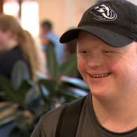
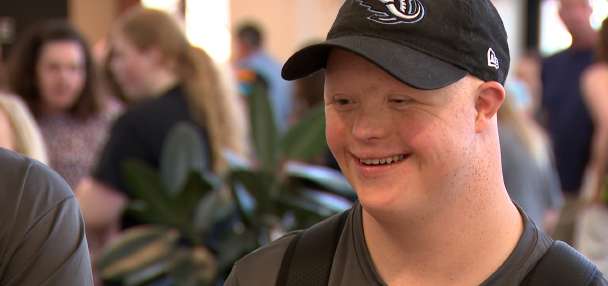
Team Utah heads to Special Olympics USA Games in Minnesota
Emma Benson, KSL | Posted June 20 - 11:17 a.m. | Save Story
It was a big day for Team Utah Friday as athletes headed to the 2026 Special Olympics USA Games.
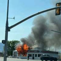
2 injured, including firefighter, in Tremonton tire shop fire
Arianne Brown, KSL | Updated June 20 - 10:50 a.m. | Save Story
A firefighter and another person were sent to the hospital following injuries sustained in a tire shop fire in Tremonton on Friday morning.

Investors see Micron earnings as pulse check of AI rally momentum
Laura Matthews, Reuters | Posted June 20 - 10:37 a.m. | Save Story
Investors are seeking signs that the U.S. stock market rally fueled by AI has more life left in it, and the upcoming Micron Technology earnings will check the pulse of chip demand to see if it is still accelerating.
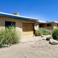
After a car crash left a Sandy animal shelter in limbo, leaders are hopeful for its recovery
Curtis Booker, KSL | Posted June 20 - 10:01 a.m. | Save Story
Leaders at the Utah Animal Adoption Center in Sandy say they're facing a financial strain after a crash damaged the building in April.

Man shot, killed at Taylorsville gas station
Joe Wirthlin, KSL | Posted June 20 - 9:57 a.m. | Save Story
A man was shot and killed in Taylorsville early Saturday during a fight at a Speedway gas station.

Markets


-DJIA--
-Nasdaq--
-S&P 500--
STAY IN THE KNOW
Get informative articles and interesting stories delivered to your inbox weekly.
Subscribe to the KSL.com Trending 5.
By subscribing, you acknowledge and agree to KSL.com's
Terms of Use
and Privacy Notice.

Sports »

Paraguay beats Turkey 1-0 at the World Cup despite being down a man to clinch Group D for US
Features »

James Burrows, director of classic TV comedies including 'Cheers' and 'Friends,' dies at 85


Utah »
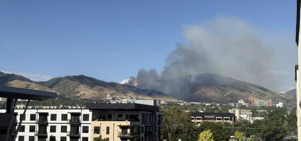
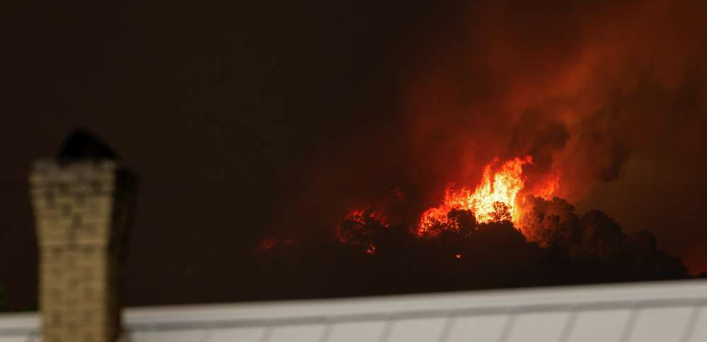
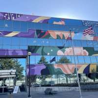
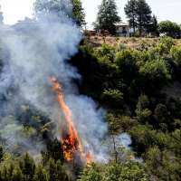
U. students told to shelter in place as fire continues to burn near Red Butte Canyon
- 'Life-threatening': Juab County wildfire forces evacuations as it explodes to 13,000 acres
- Celebrate Dad this Father's Day with these food deals
- Mike Lee pursuing bill to bolster fines on immigrants in the country illegally, their employers
- Sandy firefighters urge hydration, reparation after heat injury rescue
Voces de Utah »

Mike Lee pursuing bill to bolster fines on immigrants in the country illegally, their employers
- Nearly 3,000 Colombians in Utah eligible to vote in Colombia's presidential election
- Activities slated to mark World Refugee Day, celebrate mariachi music
- Proposed immigrant detention center site in Salt Lake City to be offloaded, newspaper reports
- West Valley City removes Cesar Chavez Drive signs; Ogden leaders still mulling issue
Politics »

Trump blames Reflecting Pool woes on vandalism
- Mike Lee pursuing bill to bolster fines on immigrants in the country illegally, their employers
- US and Iran to talk Sunday in Switzerland as Tehran says it closed Strait of Hormuz again
- President Donald Trump unveils the new Air Force One, a converted Qatari jet
- Norway imposes near ban on AI in elementary school
»
U. students told to shelter in place as fire continues to burn near Red Butte Canyon
- 'Life-threatening': Juab County wildfire forces evacuations as it explodes to 13,000 acres
- Celebrate Dad this Father's Day with these food deals
- Mike Lee pursuing bill to bolster fines on immigrants in the country illegally, their employers
- Sandy firefighters urge hydration, reparation after heat injury rescue
