Before and after: How pollution trapped by the inversion changes Salt Lake's scenery


Save Story

Show 1 more video

Leer en español

Estimated read time: 4-5 minutes

This archived news story is available only for your personal, non-commercial use. Information in the story may be outdated or superseded by additional information. Reading or replaying the story in its archived form does not constitute a republication of the story.

SALT LAKE CITY — Brace yourselves, inversion season is here.

Many across Utah’s most populated counties got their first taste of the pollution trapped by the inversion this weekend — and relief isn’t expected until at least Wednesday. That's when the Utah Division of Air Quality projects the next "moderate" air quality day will be, due to a storm that is forecasted to push through the northern part of the state.

Poor air quality isn’t a new issue for the state, but it’s certainly become a recurring topic — so much so that the state’s proposed 2020 budget includes $100 million set aside to tackle the problem.

It’s one of those issues that immediately rises back to the forefront each winter.

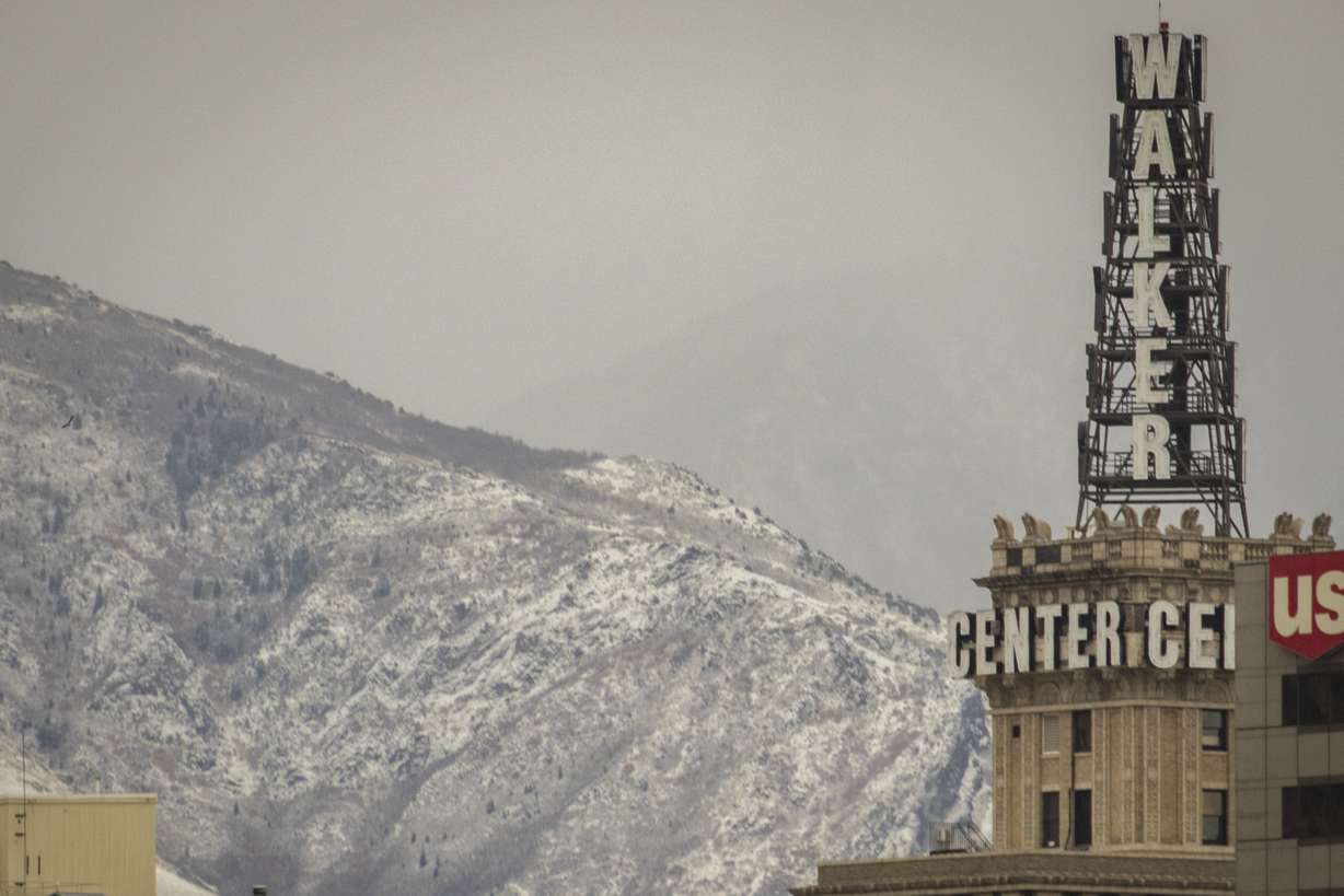
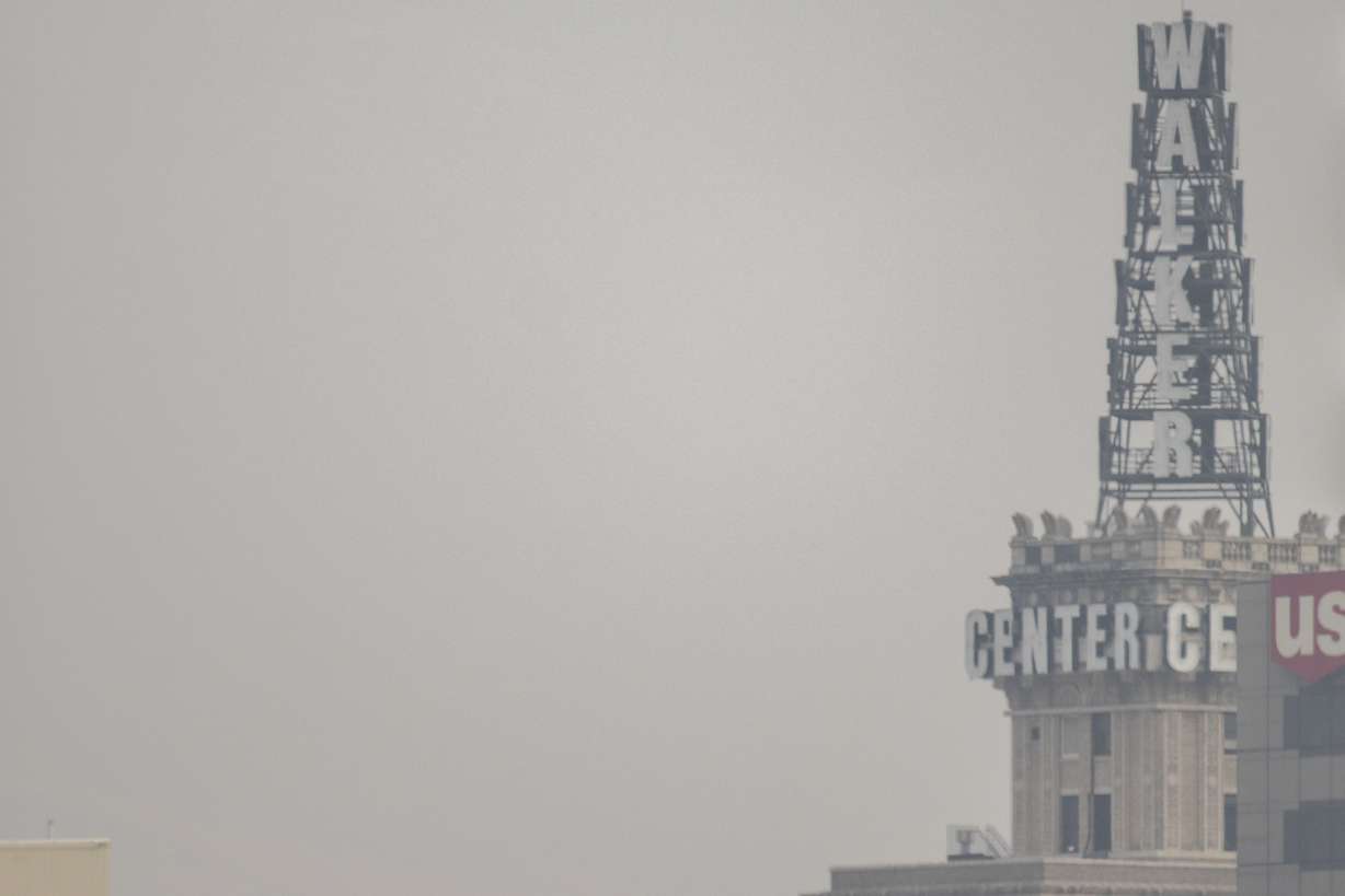
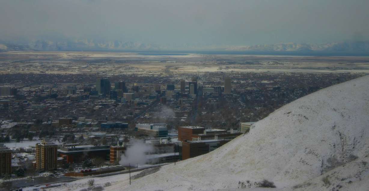
When smoke from wildfires covered the state back in August, I strolled through Salt Lake City to recreate some of the previous photos of the city I had taken over the past few years. The difference was extremely noticeable then. Mountains vanished from the skyline and details of downtown buildings were stripped away by the haze.

So how much does the pollution from the inversion change the cityscape?

I went back through the city Saturday to try the same before-and-after photo experiment to truly illustrate the difference during an inversion. In Salt Lake County, Particulate Matter 2.5, the air pollutant that causes health concerns, reached around 40 micrograms per cubic meter air that afternoon, which is commonly referred to an "orange" air quality day by the Division of Air Quality.

The visual results were even more stunning.
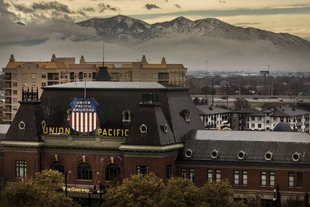
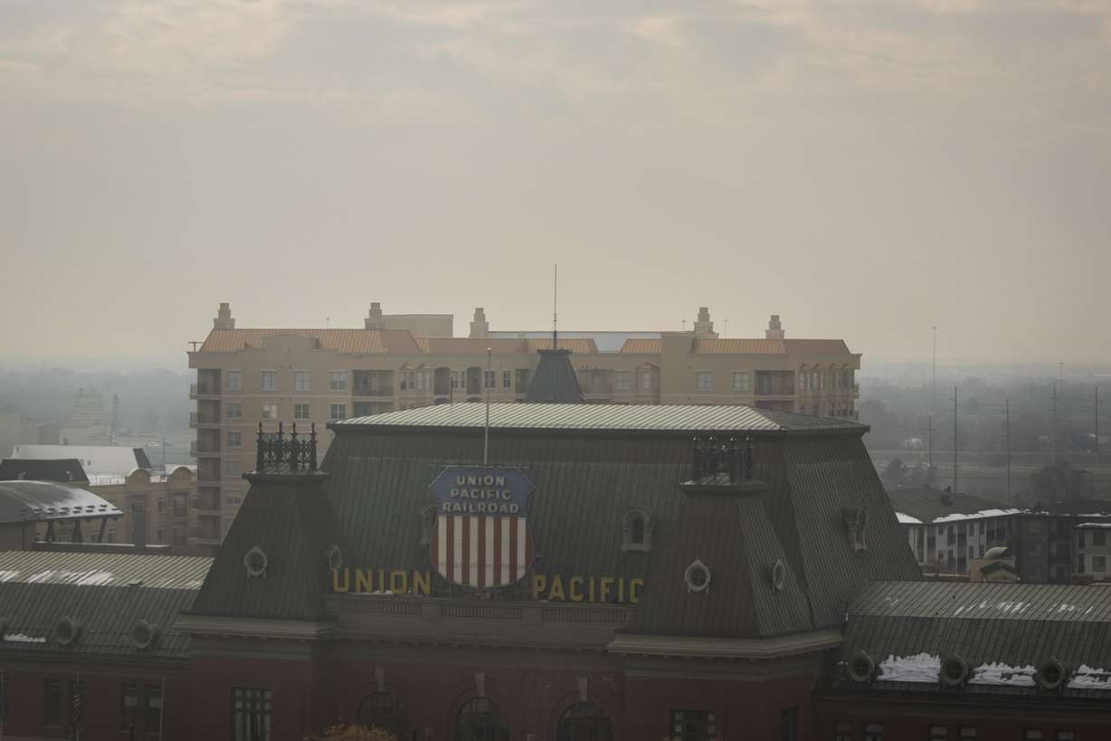
KSL Building

The KSL Building at the Triad Center, one of the city’s more western buildings, offers a great view of downtown Salt Lake City, the Wasatch Front, the Oquirrh Mountains and Capitol Hill. While the city and Capitol Hill are still visible on bad air quality days, the mountains aren’t.

Facing east

From this view, you should be able to see the foothills beyond the Salt Lake Temple, as seen in this first photo taken after a Thanksgiving storm.

Facing southeast

The same concept goes here. You can typically see all of Salt Lake County’s distinctive peaks from the building — on a clean air day.

An image from the KSL Building taken Thursday, Nov. 22, 2018. Despite a storm passing through at the time, the Wasatch range is visible beyond the Walker Center building. (Photo: Carter Williams, KSL.com)
An image from the KSL Building taken Saturday, Dec. 8, 2018. The Wasatch range is no longer visible beyond the Walker Center building. (Photo: Carter Williams, KSL.com)

Facing southwest

Here, you should be able to see the Oquirrh Mountains without a problem.

An image from the KSL Building taken after a storm on Thursday, Nov. 22, 2018. The Oqurrih Mountains are visible beyond the Union Pacific Depot. (Photo: Carter Williams, KSL.com)
An image from the KSL Building taken Saturday, Dec. 8, 2018. The Oqurrih Mountains are no longer visible beyond the Union Pacific Depot. (Photo: Carter Williams, KSL.com)

Triad Center parking garage

Again, you should be able to see distant mountains, even on a cloudy day.
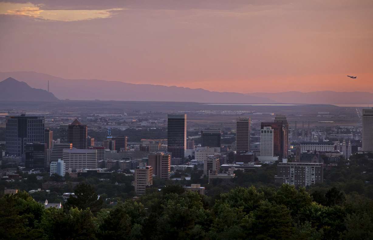
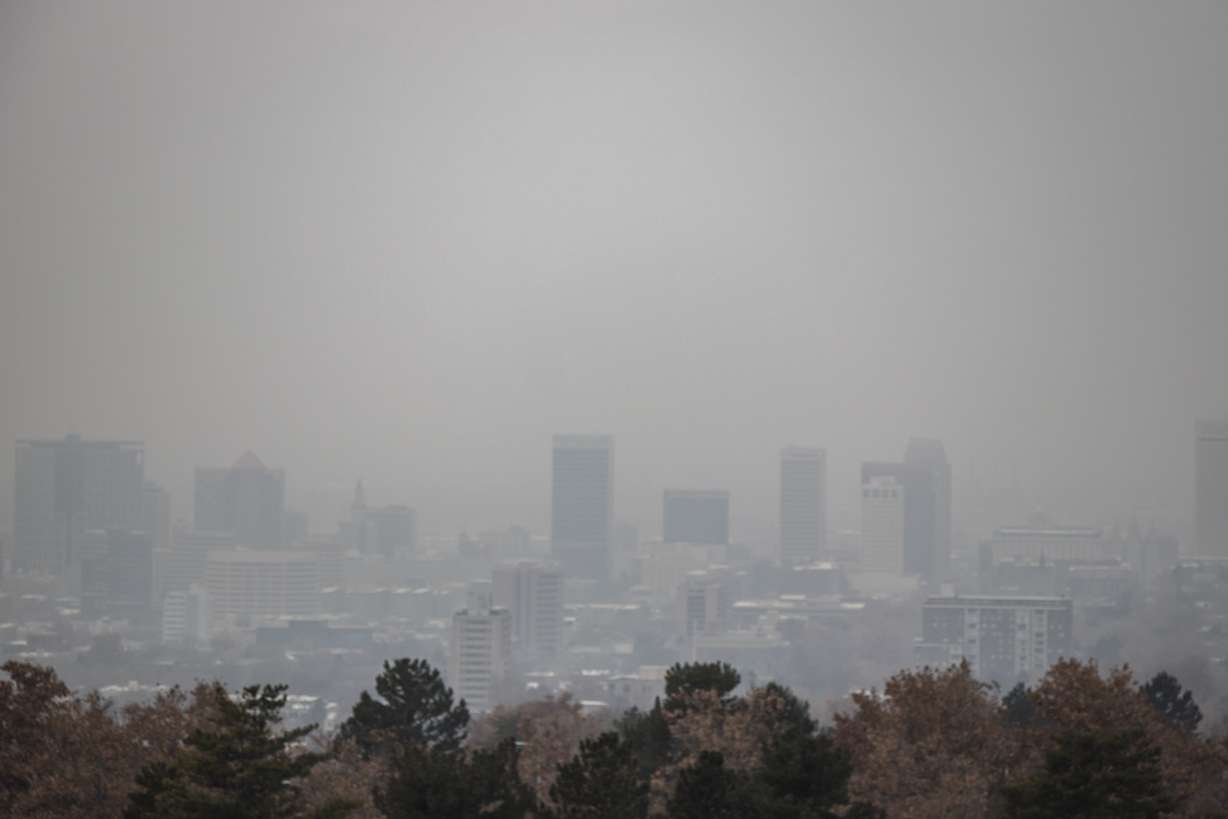
An image from the Triad Center parking garage in Salt Lake City on Saturday, Nov. 25, 2017. Despite the cloudy day, the west is very much visible as the sun sets. (Photo: Carter Williams, KSL.com)
An image from the Triad Center parking garage in Salt Lake City on Saturday, Dec. 8, 2018. The visibility west of the city is much more limited here. (Photo: Carter Williams, KSL.com)

Memory Grove

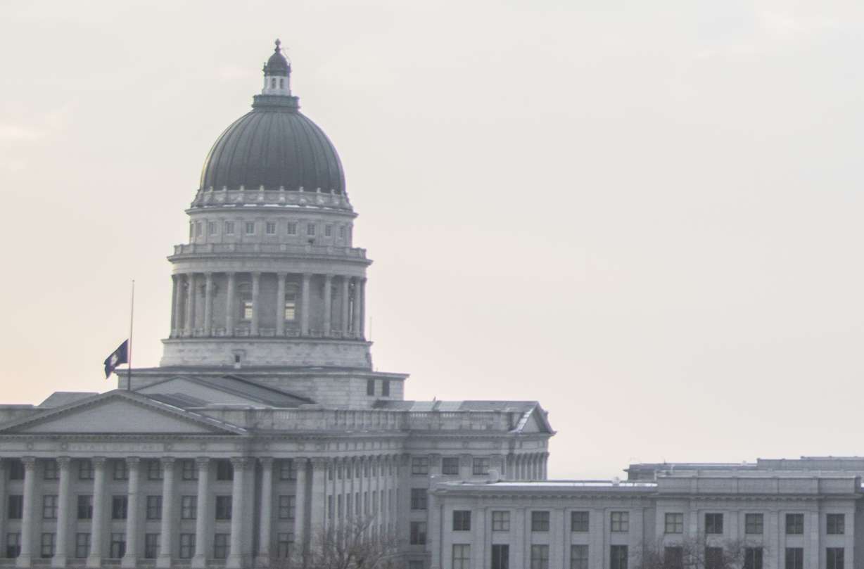
This spot, from the western part of the Avenues above the Memory Grove glen, allows visitors a beautiful view of downtown Salt Lake and it’s a great place to see a sunset behind the Utah Capitol.

Facing west

On a clean air day, you can see Antelope Island and Stansbury Island, which are pictured in the distance in the first photo. Typically, you can even see planes taking off from the Salt Lake City International Airport. All of those disappear from view during a bad air day.

A view from Memory Grove looking west during a sunset on Thursday, July 19, 2018. (Photo: Carter Williams, KSL.com)
A view from Memory Grove looking west at the Utah Capitol on Saturday, Dec. 8, 2018. The details beyond the Capitol aren't visible here. (Photo: Carter Williams, KSL.com)

Facing south

From this angle, visitors still see downtown Salt Lake City, but can’t see the Oquirrh Mountains.

Primary Children’s Hospital

The hospital’s parking lot is a great place to watch a sunset behind the downtown skyline — on a good air quality day. However, at approximately 20 blocks of distance, the downtown buildings even become a bit hazy.
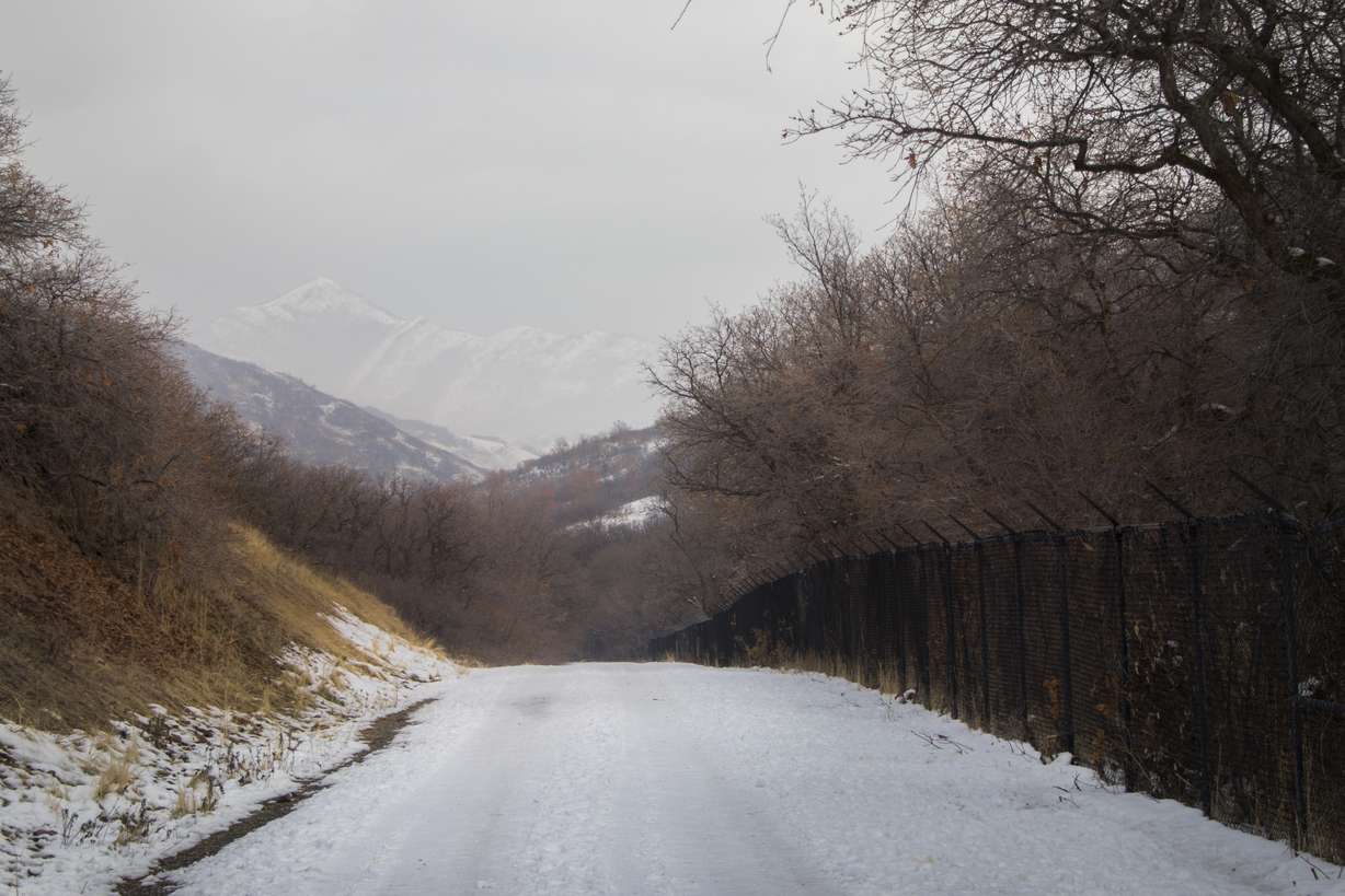
A view of Salt Lake City from the Primary Children's Hospital parking lot on Friday, July 13, 2018. Mountains in the west and the Great Salt Lake are visible in the distance. (Photo: Carter Williams, KSL.com)
A view of Salt Lake City from the Primary Children's Hospital parking lot on Saturday, Dec. 8, 2018. The city buildings began to become less clear from this vantage point. (Photo: Carter Williams, KSL.com)

Red Butte Canyon

From 100 feet of the parking lot gate, visitors get a good view of a small peak in the distance. That becomes difficult to see on an orange air day.

An image from Red Butte Canyon Road after a snow storm on Saturday, Jan. 10, 2015. The mountains in the background are distinct from here.
An image from Red Butte Canyon Road after a snow storm on Saturday, Dec. 8, 2018. The mountains in the background are much less clear from here.

Red Butte Skyline Nature Trail

This is an enjoyable trail with, as the name states, all sorts of nature. In fact, I stumbled upon a few coyotes while walking it on Saturday. However, perhaps its best quality is a breathtaking view of the Salt Lake City skyline, the valley, the Great Salt Lake, Antelope Island and Stansbury Island.

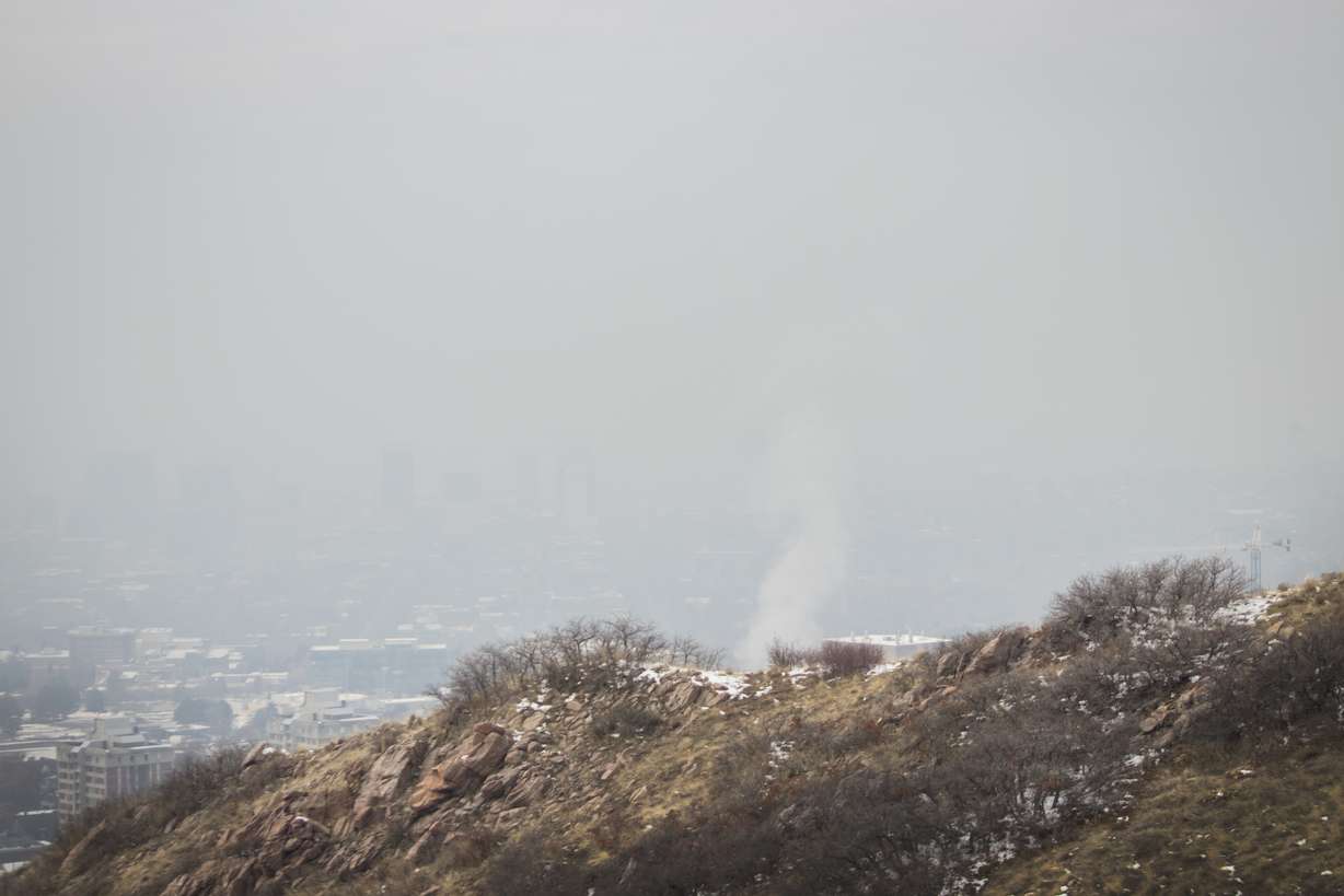
On Saturday, I tried to recreate one of the first pictures I ever took of the city, but I couldn’t even see a faint outline of the city buildings from the trail.

A view of Salt Lake City from the Red Butte Skyline Nature Trail on Saturday, Jan. 10, 2015. In addition to the city buildings, you can see the Great Salt Lake and the mountains to the west. (Photo: Carter Williams, KSL.com)
A view of Salt Lake City from the Red Butte Skyline Nature Trail on Saturday, Dec. 8, 2018. The pollution was thick enough that it was nearly impossible to make out where the city buildings were. (Photo: Carter Williams, KSL.com)

Here's one way you can see the buildings.

Related stories

Most recent Outdoors stories

Related topics

OutdoorsUtah
Carter Williams is an award-winning reporter who covers general news, outdoors, history and sports for KSL.com.

STAY IN THE KNOW

Get informative articles and interesting stories delivered to your inbox weekly. Subscribe to the KSL.com Trending 5.
By subscribing, you acknowledge and agree to KSL.com's Terms of Use and Privacy Policy.

KSL Weather Forecast