- Guardsman Pass reopened early, connecting travelers to the Wasatch Backcountry.
- The reopening follows snow clearance and low snowpack.
- Record-high temperatures are expected this week.
PARK CITY — Summer might officially be a little more than a month away, but it will sure feel like it in Utah this week.
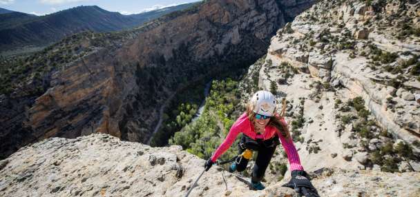
Guardsman Pass, a scenic seasonal route between Big Cottonwood Canyon and the Wasatch Backcountry, reopened on Monday, the Utah Department of Transportation reported.
🚧 ROAD OPEN: Guardsman Pass is now open for summer.
— UDOT Cottonwood Canyons (@UDOTcottonwoods) May 11, 2026
Enjoy your travels and be safe! pic.twitter.com/tjNRjyJ1fY
Its reopening comes after crews cleared out all the high-elevation snow, reconnecting travelers to many iconic recreation areas near Park City and Midway.
The seasonal reopening is the earliest since at least 2020, according to online records. It came a week earlier than the past two years, amid a lower snowpack. The road also opened nearly a month earlier than in 2023, when a record-high snowpack blanketed the state.
Summer-like temperatures return
The road's reopening coincides with another summer preview in Utah's forecast.
A high-pressure ridge is setting up over the Southwest to start the week, which will bring record-high temperatures back to Utah, said KSL meteorologist Matt Johnson.
It's reminicent to a system in March that shattered many daily temperature records. High temperatures are projected to reach the upper 80s and low 90s across valleys in Utah's northern half through Wednesday, even reaching the 80s in higher-elevation communities like Park City.
Highs will also be in the 80s and 90s elsewhere in the state, potentially reaching triple digits closer to St. George and other lower-elevation parts of southern Utah.
How long will it last?
The high-pressure system will gradually move east, reaching the Texas panhandle by Wednesday, while a low-pressure system pushes through the Pacific Northwest.
That is projected to produce windier conditions in the areas in between, like Utah, Johnson explains. It will help lower high temperatures by about 10 degrees for the remainder of the workweek, but also increase fire risks.
"Midweek fire danger is definitely elevated," he said. "Please be careful. We'll see gusts up to 20 (mph), maybe up to 30 (mph). Fire season comes early this year, just because we didn't have the snowpack we anticipated in a normal year. We've also had some rain to help grow that vegetation."
There's a small chance of showers or thunderstorms on Wednesday. High temperatures are currently forecast to remain in the 70s across the Wasatch Front heading into the weekend as the state cools.
Full seven-day forecasts for areas across Utah can be found online at the KSL Weather Center.