- Utah's April snowpack reached a 96-year record low, with 2.7 inches of snow water equivalent statewide.
- This year's peak snowpack was 8.3 inches, lowest in the modern era of data.
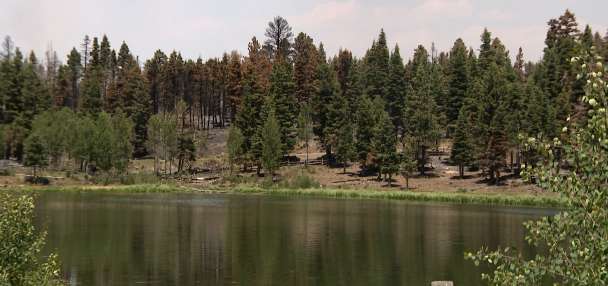
- About 60% of Utah is in extreme drought, impacting spring runoff and water supply.
SALT LAKE CITY — Federal hydrologists scrambled to find records of anything remotely close to the type of snowfall Utah's mountains were receiving about this time three years ago.
Just three years later, they found themselves doing the same to describe how little snowfall the mountains had received, and found it broke the least-desired record by "a wide margin."
Utah entered April with 2.7 inches of snow water equivalent in its mountains, which is much lower than anything ever recorded since scientists began tracking Utah's snowpack almost a century ago, the Natural Resources Conservation Service noted in a special report Friday.
"The snowpack in 2026 is truly unprecedented," wrote Jordan Clayton, a hydrologist for the Conservation Service.
While storms this week have dumped over 2½ feet of snow in some mountain areas since the start of April, the statewide snowpack has only jumped back up to 3.4 inches, which is still nearly 3 inches below the snow water equivalent collected across over 100 comparable sites on April 1, 2015, the previous low point, according to the agency.
Other hydrologists, including those with the National Weather Service, don't expect that this year's peak of 8.3 inches on March 9 will be reached again, largely because of how much snowpack was lost during a record-setting warm stretch in March.
That means this year's snowpack will end up with the lowest peak in the modern age of snowpack data collection, which was previously held by 2015's 10.2 inches.
However, snowpack monitoring in Utah's mountains goes back much further in history — and it beat all those records, too, in comparable datasets.
Scientists across the West began to discover the relationship between mountain snowfall and water sources toward the start of the 20th century. Colorado State University began collecting data in the early 1900s, and the U.S. Department of Agriculture, which oversees the Conservation Service, began overseeing across the West in the 1930s, Water Education Colorado points out.
About 95% of Utah's water supply is now traced back to snowpack, and its snowpack data dates back to 1930. This year's April 1 snowpack was lower than what was reported on the same date in 2015, 1934, 1977 and 2018, which round out the bottom five in snowpack, Clayton wrote.
Although the Conservation Service's 2026 data is a measurement of over 100 sites, the agency's all-time record-low analysis only explored 15 comparable sites, which are found throughout Utah's regions.
It's possible there were lower peaks during the pre-1980 years, but measurements weren't monitored daily like they are now, and there were fewer monitoring sites, which is why experts usually refer to records set since 1980. The same goes for years before snowpack was better understood.
Yet, the modern era shows that snowpack tends to peak in early April, so it's a good point to compare snowpacks in different eras.
This year's April 1 total fell below 1934, which had held the state's warmest year on record before that was shattered last year, largely because the 2026 water year — beginning in October — opened on a record-warm note. 1934 remains the state's third-driest calendar year on record, as well, amid the infamous Dust Bowl that slammed North America during the Great Depression.
This year also ended up well below the 1977 season, the year that forced resorts to invest in snowmaking equipment. Even with snowmaking, about half of the state's 15 resorts had shuttered service for the season by April because of the low snowfall in the mountains this year.
The record-low snowpack is already manifesting other challenges beyond that. Almost 60% of the state is now in extreme drought or worse, up from 7% the week before, the U.S. Drought Monitor reported on Thursday.
Clayton noted that it's also "created challenges for runoff modeling," but the Conservation Service and other agencies have warned that Utah will face spring runoffs that are well below normal this year. Updated water forecasts are expected to be released next week.