'%3e%3cpath%20d='M34.1406%205.85938C30.3906%202.10547%2025.3047%200%2020%200C14.6953%200%209.60938%202.10547%205.85938%205.85938C2.10938%209.61328%200%2014.6953%200%2020C0%2025.3047%202.10547%2030.3906%205.85938%2034.1406C9.61328%2037.8906%2014.6953%2040%2020%2040C25.3047%2040%2030.3906%2037.8945%2034.1406%2034.1406C37.8906%2030.3906%2040%2025.3047%2040%2020C40%2014.6953%2037.8945%209.60938%2034.1406%205.85938ZM37.0117%2023.543H31.1602V13.5391H27.6328V19.9414C28.1211%2020.6914%2028.3711%2021.582%2028.3711%2022.5625V22.625C28.3711%2023.668%2028.1172%2024.6055%2027.6328%2025.4297V26.6094H36.082C33.4883%2032.9375%2027.2891%2037.3789%2020.0039%2037.3789C10.3711%2037.3789%202.62109%2029.6289%202.62109%2020C2.62109%2010.3711%2010.3711%202.62109%2020%202.62109C29.6289%202.62109%2037.3789%2010.3711%2037.3789%2020C37.3789%2021.1484%2037.2617%2022.2656%2037.0508%2023.3477C37.0391%2023.4141%2037.0234%2023.4766%2037.0117%2023.543Z'%20fill='white'/%3e%3cpath%20d='M22.3086%2018.5352C20.4336%2018.125%2019.9531%2017.8398%2019.9766%2017.1836V17.1406C19.9766%2016.6992%2020.3477%2016.2148%2021.4023%2016.2148C22.582%2016.2148%2023.8867%2016.6797%2025.0781%2017.4766L26.8516%2015.0195C25.4453%2013.8906%2023.707%2013.3398%2021.5547%2013.3398C18.5195%2013.3398%2016.4375%2015%2016.4063%2017.4766V17.5352C16.3633%2020.2617%2018.5859%2020.9805%2021.293%2021.6016C23.0391%2021.9766%2023.5703%2022.3164%2023.5703%2022.9609L23.5469%2022.9766C23.5469%2023.3906%2023.2578%2023.7031%2022.7852%2023.8359C22.5742%2023.9062%2022.1289%2023.9727%2021.5156%2023.9727C20.7617%2023.9727%2019.7539%2023.8633%2018.6328%2023.4844C18.0898%2023.2891%2017.4727%2023.0039%2016.8047%2022.6133L20.1406%2026.625C20.2813%2026.6602%2021.0977%2026.8516%2021.7734%2026.8516C25.0039%2026.8516%2027.0859%2025.2461%2027.1094%2022.6328V22.5703C27.1602%2020.1133%2025.2148%2019.1719%2022.3086%2018.5352Z'%20fill='white'/%3e%3cpath%20d='M5.24219%2013.5664V26.6133H8.75391V23.7578L10.2969%2021.9531L14.2031%2026.6133H18.3867L12.3555%2019.5195L17.4023%2013.5664H13.4531L8.75391%2019.0586V13.5664H5.24219Z'%20fill='white'/%3e%3c/g%3e%3cdefs%3e%3cclipPath%20id='clip0_97_2430'%3e%3crect%20width='40'%20height='40'%20fill='white'/%3e%3c/clipPath%3e%3c/defs%3e%3c/svg%3e)


- Utah experienced its warmest winter in over a century, averaging 36.4 degrees.
- Climate change and lack of polar jet stream contributed to the unusual warmth.
- Low snowpack may affect reservoirs and increase fire risk, prompting state monitoring.
SALT LAKE CITY — This past winter was officially Utah's warmest in over a century, contributing to many of the snowpack challenges facing the state.
Utah posted a statewide average temperature of 36.4 degrees between Dec. 1 and Feb. 28, shattering the previous meteorological record — set during the 2014-2015 winter — by 2.2 degrees, according to National Centers for Environmental Information data released on Monday. The data collection has tracked the past 131 years of statewide climate numbers.
The Beehive State also smashed records for the highest maximum and minimum temperatures, which factored in the average temperature, while it was also the 33rd-driest winter in Utah since 1895.
The new findings are unsurprising. Salt Lake City and many other communities across the state blew past their previous all-time temperature records, some of which date as far back as 1874.
Why was winter so warm?
Climate scientists, including those at Utah State University, have long pointed to increased temperatures as a result of rises in greenhouse gas emissions, which have impacted more than just Utah. Still, six of Utah's warmest winters over the past 131 years have occurred since 2000, according to federal data.
Some interesting weather trends also elevated this past winter, too.
Utah didn't lack storms, but there wasn't an organized polar jet stream, or much polar air for that matter, to mix into many of the systems that ended up in the state, said KSL meteorologist Matt Johnson. This was a trend throughout the West, while the East had much colder temperatures.
Many of these storms brought subtropical moisture, or there were cutoff lows that impacted the severity of the system. In layman's terms, Utah basically had more fall- or springlike storms that occurred during the winter
"We really only had two breakout storm cycles — late December into early January and then another one (in mid-February) — that helped our snowpack," he said. "We just didn't really tap into any substantial storm cycles that would give us a more normal winter."
Air from the Southwest before these storms contributed to the record-setting warmth. The warmer storms resulted in higher snow lines, meaning many valleys and many lower-elevation snowpack basins received more rain than snow.
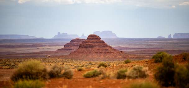
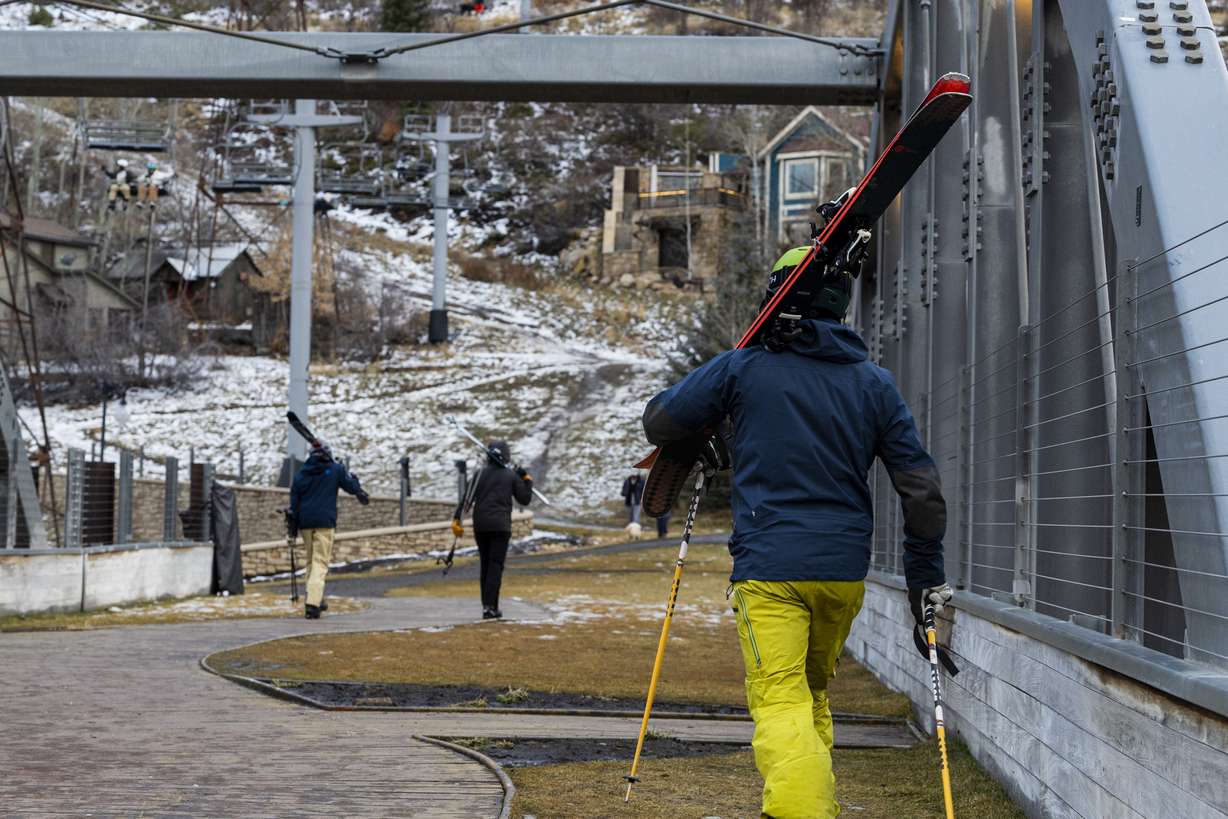
Salt Lake City, which normally receives 35.4 inches of snow each winter, collected just 2.5 inches this year. Even more perplexing, snow collection at the National Weather Service's Alta site — located at about 8,500 feet elevation — ended up approximately 82 inches below its 30-year normal, even though overall precipitation totals were 1.7 inches above normal this winter.
That trend persisted throughout the state, resulting in fewer instances of cooler air being locked in place by snow on the ground.
"A lot of time, that actually plays into our (temperature) averages," Johnson adds. "Cold air and cold-pool inversions are so persistent (across many regions), usually during the winter, that when you don't have storms, your temperatures are still down because you're locking in that cold air. We didn't get any of that this year."
An impact on Utah's snowpack
What happened in Alta exemplifies patterns across many low- and mid-elevation snowpack basins this season, which is why this year's statewide snowpack is so low.
Utah's 2014-15 winter still holds the record for the lowest snowpack in the modern era of data collection, which dates back to the 1980s. The 10.2 inches of snow water equivalent collected statewide that year could be beaten if Utah doesn't collect 1.7 inches of additional snowpack this spring.
This winter ultimately produced 6.3 inches of snow water equivalent statewide, which was the same amount collected during the record-low year, according to Natural Resources Conservation Service data.
Yet, despite this winter ending up 2.2 degrees warmer than that winter, Utah's snowpack collection sites collected, on average, 1.8 inches of precipitation above the 2014-15 winter. That's again indicative of how warm the storms have been.
It could have repercussions for later this year.
The National Weather Service's Colorado Basin River Forecast Center updated its spring runoff outlook on Friday, projecting that snowmelt could be approximately 60% of normal or less at many of the major creeks and rivers in the state. That could impact many reservoirs this spring and summer.
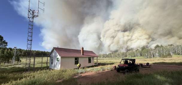
State and federal firefighters are also tracking the conditions. The low snowpack can create drier vegetation, potentially resulting in an earlier fire season, they noted on social media last week.
That's something Utah leaders are keeping an eye on as the regular snowpack collection period comes to an end. That could mean new declarations or drought measures.
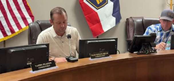
"We'll watch it closely," Gov. Spencer Cox told KSL on Friday. "If things dry out again, we may have to take steps earlier in the year than we normally would."