Estimated read time: 3-4 minutes
This archived news story is available only for your personal, non-commercial use. Information in the story may be outdated or superseded by additional information. Reading or replaying the story in its archived form does not constitute a republication of the story.
SALT LAKE CITY — It's shaping up to be a windy but mostly pleasant weekend throughout Utah, but forcasters say that will end by Sunday night heading into the final week of April — which is good news for the state.
The National Weather Service projects a spring storm with the potential to bring heavy precipitation to the state beginning early Sunday evening; it is expected to linger into Tuesday, bringing upwards of an inch of rain into northern Utah and Wasatch Front valleys, and possibly more than 1 foot of snow in the Wasatch Mountains.
The weather forecast first calls for a slight chance of passing showers along the Wasatch Front on Saturday. Temperatures are expected to top out in the upper 60s across the Wasatch Front, and in the low 80s in St. George over the weekend.
2) First off, let's talk about the winds. These will be strongest from around Utah County southward, and strongest on Sunday over southwest Utah. This could create choppy conditions on area lakes. pic.twitter.com/AbQqHhoFUw
— NWS Salt Lake City (@NWSSaltLakeCity) April 23, 2021
The weather service said wind gusts are forecast to reach upwards of 20 to 25 mph for most of the Wasatch Front on Saturday and Sunday, as well as 30 mph to 40 mph in southern Utah. The agency warned that red flag fire conditions will remain in place for most of southern Utah over the weekend before the storm arrives.
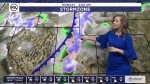
The precipitation is the result of a cold front coming in from the Pacific Northwest, said KSL meteorologist Kristen Van Dyke. The storm is expected to arrive in most parts of the Wasatch Front late Sunday afternoon or evening, with showers lingering into Tuesday.
"We're going to be looking at showers developing for the second half the day (Sunday), so most of Sunday (is) looking OK for northern Utah," she explained. "By Sunday night, this front comes swinging through and we can see heavy precip developing along the front. We'll have snow in the higher elevations — most of it above 6,000 feet."
The weather service wrote in a notice Friday morning that there could be "significant snow accumulations" for the mountains. In a tweet Friday afternoon, the agency added that 6 to 12 inches or more is expected for the northern Utah mountains, as well as 5 to 10 inches in the southern Utah mountains.
The storm isn't expected to provide enough to bust Utah's persistent drought conditions, but it does figure to bring much-needed precipitation throughout the state. It's also expected to provide rain showers for southern Utah beginning late Sunday into the early morning hours on Monday for places like Cedar City and St. George, according to weather service forecasts.
The weather service added that the storm has the potential to provide a half inch to an inch of precipitation from Logan across the Wasatch Front south through Nephi, from Sunday evening through Tuesday. It also has the potential to provide upwards of a half inch of rain in southern Utah valleys.
More than half of the state remains in an exceptional drought, while 90% of the state remains at least in an extreme drought, according to the U.S. Drought Monitor.
Entering Friday, the National Weather Service stations in Utah were both well below average for this point in the water year, which began Oct. 1, 2020. Salt Lake City station precipitation totals were listed at 3.67 below average, while the Cedar City precipitation totals were 5.50 inches below average.
Full forecasts for areas across Utah can be found at the KSL Weather Center.