Estimated read time: 2-3 minutes
This archived news story is available only for your personal, non-commercial use. Information in the story may be outdated or superseded by additional information. Reading or replaying the story in its archived form does not constitute a republication of the story.
SALT LAKE CTY — As the weather warms this spring, water managers in Utah communities are getting a good idea of how much water the winter storms delivered. It's a tale of two regions as Utah struggles to emerge from drought.
That's the message hydrologist Randy Julander delivered at the annual Utah Water Users Workshop in St. George, earlier this week.
"Absolutely ecstatic up here in the north, and despair and despondency down south," said the snow survey hydrologist with the Natural Resources Conservation Service.
February snowstorms in Utah's northern mountains delivered exactly what Utah needed, he said. Wet snowstorms brought plenty of water to help refill reservoirs. Those storms lifted the statewide snowpack totals to 90 percent of average. But, southern Utah missed out on most of it, especially the southwest, where the snowpack is at 45 percent.
"Most of the bad news will be in the agricultural sector," Julander said.
Many farmers and ranchers in southern Utah may only get half of their water allocation this summer, he said.
"It's just a tough situation for agriculture to be in."
During the past three years, reservoir levels across the state have fallen considerably. In northern Utah, when the snowpack melts over the next two months, and the runoff in the mountains starts to flow, Julander said most of the smaller reservoirs in northern Utah will be in good shape.
"We expect adequate recharge into most of the reservoirs, some of them are not likely to fill unless we get back into a wet pattern, like February," the hydrologist said.
While southern Utah suffers, there are no concerns about snowpack in the Bear River Range east of Logan.
"Just a phenomenal amount of water," Julander said.
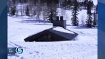
He and his colleagues went to the weather station at Tony Grove Lake this week just to make sure the exceptional readings were accurate. They found themselves on top of 10 feet of snow. He characterized the snow packed area as Ground Zero for all of the storms that swept across Utah in February.
"Storm after storm after storm; we got 25 inches of water in that snowpack over the month of February," he said.
That's nearly an inch of snow water equivalent each day. Enough to nearly bury the restroom facilities at the Tony Grove campground.
But, even with that February snowfall, the potential for flooding this spring is low. Julander says it would take a major rainstorm on top of the snowpack to create any serious flooding, but localized flooding is always a possibility.