Estimated read time: 3-4 minutes
This archived news story is available only for your personal, non-commercial use. Information in the story may be outdated or superseded by additional information. Reading or replaying the story in its archived form does not constitute a republication of the story.
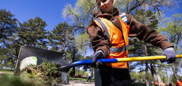
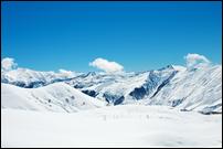
SALT LAKE CITY — The month of February swept across northern Utah, delivering four significant storms that lifted the region out of what looked to be a disastrous water year.
Consider that Tony Grove in Logan Canyon received 20 inches of "snow water" in February, more than the annual average precipitation at Salt Lake City International Airport.
"We had a nice recovery for that portion of the state. Projections are we may have close to a normal year in northern Utah," said Jordan Clayton, a hydrologist with the Natural Resources Conservation Service's Utah Snow Survey.
Clayton briefed members of the Utah Water Users Association at a Thursday meeting at the Utah Department of Natural Resources, which also included an outlook by the National Weather Service, U.S. Bureau of Reclamation and U.S. Geological Survey.
The forecast meeting outlined the signficant impacts to northern Utah because it was on the tip of an "atmospheric" river that delivered the much-needed moisture.
Wet storms left northern Utah at normal or near normal in most locations, pumping up thirsty snowpacks — like that of the Weber-Ogden River basin — from levels that were hovering in the 70 percent to 75 percent range.
February precipitation across the state was 130 percent of average, generally delivering snow at elevations of 7,500 feet and above and saturating hillsides. All but three of the days were above average for temperatures.
Clayton said the storms left the statewide snowpack average slightly ahead of where Utah was in 2012 and 2013 — a somewhat encouraging signal given the back-to-back dry years.
Related Stories:
Snowpack looking better after storms, hydrologists say
The water situation for Utah looked dismal last month, but storms over the past week have made a huge difference for all who live in northern Utah."February was what we needed at the right time when things could have gone really south, and when you look at the south, that could be northern Utah," said Brian McInerney, hydrologist with the National Weather Service in Salt Lake City.
Southwest Utah is in dire shape, McInerney noted, sitting at 46 percent of average. Some snow measurement sites have already melted out, and stream flow forecasts for the two major sources of water — the Virgin and Santa Clara rivers — are trickling in the low- to mid-30s percentile.
Ron Thompson, general manager of the Washington County Water Conservancy District, said he's discouraged by the numbers.
"It looks pretty dismal, but we are used to dismal," he said.
Thompson said he does not think the municipal water supply will be curtailed, but his district is going to embark on an aggressive water conservation message so the area can limp through the months ahead.
"I don’t honestly recall a February being this dry in my years with the water district, so it is going to test us," he said.
It's too early to say what type of reductions might be necessary for the agricultural community, but it has had to weather dry years in the past, Thompson said.
"The forecast does not give us a reason to be optimistic," he said.
The February infusion of moisture also played favorites with the water supply in terms of reservoir storage.
Because of the past two years of dryness, reservoir storage remains below average. Statewide, storage capacity is at 48 percent, compared with 56 percent last year at this time.
Several reservoirs will not come close to filling, including Jordanelle, Rockport, Pineview, Echo, East Canyon and Willard Bay.
Bountiful snowpacks in eastern Colorado, however, have created stellar numbers for the upper Green River and the Yampa, which translates into stream flows of 116 percent of average for Lake Powell.
While that won't result in "filling" Lake Powell, it creates a better future for recreation and for downstream users at Lake Mead.
Larry Dunn, lead forecaster with the National Weather Service in Salt Lake City, said the next few weeks in March — what's left of the snowpack accumulation season — promise to bring some periodic storms punctuated by periods of dryness.
In other words, he cautioned that the month won't be warm enough to wreck what happened in February in the northern half of the sate, but neither will it storm enough to save southern Utah.