Estimated read time: 4-5 minutes
This archived news story is available only for your personal, non-commercial use. Information in the story may be outdated or superseded by additional information. Reading or replaying the story in its archived form does not constitute a republication of the story.
- Meteorological winter ended with Utah's snowpack below its 30-year median average.
- Northern Utah's Bear River basin exceeded normal levels, while multiple basins faced record lows.
- Potential storms offer hope that March and early April can close the state's snowpack season strong.
SALT LAKE CITY — Meteorological winter came to a close on Friday, ending fruitful for one Utah snowpack basin, in particular, normal for a few others and dismal for the rest.
Utah, on average, collected 7.9 inches of snow-water equivalent — a measure of the water contained in mountain snow — between the start of December and the end of February. The three-month total fell 1.8 inches below the state's 30-year median average, according to Natural Resources Conservation Service data.
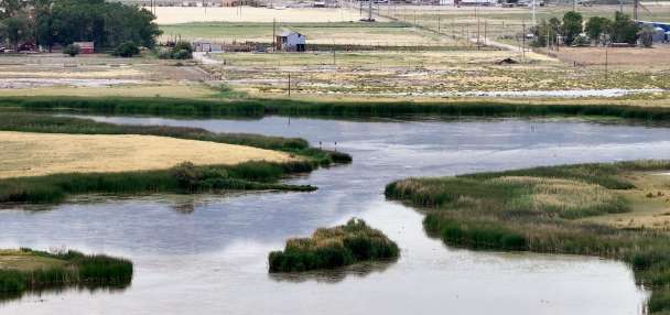
It was a great season for the Bear River basin in northern Utah, which collected 12.6 inches of water, nearly 2 inches above its normal. A few other basins directly below it wound up less than an inch below normal. Altogether, the Great Salt Lake basin — a combination of basins across Utah's northern half — ended the season running at about 99% of its median average.
Utah's statewide figure was weighed down most by central and southern Utah. Five of the state's 15 most important snowpack basins — Escalante-Paria, Lower Sevier, Southeastern Utah, Southwestern Utah and Upper Sevier — ended meteorological winter with lowest-ever running totals since modern snowpack data was implemented in the 1980s.
How every major Utah snowpack basin fared this winter
KSL.com analyzed Natural Resources Conservation Service data collected from Utah's 15 most important snowpack basins from the start of meteorological winter on Dec. 1, 2024, through its end on Friday.
Each basin is ranked in order of how it compares to its "normal," which is the median average from comparable dates from 1991 to 2020.
- Bear River: 12.6 inches of snow-water equivalent (1.7 inches above median average)
- Weber-Ogden: 12.6 inches of snow-water equivalent (0.3 inches below median average)
- Provo-Utah Lake-Jordan: 11.6 inches of snow-water equivalent (0.3 inches below median average)
- Northeastern Uintas: 4.8 inches of snow-water equivalent (0.9 inches below median average)
- Duchesne: 6.7 inches of snow-water equivalent (1.4 inches below median average)
- Dirty Devil: 4 inches of snow-water equivalent (2.6 inches below median average)
- Tooele-Vernon Creek: 8.3 inches of snow-water equivalent (2.8 inches below median average)
- Price-San Rafael: 5.4 inches of snow-water equivalent (3.3 inches below median average)
- San Pitch: 5.1 inches of snow-water equivalent (3.5 inches below median average)
- Lower Sevier: 3.3 inches of snow-water equivalent (4.7 inches below median average)
- Southeastern Utah: 2.4 inches of snow-water equivalent (5.2 inches below median average)
- Beaver: 3.4 inches of snow-water equivalent (5.4 inches below median average)
- Escalante-Paria: 0.8 inches of snow-water equivalent (5.6 inches below median average)
- Upper Sevier: 2.3 inches of snow-water equivalent (5.9 inches below median average)
- Southwestern Utah: 1.2 inches of snow-water equivalent (6.9 inches below median average)
The snowpack collection and spring snowmelt periods account for about 95% of the state's year-round water supply. And while this winter produced many below-normal figures, the season is far from over. Utah's snowmelt typically begins in early April, and a storm that entered the state late Sunday could be the beginning of a potentially productive March.
What happened this winter?
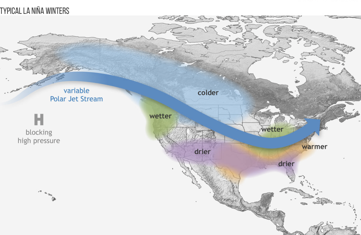
Utah's snowpack collection followed the average impact La Niña has on the state. The oceanic pattern can produce a wide range of winters in Utah, but it typically leaves wetter conditions in northern Utah and drier conditions in southern Utah.
KSL meteorologist Matt Johnson said several atmospheric rivers passed through northern Utah and southern Idaho, leading to Bear River's success this winter. The numbers weren't as eye-popping as all the records set in 2023, largely because many of these storms were warmer, smaller or less frequent than the last few winters.
The milder storms also led to smaller snow totals in low-level snowpack sites and puzzling totals along valley floors.
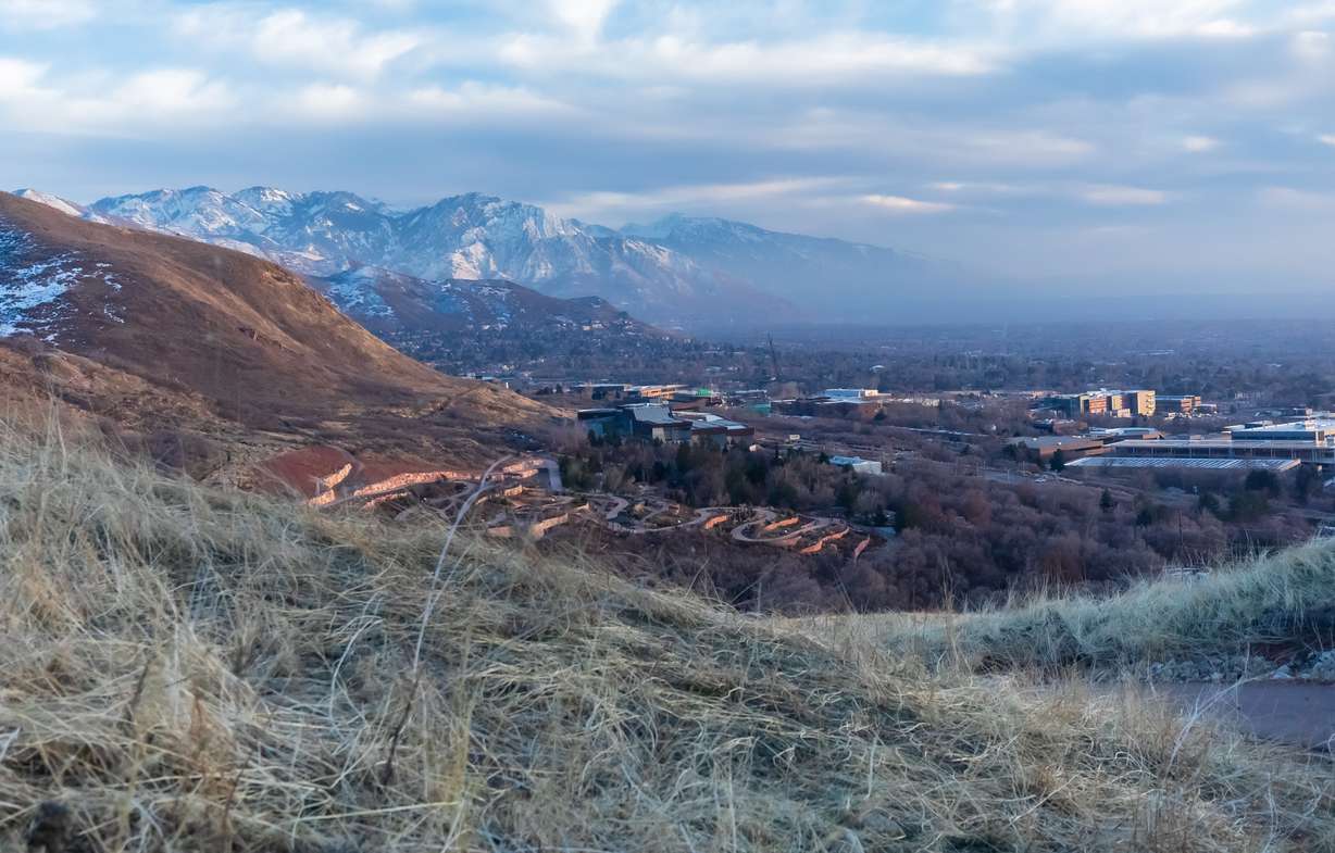
Provo's 8.7 inches was the lowest snowfall total since at least 1916. At 11.4 inches since June 30, Salt Lake City's annual snowfall total remains on pace to be its lowest since the National Weather Service began collecting records in 1874. That's despite gaining 2.99 inches of precipitation throughout the meteorological winter.
"It really speaks to how mild the storms were, and it also speaks to the lack of dynamics in our storms," Johnson said, adding that most storms just didn't have the right organization to provide valley snow.
Some of these storms brushed through central Utah, but nearly all of them skipped southern Utah. Many of the region's sites failed to receive any new snowpack from Thanksgiving to Valentine's Day when a mid-February storm nearly tripled southwestern Utah's season totals. Despite that, it collected less than a fifth of its winter median average.
The lack of moisture allowed extreme drought to return across southwestern Utah. Jordan Clayton, a hydrologist for the Natural Resources Conservation Service, warned last month that soil moisture levels in the region had dropped to "historic minimums," which could impact "the magnitude of what little snowmelt runoff the region produces."
State water managers also said they're bracing for a below-normal runoff in many parts of the state with how the winter played out.
"Most of our basins are likely to experience below-average streamflows this spring runoff," Candice Hasenyager, director of the Division of Water Resources, said last month.
March madness?
Utah still has about a month before the snow melts, which puts a lot of pressure on March and early April to deliver this year. Long-range outlooks offer hope for the next two weeks.
Some projections have many mountain sites gaining over 2 inches of snow-water equivalent over March's first half, including the potential of over 3.5 inches closer to Brian Head in southwestern Utah.
MARCH MADNESS: I'm seeing a pretty good signal this morning for an active first half of March. The next 10-14 days could deliver 2-7 FEET of new snow to the Utah mountains! Yes even southern Utah picking up the goods here, just what the doctor ordered!! #utwxpic.twitter.com/N5kAXsMInt
— Matthew Johnson (@KSL_Matt) March 3, 2025
The National Weather Service Climate Prediction Center also updated its March outlook on Friday to list some parts of northern Utah having slightly higher odds of above-normal precipitation this month. The rest of the state has "equal chances" — meaning there's no clear signal if March will be wetter, drier or close to normal, which is an improvement from earlier outlooks that listed dry trends persisting in southern Utah.
Johnson says many northern Utah basins should reach a normal season if the projections come to fruition. Basins south of Mount Nebo could also get a much-needed boost, but it likely won't save southern Utah's season.
"It can at least mitigate the damage with the storms coming through," he said.
It also helps that Utah's reservoir system remains 82% full, nearly 20 percentage points above the March median average. However, a bad season could make it difficult for many reservoirs to refill after this season.
"After this summer, we could be in a bad position in southern Utah with the reservoirs," Johnson adds. "I'm afraid that even if we can turn the faucet on this spring, southern Utah may still be up a creek without a paddle."