Estimated read time: 3-4 minutes
This archived news story is available only for your personal, non-commercial use. Information in the story may be outdated or superseded by additional information. Reading or replaying the story in its archived form does not constitute a republication of the story.
- Extreme drought has returned to Utah, affecting over 4% of the state.
- Utah's reservoir system is 78% full, but central and southern areas could face challenges this year.
- Officials urge water conservation as dry conditions continue.
SALT LAKE CITY — Extreme drought has returned to Utah for the first time in nearly two years, but a weekend storm could help parts of the state that have so far missed out on winter storms.
Moderate drought conditions or worse now blanket about two-thirds of the state, which is up from about 40% last week, according to the U.S. Drought Monitor's weekly update on Thursday. It adds that about 8% of the state is in severe drought, while a little over 4% — covering large chunks of Washington and Iron counties — are in extreme drought.
It's the first time that the Drought Monitor has listed any part of Utah in extreme drought since March 2023. Another 33% is listed as "abnormally dry," leaving just 1.3% of the state not listed in any drought category.
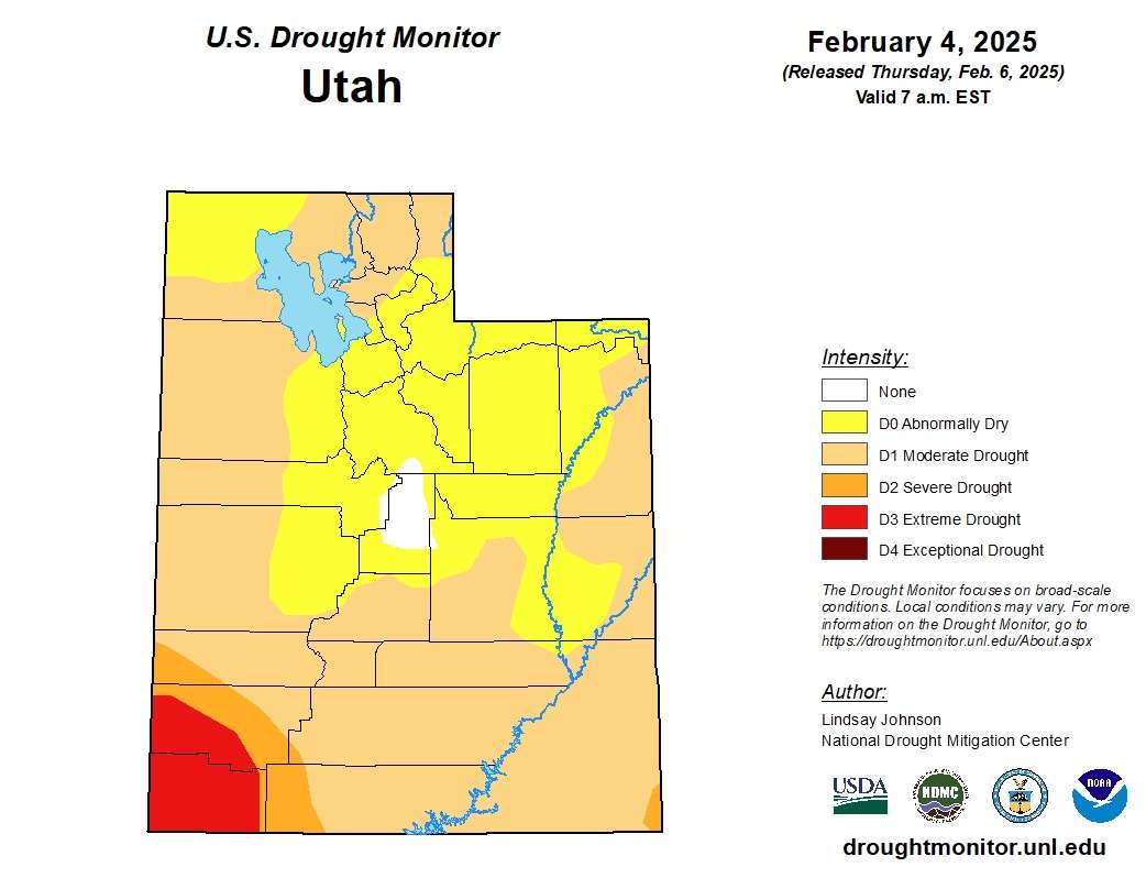
Utah's new extreme drought is part of a larger drought growing across parts of Arizona, California and Nevada. Exceptional drought — the agency's worst drought category — returned this week to an area near Lake Mead.
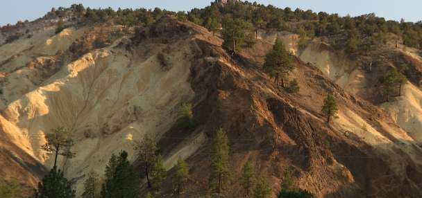
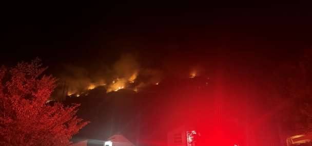
"Conditions are alarmingly dry, with dry soil and high fire danger," Lindsay Johnson, a climatologist for the National Drought Mitigation Center, wrote in an adjoining report.
The update comes a day after the Washington County Water Conservancy District reported that St. George remains on pace for its driest winter since city records were first recorded in 1895, while the county is on pace for its lowest water year on record.
Southwestern Utah's snowpack basin has only collected 1.4 inches of snow water equivalent since the water year began on Oct. 1, 19% of the median average for this point in the season, according to Natural Resources Conservation Service data.
Washington County commissioners called on residents to reduce water consumption and pray for rain last month as the dry conditions continued into the new year. The basin's last significant boost came during Thanksgiving weekend.
Candice Hasenyager, director of the Utah Division of Water Resources, told KSL.com that the state is closely monitoring conditions, especially in central and southern Utah. Other snowpack basins within those regions ranged from 35%-79% of their respective median averages on Thursday.
Snowpack basins along the Wasatch and northern Utah regions remain above 80%, thanks to storms that have passed through those regions more frequently this season. It's kept the statewide average at 78% of the first week of February normal.
The number is also expected to increase a bit as an incoming storm is forecast to provide a mix of rain and snow across the state between Friday and Saturday. KSL meteorologist Matt Johnson said it's projected to deliver 2-6 inches of snow in the southern mountains.
"It's not going to be a ton, but it is something," he said.
What helps is that Utah's reservoirs remain 78% full statewide, well above the February median average. However, many reservoirs in central and southern Utah could struggle to refill if dry conditions linger.
Hasenyager said the state will continue to push conservation messages as the drought intensifies.
"That's always part of our efforts — to make sure we're managing our water supplies as wisely as possible," she said. "We need to do that whether we're in drought or not, but it definitely becomes more important when we're in low water supply conditions."