Estimated read time: 4-5 minutes
This archived news story is available only for your personal, non-commercial use. Information in the story may be outdated or superseded by additional information. Reading or replaying the story in its archived form does not constitute a republication of the story.
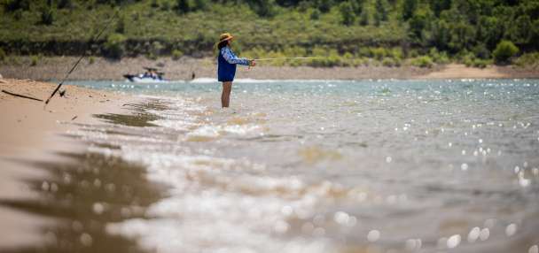
SALT LAKE CITY — Utah could be in for another hot summer.
The National Weather Service Climate Prediction Center released an early projection of meteorological summer on Thursday, with a graph that extends beyond the typical three-month, long-range outlook the center releases in mid-May. It lists almost all of the United States — including all of Utah — as having a greater probability of above-normal temperatures throughout the combined months of June, July and August this year.

The Beehive State has a 50% to 60% probability of above-normal temperatures, according to the early outlook. Utah's 20th-century average temperature for June, July and August is 68.3 degrees, while its 30-year normal (1991 through 2020) is 70.1 degrees, per federal climate data.
Meanwhile, the odds are leaning slightly toward a potentially drier summer, as well. Most of Utah is listed as having a 33% to 40% probability of below-normal precipitation after a productive start to the water year. The odds jump to 40% to 50% within a large chunk of eastern Utah, joining parts of the eastern Rockies and western Great Plains as having the worst precipitation odds at the moment.
Summer is historically Utah's driest season — becoming slightly drier in recent decades. The state averaged 2.94 inches of precipitation during summer in the 20th century, while the 30-year normal is 2.65 inches.
What's behind Utah's forecast?
None of this is to say there won't be any rain or cooldowns over the summer months.
The Climate Prediction Center's long-range forecasts are a mix between current conditions and what has happened in the past when similar conditions existed. In this case, multiple models indicate "anomalous dryness" is favored in the Four Corners and West Texas regions, Anthony Artusa, a meteorologist for the center, wrote in an adjoining report Thursday.
"There is also a significant negative correlation between this strong dry signal over the eastern monsoon region and abundant snowpack over the Central Rockies (Colorado and Utah)," he wrote. "Historically, this correlation favors a slow start to — and potential underperformance of — the Southwest monsoon."
Another shift in oceanic patterns is forecast in the coming months, which factors into this. The Climate Prediction Center reports there's an 85% probability that the ongoing El Niño pattern will end and move to ENSO-neutral by June. There's a 60% chance that La Niña will return between June and August.
Some data backs studies that indicate La Niña summers produce more robust monsoons than El Niño summers; however, the data also shows a wide variety of good and bad monsoons during ENSO-neutral summers, when there is no El Niño or La Niña pattern, Emily Becker, lead writer for the National Oceanic and Atmospheric Administration's ENSO blog, wrote in 2021.
However, it takes time for the weather to adjust to the new oceanic patterns, and that can also factor into the long-range projections, KSL meteorologist Matt Johnson explains.
"We're in a transition phase and sometimes when you're in a transition phase — from an El Niño to a La Niña — you can get difficult outcomes that don't always have an answer," he said.
Playing into a trend
Should the long-range forecast come to fruition, it would play into a general trend of hotter summers in Utah.
All 15 of the state's hottest summers since 1895 have happened within the past 30 years, including 2021 (No. 1) and 2022 (No. 8) which aren't captured in the 30-year normal yet. Johnson said the number of 100-degree days has also risen, especially over the past decade.
"The climate is definitely changing, and the weather is responding," he said. "We're going to see more of these prolonged high-pressure events, prolonged heat waves, more intense heat waves ... and it's happening at a pretty quick rate."
While the 30-year precipitation normal has also dropped, there's no clear trend in terms of wet or dry summers. The past three summers ended up above normal after five straight dry summers, and the five driest summers all happened in different decades between 1900 and the early 2000s.
The forecast shouldn't affect Utah's water supply, though it could indicate drought conditions may return in some parts of the state. There could also be wildfire implications if this summer's monsoon underperforms.
Gina Palma, a meteorologist for the Great Basin Coordination Center, provided a fire outlook through July for most of Utah, Nevada and Idaho earlier this month. She pointed out that some models indicate cooler temperatures than the Climate Prediction Center; however, several models indicate drier conditions emerging within Utah and parts of Nevada.
This may cause the vegetation to begin to dry out during the summer, while a delayed monsoon could extend the fire season. The models also indicate there could be more dry lightning and stronger winds at times this summer, which may elevate fire potential during points of the summer.
The center currently lists normal fire risks for the entire region it covers, but Palma said the season could begin to pick up in June. The center lists parts of northwest Utah, southern Idaho and northeast Nevada as having "above normal" risks by July. It has yet to release outlooks for August or September.
"We'll be keeping a close eye on the monsoon," she said. "(These are) definitely some things to keep an eye on that raise our eyebrows a little bit for the fire potential going into the summer."