- Utah's snowpack remains at its record lowest point despite recent storms.
- An active storm pattern may continue into early March, but there's low probability that it will help Utah overcome current deficits.
- Hydrologists predict below-average streamflows this year, which will impact some reservoirs.
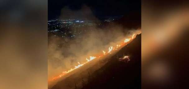
SALT LAKE CITY — Weather forecast models are finally tilting in favor of precipitation across Utah following this week's storm pattern, after weeks of mostly dry weather that caused the state's snowpack to drop to record-low levels.
A mix of rain and snow — possibly the most valley snow the Wasatch Front has experienced this winter — is in the state's seven-day forecast, likely impacting the state early next week. Leftover moisture could linger across northern Utah later in the week, too.
Long-range models are leaning toward a more active pattern that could last into at least early March, with more activity possible in Utah's northern half that is typical for a La Niña winter, said Glen Merrill, a hydrologist for the National Weather Service.
"We're maintaining that long wave trough, which is good news," he said as he and other federal agencies offered an updated outlook on Utah's water supply for this year on Friday. "It's a good pattern to see, not just for this (next) week but ... (we're seeing) a positive signal going into the weeks thereafter."
That means there's a growing chance that this may not be Utah's worst winter ever.
The bad news? It's becoming increasingly unlikely that Utah will have a normal snowpack collection this season. That, in turn, would lead to below-normal spring runoffs that may impact some reservoirs this year.
Can Utah get a normal snowpack?
This week's storm helped Utah's statewide snowpack climb back to the previous record low for this point in the year.
Several mountain sites ended up with over a foot of new snow over the past few days, which translated to an average of 0.7 inches of snow water equivalent across the state's network of over 100 tracking sites — the first sizable gain since Jan. 9, according to the Natural Resources Conservation Service update Friday morning.
The statewide average remains at 55% of the median average for mid-February despite the gain, and it will need several more storms to get back on track, says Jordan Clayton, a hydrologist for the Conservation Service.
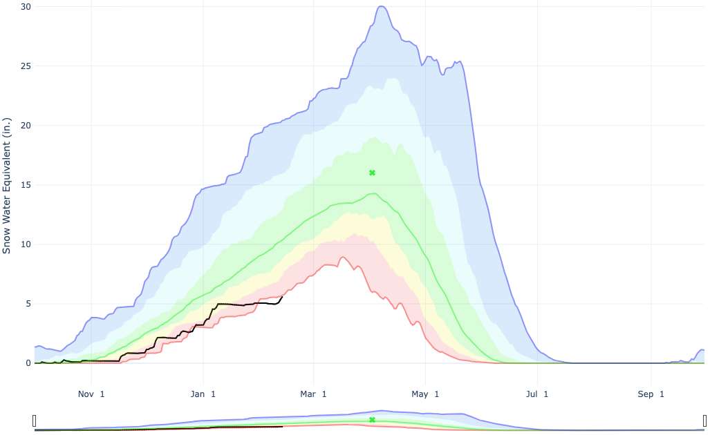
Utah would need approximately five storms averaging 1 inch of snow water equivalent statewide to get back to the normal for this point in the year — and four additional storms of that magnitude to match the seasonal snowpack average by the normal peak in April.
Utah has received even more significant storms in the past that can produce multiple inches of water statewide, which would reduce the number of needed storms. But that's a difficult task even with the active pattern in the forecast.
That's because it's unlikely the pattern will help overcome the large deficit in snowpack collection to this point in the season. It's why Clayton says there's now just a 10% chance Utah experiences a normal statewide snowpack this season, and there's a 30% probability it's a record-low one.
"We're only getting storm activity that's close to normal for this time of year," he told KSL afterward. "We'll take it, but ... we're struggling to keep up with that normal line that's continuing to increase — and the minimum observation line is continuing to increase."
Utah's updated water outlook
This week's storm also didn't change what's expected once all that snow melts. The Conservation Service, Colorado Basin River Forecast Center and U.S. Geological Survey all project below-average streamflows, barring a significant shift in the weather.
Almost all of these are expected to be 70% or lower than the median average across the state. Inflows into the Great Salt Lake and Lake Powell could end up below 50% of normal. What helps is that Utah's soil moisture levels remain above normal, meaning that any additional snowpack the state collects is likelier to flow into creeks, rivers and streams that feed into the state's lakes and reservoirs.
Related:

Why the water outlook for Lake Powell and Utah just got worse
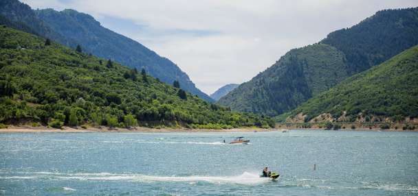
Inflows into Lake Powell were already bleak, and January didn't provide any favors.Utah's reservoir system remains at 66% full, which is above normal for this time of the year, too, according to the state. What's unclear is how it will look after the snowmelt, which could lead to water management decisions in some areas.
Larger reservoirs are in better shape, as it takes several good years to fill them up and several bad ones to drain them. The reservoirs that rely on a good snowpack every year may look emptier this year.
"Basically, across the board, there's very low likelihood that any of them will be topping off this year," said Gary Henrie, a civil engineer at the U.S. Bureau of Reclamation.