Estimated read time: 5-6 minutes
This archived news story is available only for your personal, non-commercial use. Information in the story may be outdated or superseded by additional information. Reading or replaying the story in its archived form does not constitute a republication of the story.
SALT LAKE CITY — Utah's snowpack collection this season pales in comparison to what it looked like this time last year, but it's still impressive compared to other winters in recent memory.
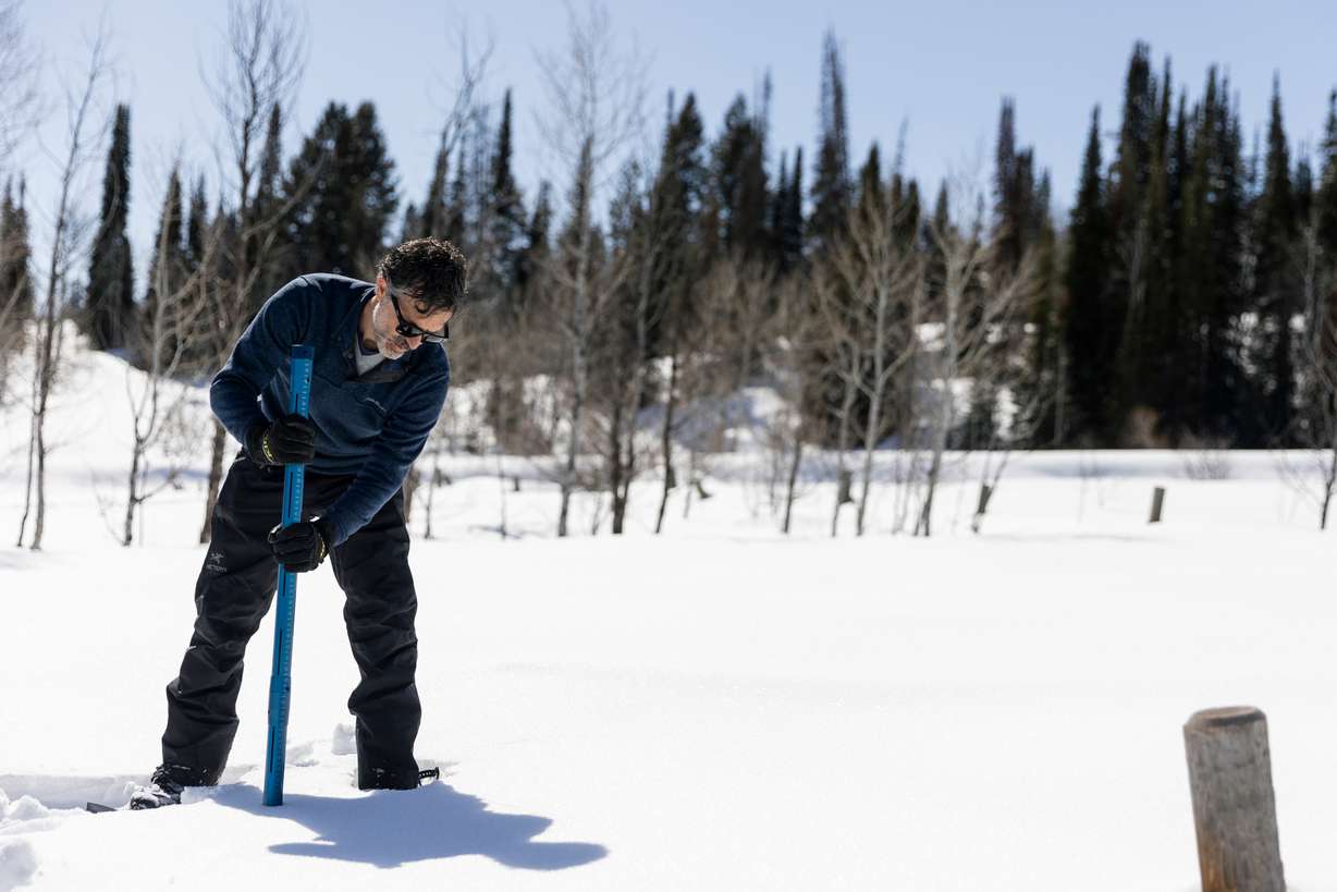
The statewide snowpack — an average of more than 100 mountain sites across Utah — entered Thursday at 18.5 inches of snow water equivalent, according to Natural Resources Conservation Service data. That's 11.5 inches of water below last year's record peak, but 2.5 inches above the state's median average and 4.2 inches above the 30-year normal.
It's also about 6.5 inches above what was collected in both 2021 and 2022 amid a statewide drought. In fact, this year marks the state's first back-to-back "well-above-normal" snowpack years since 2005 and 2006, says Jordan Clayton, a hydrologist for the agency and supervisor of its Utah Snow Survey.
"We're having a really nice snowpack season," he said. "We were hoping for two above-normal snowpack seasons, and that's what we got."
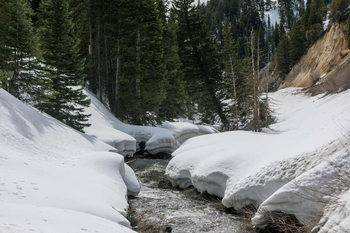
However, what snow is collected in the mountains has to melt eventually, and that process is already underway in some parts of the state.
Wednesday marked Utah's average snowpack collection peak and Thursday marked the average peak of the past 30 years. This year may be close to the normal. Utah's average snowpack reached 18.8 inches of water after a storm blasted the mountains over Easter weekend; it's unclear if another storm forecast for this weekend — or future storms — could move the collection above the current peak.
This process is crucial for Utah's water supply. About 95% of Utah's water comes through the mountain snowpack collection and spring snowmelt process, as the snow melts into streams, creeks and rivers that flow into the state's lakes and reservoirs. But it's a delicate process that can be extremely beneficial for Utah when the weather conditions are right, and extremely dangerous when the wrong conditions emerge.
Last year's record snowpack showcased these two extremes. Utah's reservoir system jumped from 42% capacity in November 2022 to 86% by July 2023. Yet the amount of snow also stoked fears about major flooding impacts similar to those that ravaged the state in 1983, the last time Utah had collected a snowpack as large as 2023.
So what about this year?
Assessing this year's flooding risks
Flooding is a concern again this spring, but Clayton says it's not "terribly concerning."
He and other experts agree that the situation isn't as dire as it was this time last year. That's because there isn't as much water in the high-elevation mountain snowpack, while warmer conditions this winter compared to last year meant less snow fell in mid- and low-level snowpack basins.
At the same time, water managers have also prepared for possible flooding by releasing water from reservoirs. For example, Salt Lake City Public Utilities ramped up controlled releases from Little Dell Reservoir earlier this week because there's more water in the snowpack that refills the reservoir than there is space in the reservoir to hold that water.
It's just one of several examples either underway or expected this spring. That's because Utah's reservoirs only dipped back down to 74% capacity by October and November and are now close to 85% full, before the majority of the snowpack melts. This could mean additional water for larger bodies of water that have struggled the most from drought and overconsumption in recent decades, like the Great Salt Lake and Lake Powell.
The ideal spring
Weather ultimately plays the greatest role in whether there is or isn't severe flooding, though.
While there were some flooding issues "here or there" last spring, Utah was able to avoid extreme flooding because the right conditions emerged, Clayton said. There were some warmups, but also cooldowns that allowed for a gradual melt of the snowpack from early April to early July.
We want that heating and cooling to happen in a very gradual way.
–Laura Briefer, director of Salt Lake City Public Utilities
This was not the case in 1983. Utah's snowpack peaked at 26 inches of snow water equivalent on April 13 that year; however, a series of storms kept the average at 25.4 inches by May 20 before a significant warmup. About 90% of the collection melted within the following 30 days, creating all sorts of mayhem throughout the state.
"We want that variation in our spring weather," said Laura Briefer, director of Salt Lake City Public Utilities. "We want that heating and cooling to happen in a very gradual way."
This year's outlook is still a bit murky, but the long-range forecast could lean toward the ideal conditions for another above-normal snowpack.
The National Weather Service's Climate Prediction Center lists Utah as having "equal chances" for above, below or near-normal temperatures and precipitation for the combined months of April, May and June, which means there's no clear signal as to what to expect this spring.
It could also mean conditions are similar to last year, says KSL meteorologist Matt Johnson.
"It could swing either way, but it indicates that we'll probably get a mixture of high-pressure systems and low-pressure systems, keeping that temperature where it should be," he said. "We do need the high-pressure systems because we do need to melt off some of the snowpack, but we don't want it to come down at a fast rate so we need ... that variation between high and low to come and go."
He adds that the majority of the snowmelt occurs in May and June, especially in the areas closer to the state's population core, so the variation would likely need to continue through those months to avoid severe flooding.
Even if Utah avoids severe flooding, water managers expect the state's creeks, rivers and streams to flow above normal over the next few months as the snowpack melts. Briefer said people should be careful around these waterways and keep an eye on children and pets since they can be carried away by the swift currents.
Utah officials also have resources available for people to prepare for flooding just in case.
Contributing: Daniel Woodruff