Estimated read time: 4-5 minutes
This archived news story is available only for your personal, non-commercial use. Information in the story may be outdated or superseded by additional information. Reading or replaying the story in its archived form does not constitute a republication of the story.
SALT LAKE CITY — Punxsutawney Phil didn't see his shadow Friday, signaling an early spring over six more weeks of winter, based on a Groundhog Day tradition dating back more than 130 years.
But how does Phil's prediction line up with long-range forecast models? It turns out that the rodent may be onto something when compared to outlooks put together by the National Weather Service's Climate Prediction Center, even in Utah, and he may have El Niño to thank.
"He may have gotten lucky this time in that it coincides with what the mid- and long-range model projections are," said KSL meteorologist Matt Johnson, with a chuckle.
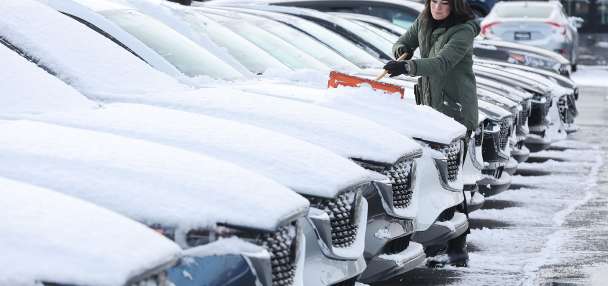
In Utah's case, it already felt like spring before Groundhog Day. Wednesday's high reached 62 degrees in Salt Lake City, falling 1 degree shy of a record set in 2003 and hitting the normal high for mid-April, per weather service data.
That was before the remnants of a "Pineapple Express" system arrived, which has provided mostly a mix of valley rain and mountain snow throughout the state, reminiscent of a spring pattern. Johnson said two more similar low-pressure systems out in the Pacific Ocean are forecast to impact Utah next week, tapping into tropical moisture.
High temperatures along the Wasatch Front are currently forecast to reach as high as the upper 40s at points over the next seven days even with the storms.
"This is very El Niño-esque, as typically the jetstream and storm pattern comes from the West and Southwest," Johnson said, noting that both storms appear to have equally "impressive" precipitation potential as the first one. "It's very spring-esque with the valley rain, high-elevation mountain snow."
The water-heavy snow is great news for Utah's snowpack but could elevate avalanche risk, as well. Full seven-day forecasts for areas across Utah can be found online, at the KSL Weather Center.
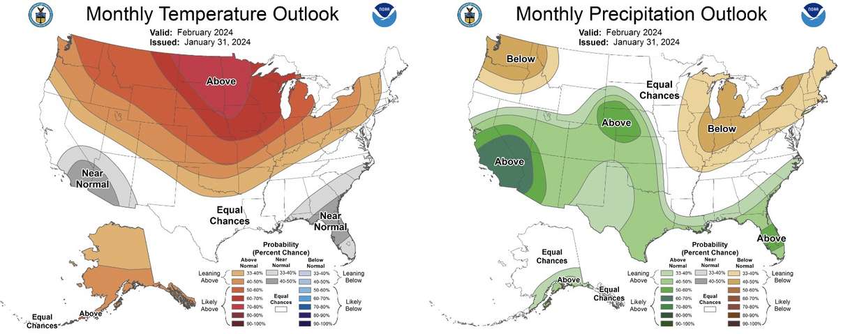
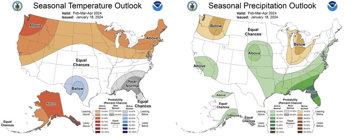
Beyond that, the Climate Prediction Center's latest outlooks cover a range between Feb. 7 and Feb. 23, along with a projection for the full month overall and a three-month overview that includes March and April.
Those indicate that Utah has a slight probability of having below-normal temperatures between next week and the middle of the month, but most of the state is listed as having a greater chance of above-normal temperatures during the second half of the month and throughout the month overall. The same goes for the three-month outlook.
Those outlooks also offer fairly favorable precipitation outlooks. Most list Utah as having either a stronger probability of above-normal temperatures or "equal chances," where there isn't a clear signal whether Utah will have above, below or near normal precipitation. It could mean more storms that produce valley rain and mountain snow.
None of this is to say that winter weather is truly over before the season officially ends on March 19. Long-range outlooks are merely probabilities of what could happen over a range of time based on current trends and what's historically happened under similar circumstances. It's also unclear how much warmer or colder temperatures would be from a normal day at the end of winter.
And Salt Lake City's average final day of receiving snowfall is April 16, a few weeks into spring.
But the models indicate a more traditional El Niño oceanic pattern could be set up over the next six weeks, providing a more spring-like experience across most of the country.
Johnson explains that the pattern typically brings more "blocking" high-pressure systems that tend to build up over the Pacific Northwest and the middle of Canada, resulting in warmer temperatures for the northern half of the country. These also push jetstreams south, sending a storm track closer to the Southwest, which is why that region has stronger odds for above-normal precipitation.
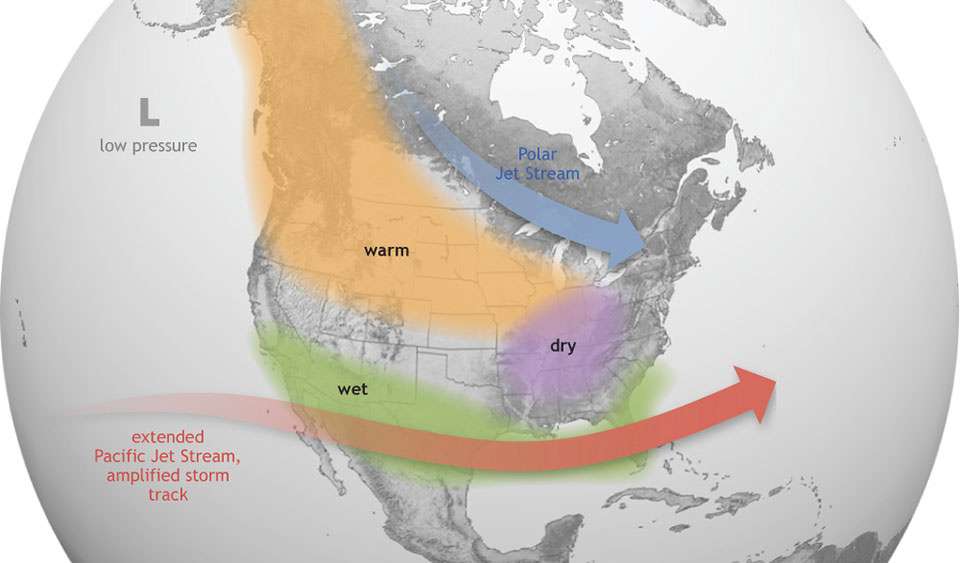
The center projects that states in the Pacific Northwest, Midwest and most of the Northeast have a greater probability for above-normal temperatures this month and over the next three months. Parts of the Southwest and Southeast may have a greater shot at below-normal to near-normal temperatures.
If the center's outlook does come to fruition, many Americans may end up feeling like an early spring arrived just as Phil predicted.