
Estimated read time: 5-6 minutes
This archived news story is available only for your personal, non-commercial use. Information in the story may be outdated or superseded by additional information. Reading or replaying the story in its archived form does not constitute a republication of the story.
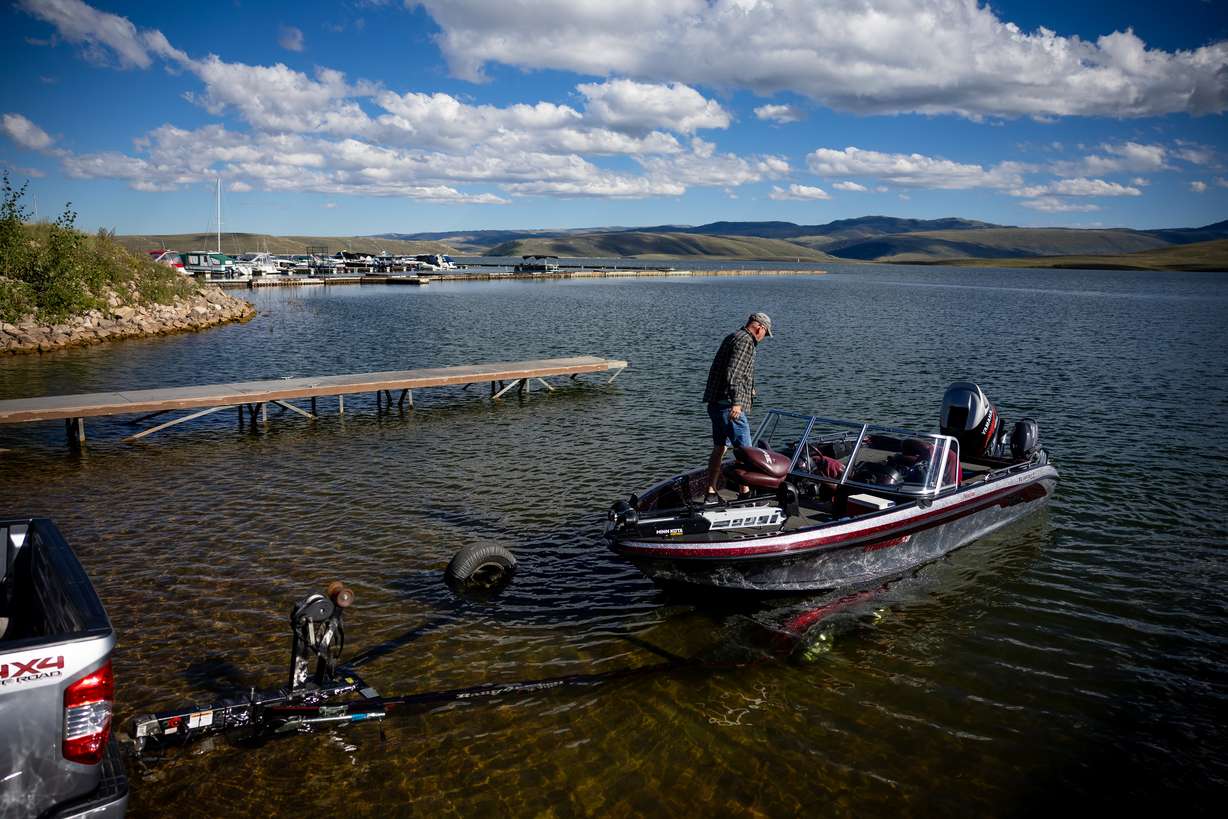
SALT LAKE CITY — After a string of hot and dry years, including the driest on record, Utah almost needed a miracle to exit the severe drought that took over the West.
Then came 2023.
A relentless series of storms in the first third of the year left unprecedented levels of snow in the mountains. Precipitation remained a key fixture by the end of summer and, even with a drier fall than usual, high enough water levels nearly wiped the state clear of even moderate-drought status for the first time in four years.
"Last year was like winning the lottery," said Jon Meyer, assistant state climatologist at the Utah Climate Center at Utah State University. "It was such a huge windfall of precipitation that never really let up."
Utah ended up with its highest snowpack ever by the end of the snow collection season, and — with an average of 15.08 inches — 2023 ended up the state's 30th wettest calendar since 1895, according to data released by the National Centers for Environmental Information last week. It was on track to be higher before a slowdown of storms in the second half of the year.
Utah also recorded an average temperature of 48.5 degrees, the 37th-warmest on record, after a warmer second half of the year.
Overall, 2023 was the country's fifth-warmest on record, with an average temperature of 54.4 degrees. Precipitation collection of 29.46 inches in 2023 ended up a little below normal.
2023 precipitation impact on drought
Utah's most recent drought situation emerged in 2019, but it worsened dramatically a year later, which was the driest calendar year on record. Back-to-back below-normal snowpack seasons didn't help things either, and severe drought conditions persisted into 2023.
Nearly 97% of Utah remained in at least moderate drought, including nearly 90% in severe drought and a quarter of the state was in extreme drought, or worse, at the start of 2023, according to the U.S. Drought Monitor. The state's reservoirs, excluding Lake Powell and Flaming Gorge, remained at 45% of capacity.
Utah ended up with its 13th-wettest first half of a year largely because of its record 30-inch statewide snowpack. With a delayed but relatively normal monsoonal season and drier meteorological fall, the second half ended up Utah's 47th-driest on record.
Utah's water situation still looked significantly better by the end of the year. Nearly one-tenth of the state was listed in moderate drought at the start of this year, while another 22% is "abnormally dry." Utah's primary reservoirs are about 79% full, after peaking at 86% capacity this summer.
A 'tale of 2 years'
That chain of winter storms also put 2023 on pace to fall below the 20th-century average for the first time since 1993 throughout most of the year. It's a heating trend experts tie to the changing climate in the state.
The storms brought in cooler air and kept snow on the ground, while the clouds kept solar heating at bay. The mountain snow cover remained in place throughout spring and into the start of the summer, which also helped reflect the sun's energy and keep things cooler than usual, Meyer adds.
This trend ended in the second half of the year, though. July was almost as hot as ever, and every month after that ended up above the 20th-century mean, as more high-pressure systems set up as compared to the first half of the year. The average temperature rose as precipitation slowed down.
Utah's year-to-data average temperature remained 0.2 degrees below the mean after August and tied it after September. It jumped to 0.2 degrees above the mean by the end of October and continued to rise from there. Last month was Utah's seventh-warmest December on record and the year finished 0.9 degrees above the mean in the end.
"It was definitely sort of a tale of two years," Meyer said. "The back half of 2023 was when we finally returned to a little bit of a familiar weather pattern of the past four or five years. Falls were warmer than normal and drier than normal, and that rebounded the extra cool start to the year."
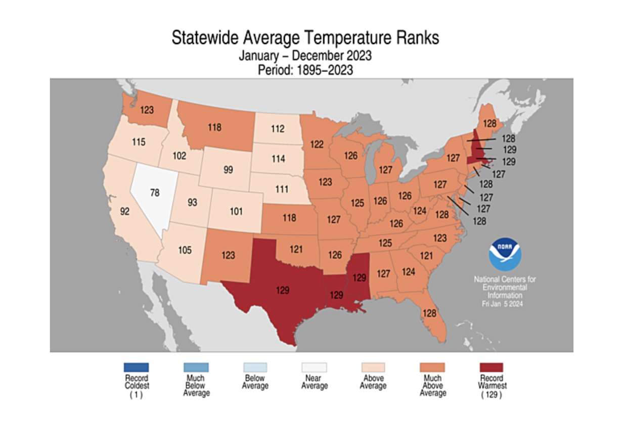
Utah's average temperature last year, and its relationship to the normal, was much lower than other states in the country. Warmer-than-normal temperatures impacted the northeast and southern states throughout the year.
In the end, 2023 was within the top 10 warmest on record for most of the U.S. states. It was the hottest on record for Louisiana, Massachusetts, Mississippi, New Hampshire and Texas.
What's in store for 2024?
It's impossible to know how this year will shake out, other than it'd be hard to replicate 2023.
Utah's statewide snowpack entered the year at 69% of normal, but an active storm track already boosted it up to 83% by Friday morning with more on the way. The three-month outlook leans in favor of more precipitation in the state, as well.
It is not until the end of winter or early spring that experts will have a better idea of what this year's water capacity and drought situation may look like, Meyer said. The good news is that since most reservoirs remain higher than normal for this point in the year, there's less water needed to refill them.
A closer-to-normal snowpack, however, could be impactful for bodies of water in need like Lake Powell or the Great Salt Lake. Both reached new lows during the drought and remain well below full capacity because they're so large they require more water to fill up.
Several water managers conducted controlled releases to the Great Salt Lake in the spring of last year when it was clear there was enough water to refill the reservoirs within its basin. Its southern arm gained about 5 feet from the additional inflows. Lake Powell also made major gains.
An average snowpack may force that to happen again.
"Any average year is going to be a big deal because that helps recharge them," Meyer said. "Any year where we don't have below-average precipitation, those are great years because it allows us to kick the can down the road. … That's what we need not only for this year, but years coming forward."


