'%3e%3cpath%20d='M34.1406%205.85938C30.3906%202.10547%2025.3047%200%2020%200C14.6953%200%209.60938%202.10547%205.85938%205.85938C2.10938%209.61328%200%2014.6953%200%2020C0%2025.3047%202.10547%2030.3906%205.85938%2034.1406C9.61328%2037.8906%2014.6953%2040%2020%2040C25.3047%2040%2030.3906%2037.8945%2034.1406%2034.1406C37.8906%2030.3906%2040%2025.3047%2040%2020C40%2014.6953%2037.8945%209.60938%2034.1406%205.85938ZM37.0117%2023.543H31.1602V13.5391H27.6328V19.9414C28.1211%2020.6914%2028.3711%2021.582%2028.3711%2022.5625V22.625C28.3711%2023.668%2028.1172%2024.6055%2027.6328%2025.4297V26.6094H36.082C33.4883%2032.9375%2027.2891%2037.3789%2020.0039%2037.3789C10.3711%2037.3789%202.62109%2029.6289%202.62109%2020C2.62109%2010.3711%2010.3711%202.62109%2020%202.62109C29.6289%202.62109%2037.3789%2010.3711%2037.3789%2020C37.3789%2021.1484%2037.2617%2022.2656%2037.0508%2023.3477C37.0391%2023.4141%2037.0234%2023.4766%2037.0117%2023.543Z'%20fill='white'/%3e%3cpath%20d='M22.3086%2018.5352C20.4336%2018.125%2019.9531%2017.8398%2019.9766%2017.1836V17.1406C19.9766%2016.6992%2020.3477%2016.2148%2021.4023%2016.2148C22.582%2016.2148%2023.8867%2016.6797%2025.0781%2017.4766L26.8516%2015.0195C25.4453%2013.8906%2023.707%2013.3398%2021.5547%2013.3398C18.5195%2013.3398%2016.4375%2015%2016.4063%2017.4766V17.5352C16.3633%2020.2617%2018.5859%2020.9805%2021.293%2021.6016C23.0391%2021.9766%2023.5703%2022.3164%2023.5703%2022.9609L23.5469%2022.9766C23.5469%2023.3906%2023.2578%2023.7031%2022.7852%2023.8359C22.5742%2023.9062%2022.1289%2023.9727%2021.5156%2023.9727C20.7617%2023.9727%2019.7539%2023.8633%2018.6328%2023.4844C18.0898%2023.2891%2017.4727%2023.0039%2016.8047%2022.6133L20.1406%2026.625C20.2813%2026.6602%2021.0977%2026.8516%2021.7734%2026.8516C25.0039%2026.8516%2027.0859%2025.2461%2027.1094%2022.6328V22.5703C27.1602%2020.1133%2025.2148%2019.1719%2022.3086%2018.5352Z'%20fill='white'/%3e%3cpath%20d='M5.24219%2013.5664V26.6133H8.75391V23.7578L10.2969%2021.9531L14.2031%2026.6133H18.3867L12.3555%2019.5195L17.4023%2013.5664H13.4531L8.75391%2019.0586V13.5664H5.24219Z'%20fill='white'/%3e%3c/g%3e%3cdefs%3e%3cclipPath%20id='clip0_97_2430'%3e%3crect%20width='40'%20height='40'%20fill='white'/%3e%3c/clipPath%3e%3c/defs%3e%3c/svg%3e)


Estimated read time: 2-3 minutes
This archived news story is available only for your personal, non-commercial use. Information in the story may be outdated or superseded by additional information. Reading or replaying the story in its archived form does not constitute a republication of the story.
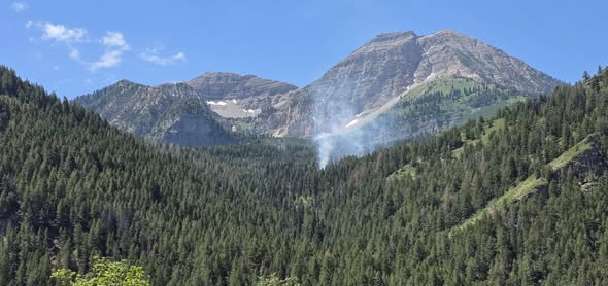
SALT LAKE CITY — Labor Day is often seen as the unofficial end of the summer, and that couldn't be more true this year as Monday marked the first snowfall of the season in Utah's mountains.
Snowbird and Solitude resorts both celebrated their first snowfalls of the season, and snow was seen covering state Route 150 near Bald Mountain Pass in the western Uintah Mountains.
"In all seriousness, if you are venturing into the higher terrain, particularly above 10,000 feet be prepared for winter-like conditions," the National Weather Service Salt Lake City forecast office posted on the social media platform X, formerly known as Twitter.
The first snowfall last season occurred on Sept. 16, 2022, near the same area of Bald Mountain Pass, according to KSL-TV meteorologist Matthew Johnson.
"It was Sept. 16 last year. This year it was Sept. 4, but I have seen it as early as late August, so it's not out of the norm," he said. "It's definitely something we expect this time of year."
The dusting of snow in the mountains Monday will likely melt off, and Utah may see a couple more small snowfalls over the next month and a half before snow starts to stick in the mountains in late October.
"It's really not until usually late October and early November that we start to see more consistency" with snowfall, Johnson said.
Monday's mountain snow was accompanied by thunderstorms and rain through much of the Wasatch Front in the morning, but skies are expected to clear later in the afternoon.
A mudslide in Price Canyon closed U.S. 6 in both directions between Helper and Soldier Summit on Sunday, and the road is expected to remain closed until Monday afternoon.
The National Weather Service issued a flood advisory for parts of Salt Lake County Monday morning. Both Big and Little Cottonwood canyons received more than an inch of rainfall over the past 24 hours, and Draper received 1.29 inches.
The thunderstorm brought lower temperatures to the Wasatch Front, with temperatures between 10 and 13 degrees cooler Monday morning compared with the same time the day prior.
But temperatures are expected to rise later this week with highs in the 80s, Johnson said.
"(There's) more sunshine starting tomorrow. I think we'll see some peeks of sunshine as early as today," he said Monday. "It's just today that's kind of on the cool side — a little taste of fall, and we might start to see those mountain leaves on the maples start to turn just ever so slightly."
As the storm system continues on to Wyoming later Monday, showers may linger along the Wasatch Front until around 1 p.m. or 2 p.m.
"But I think the afternoon should start to dry out and it shouldn't be too bad of a Labor Day afternoon and evening," Johnson said.