Estimated read time: 4-5 minutes
This archived news story is available only for your personal, non-commercial use. Information in the story may be outdated or superseded by additional information. Reading or replaying the story in its archived form does not constitute a republication of the story.
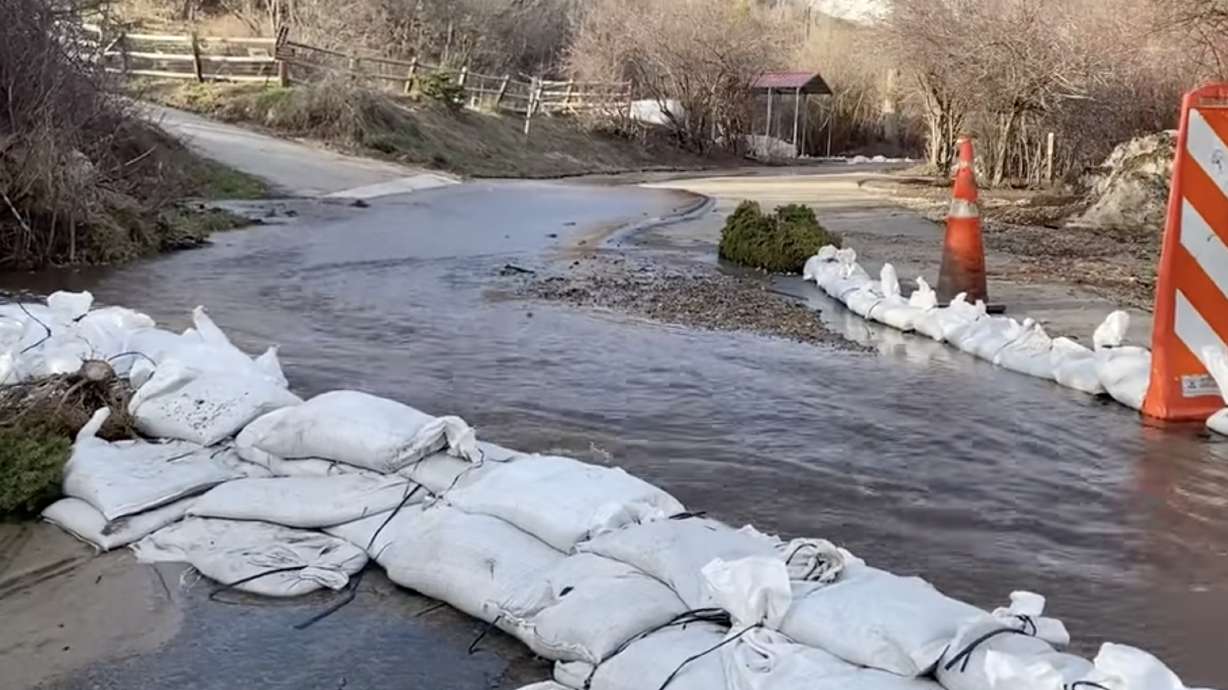
SALT LAKE CITY — Flooding and avalanche risks continued to impact parts of Utah on Monday after an active weekend, as record-high temperatures are causing major chunks of the state's record snowpack to melt rapidly.
Both directions of U.S. 89 reopened between U.S. 6 and Fairview after there was flooding the roadway in the area for several hours Monday, according to the Utah Department of Transportation. The National Weather Service had issued a flood advisory for Thistle Creek near the U.S. 6 junction in Utah County on Monday morning, noting that snowmelt will likely cause hydrologic flooding, possibly making roadways impassable.
The agency also issued flood warnings for multiple areas and waterways across Utah on Monday:
- An area flood warning for Garden City to the Idaho border, where flooding in any low-lying and flood-prone locations areas is likely over the next few days. Garden City Mayor Mike Leonhardt issued a state of emergency over the weekend.
- Emigration Creek in Salt Lake City's east bench. Flooding in Emigration Canyon began Sunday evening, as the creek began flowing above its banks and closer to homes and businesses like Ruth's Diner in the area.
- Little Bear River at Paradise, Cache County
- Sevier River near Hatch, Garfield County
- South fork of the Ogden River near Huntsville
In addition to the active flood warnings and advisories, flood watches remain in place for East Canyon Creek (near Jeremy Ranch downstream to East Canyon Reservoir), the Little Bear River (below Hyrum Dam to Cutler Reservoir) and the Lower Weber River (at Plain City).
Salt Lake County officials also announced Monday that it will extend its closure of Sugar House Park in Salt Lake City to vehicles for another two weeks. The closure has been in place for over a week because the pond, which also serves as a retention basin, is flowing over the roadway in the park, as a result of extra inflow from Parleys Creek.
The detention pond @ Sugar House Park is hard at work! The road will be closed to vehicles for 2 more weeks.
— Salt Lake County Parks & Recreation (@SLCOParksandRec) May 1, 2023
Pedestrians and bikers are welcome to use the park. Keep pets & children out of the water!#runoffready#SLCo#PeopleParksPlaypic.twitter.com/58cQfW1fbj
Uphill traffic into Little Cottonwood Canyon is also currently closed because of avalanche mitigation efforts, according to UDOT. Uphill traffic into Big Cottonwood Canyon was temporarily closed between 11 a.m. to 5 p.m. for the same reason.
The flooding and avalanche concerns come as Utah's record snowpack is finally melting in earnest across the state. The statewide figure dropped another 4 inches over the past five days, slipping to 22.5 inches of water by Monday morning, according to Natural Resources Conservation Service data. The statewide snowpack peaked at 30 inches on April 8; however, it only dropped 3.5 inches between then and last Wednesday.
Utah's current statewide figure also fell out of record status over the weekend, the first time it has not been in uncharted territory since March 15. That means there is finally less water in Utah's statewide snowpack than there was at this point in the year back in 1983.
More snowpack runoff is expected this week, even in areas outside of current warnings and watches. The National Weather Service advises that there is a "high chance" of localized flooding in some mid-elevation watersheds again over the next few days, especially in northern Utah, as it happens.
"Streams, creeks, and rivers will continue to experience significant rises moving forward throughout the upcoming week, especially low and mid-elevation watersheds across (the state)," the agency wrote in an advisory Sunday.
Record-high temperatures persist in Utah
Salt Lake City set a new daily record on Sunday when temperatures reached 87 degrees. It fell just short of reaching 90 degrees on Monday, which would have set a city record the earliest 90-degree day in the city's history. The current record was set on May 2, 1947, and has held for the last 149 years that have been tracked by the National Weather Service.
KSL meteorologist Matt Johnson explained that record-high temperatures result from air mass patterns in the West, which will continue to produce hot temperatures on Tuesday. A low-pressure system off the Pacific Coast in California is helping pump "warm, dry desert air" from the south into Utah and other parts in and around the Great Basin where a high-pressure system moved in over the weekend.
Clouds and scattered showers are possible in parts of the state the next three days, before the next cooldown arrives in the form of rain and possibly thunderstorms.
"Our best chance to see some showers and cooler weather isn't until Thursday," Johnson said. "So, through Wednesday, we're well above normal and (there's) excessive snowmelt likely."
High temperatures across the Wasatch Front are forecast to drop into the upper 60s to lower 70s by the end of the workweek and into the weekend. The same goes for southern Utah areas like St. George.
Full seven-day forecasts for areas across Utah can be found online, at the KSL Weather Center.
Contributing: Shara Park


