Estimated read time: 6-7 minutes
This archived news story is available only for your personal, non-commercial use. Information in the story may be outdated or superseded by additional information. Reading or replaying the story in its archived form does not constitute a republication of the story.
SALT LAKE CITY — More flooding is possible across parts of Utah as the state's record snowpack goes through more melting this week, hydrologists say.
The National Weather Service issued another flood advisory for Emigration Creek that remains in place through late Wednesday morning. The creek may reach 140 cubic feet per second, which is above the creek's threshold to cause minor flood damage to homes and other structures along the stream, including Hogle Zoo, according to the alert.
More than three dozen homes by the creek were temporarily listed under a voluntary evacuation order last week after flooding in the area of 1700 South between 1500 East and 1700 East. Wasatch Hollow Park was also closed. Laura Briefer, the director of Salt Lake City Public Utilities, told KSL NewsRadio Monday that a large piece of metal clogged a flood control culvert in the area, resulting in the flooding.
Crews from Salt Lake City and Salt Lake County worked Saturday to clear up the issue this weekend and it should help the situation.
"The system could have handled the flow, as far as we can tell (had it not been clogged)," she said. "We're pretty confident that the metal plate obstruction was really the culprit here."
Our Heavy Rescue Team spent the afternoon helping clear out a major blockage at Wasatch Hollow this afternoon. A large flat piece of metal had been preventing water from flowing as it should. pic.twitter.com/ZUYE66NkhB
— Salt Lake City Fire Department (@slcfire) April 15, 2023
More strong streamflows are expected in the coming weeks and months because there is plenty of water still left in Utah's mountains, which may lead to more flooding. Less than 10% of Utah's record 30-inch statewide snowpack has melted so far, as of Monday morning. That means there are still 27.5 inches of water left to melt, on average.
"We are expecting higher-than-normal flows pretty much everywhere, especially as temperatures rise," said Paul Miller, service coordination hydrologist for the National Weather Service's Colorado Basin River Forecast Center. "We're closely monitoring the (creeks with defined flood stages) so the weather forecast office in Salt Lake City will be issuing flood watches and warnings when appropriate. ... The big message is we're going to see high water everywhere and we're going to see colder-than-normal water everywhere."
Record snowpack to record streamflows?
This year's snowpack broke all sorts of records and more records could be broken as it melts. For example, the Colorado Basin River Forecast Center, earlier this month, issued a runoff forecast for Big Cottonwood Canyon. It calls for a peak flow of 930 cubic feet per second, which is more than double the average peak, and 130 cubic feet per second above the creek's flood stage.
It's also just above the creek's all-time streamflow of 925 cubic feet per second, recorded on June 1, 1984. The forecast calls for a worst-case maximum of 1,100 cubic feet per second, which would likely worsen any flooding by the creek.
Our latest forecast for peak flow at Big Cottonwood Creek is 930 CFS which would beat the record set in 1984. Because peak river flows are so dependent on spring weather, we issue a range of forecasts. The low-end forecast is 820 CFS and the high-end is 1,100 CFS. #utwx#floodpic.twitter.com/edplGw25ID
— Colorado Basin RFC (@nwscbrfc) April 14, 2023
There's a lot that goes into this projection, Miller explains. First, hydrologists review the precipitation and snowpack levels across certain zones that melt into the creek. They then look into forecast precipitation and temperatures to project when and how the snow will melt. It also takes into a wide range of variables, such as previous soil moisture levels, evaporation and vegetation impact in the outlined zone.
"We tend to look at big areas and we forecast how much water is going to melt, and we route that water downstream through other big areas," he said.
Similarly-high streamflows are expected all over the Wasatch region and Utah, particularly around the usual peak in mid-May; however, Miller advises that all streamflow forecasts are "highly dependent on the weather."
Nearly all streams are expected to end up with peaks that are twice the normal, while records could break if Utah heats up too quickly. There's also enough snow to keep high flows going into July, so the snowmelt process could take some time this year. Other big projections include:
- Bear River (at Paradise, Cache County): 240% of average
- City Creek: 180% of average
- Ogden River: 260% of average
- Parleys Creek: 320% of average
- Utah Lake inflows: 330% of average
- Weber River (at Gateway, Morgan County): 250% of average
Experts warn that residents and outdoor recreation enthusiasts should be careful around the creeks this spring and early summer because the water will be as cold as it is swift. Dustin Dern, assistant chief at Unified Fire Authority, even recommended last week that people "just stay away" from any strong currents.
"Keep your pets away. Keep your children away," he said. "Don't try to walk across slick logs and rocks and all those things."
The strong currents may also result in more debris-caused flooding events.
Utah's streams are expected to reach levels not seen since at least the last above-normal water year in 2019, if not 2011, the last time Utah's snowpack surpassed 24 inches. Streams and rivers could pick up more debris and carry it downstream, something that is a bigger concern for any stream that cuts through a recent burn scar.
"It's definitely a distinct possibility," Miller said. "There's a lot of debris to be collected, there's vegetation that's grown (since 2011) and fast-moving high water that's really pushing things through channels and systems and then you get the debris accumulation at Emigration (Creek)."
Benefits to the Colorado River, Great Salt Lake
While the flood risk remains in place while there's snowpack left in the mountains, some of the worst-hit bodies of water stand to make major gains for the first time in years.
The Colorado Basin River Forecast Center recently forecast that runoffs will be 177% of the average by Lake Powell. If it comes to fruition, the reservoir, which hit an all-time low in Feburary for the second-straight year, would receive about 11.3 million acre-feet worth of water. That's not to say all of it will stay in the reservoir, which can hold up to about 26 million acre-feet of water, but it would help reverse some of its downward trends.
"It's a really large amount of water going in there," Miller said. "That's a great thing for the basin."
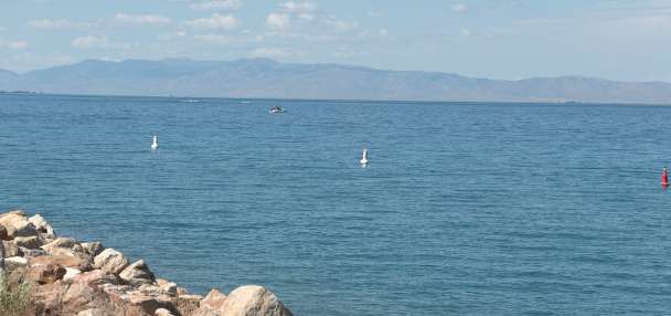
The Great Salt Lake will also continue to benefit from the runoffs, though it is tougher to project its outlook. The lake's level at the Saltair Boat Harbor is now up nearly 4 feet since November, according to U.S. Geological Survey data. But Miller said the lake levels are dependent on factors that the agency can't control, primarily upstream water consumption.
Yet the high streamflows forecast for the next few weeks and months are expected to help the lake continue to rise.
In the meantime, Miller advises residents to pay attention to Utah's forecast to prepare for any flooding in advance, as well as pay attention to any advisories or warnings issued by the National Weather Service.
"Even though there may not be a warning out, flows are going to be high (and) they're going to be fast," he said. "Exercise caution when you're going out and enjoying the nice days we've all been waiting for."
Contributing: Debbie Dujanovic and Dave Noriega