Estimated read time: 2-3 minutes
This archived news story is available only for your personal, non-commercial use. Information in the story may be outdated or superseded by additional information. Reading or replaying the story in its archived form does not constitute a republication of the story.
SPRINGDALE, Washington County — This year's barrage of storms is beginning to impact the roads at Utah's most visited national park.
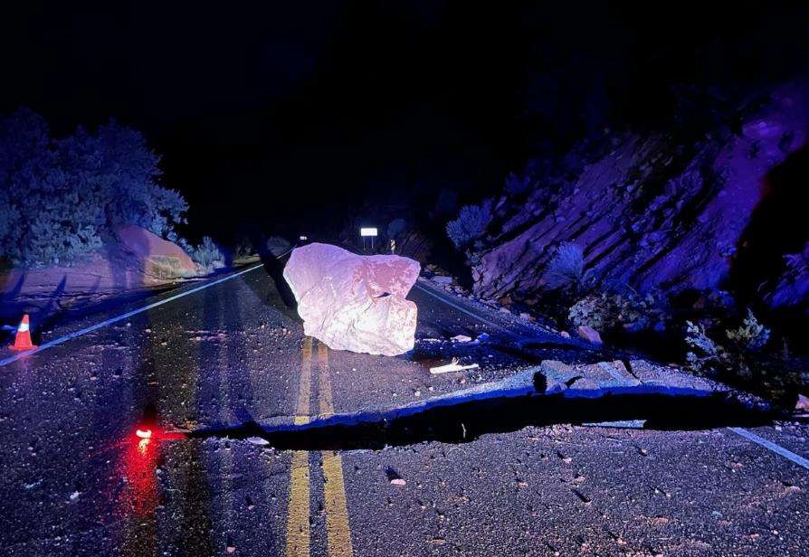
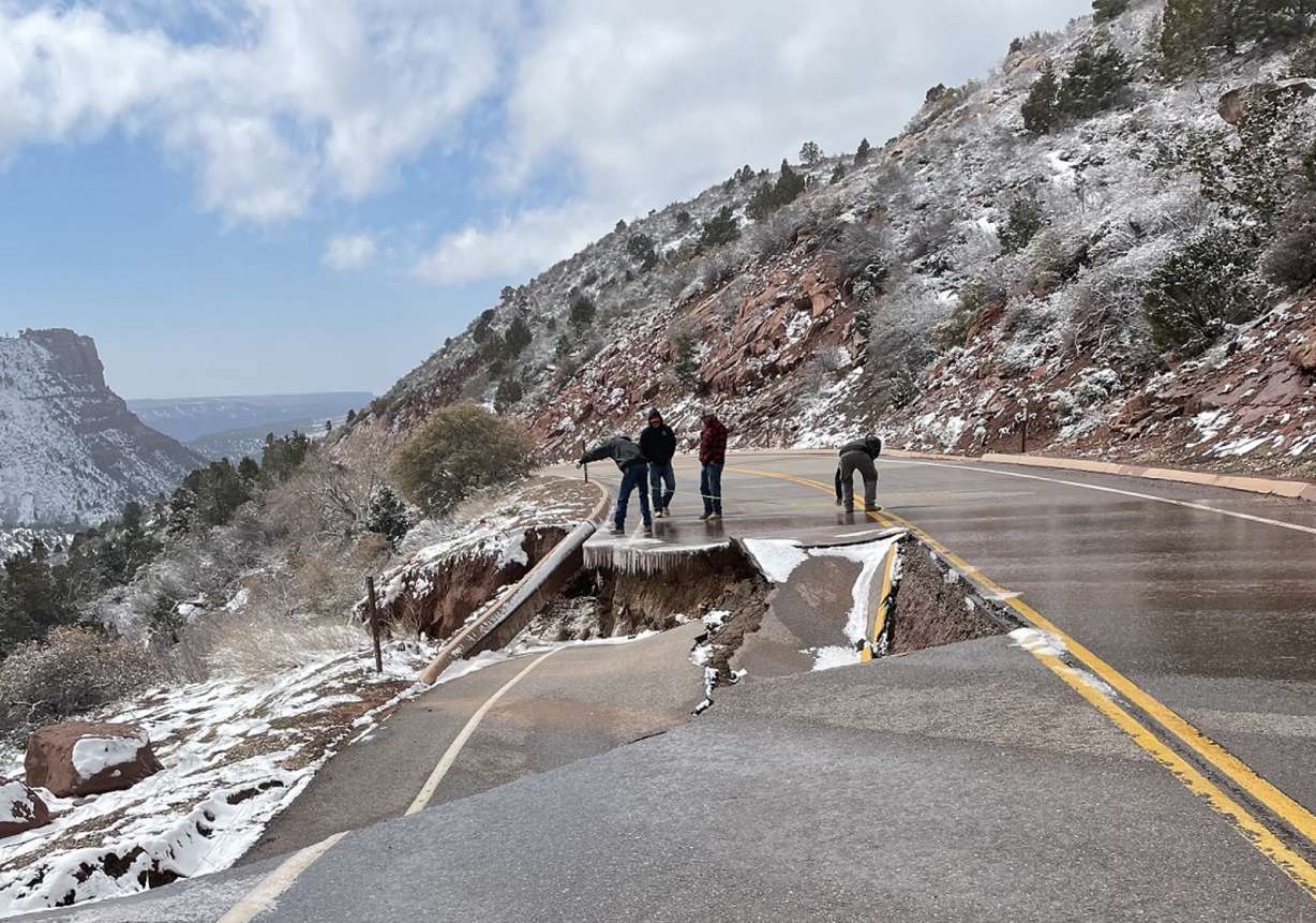
Zion National Park officials said Thursday that maintenance crew and engineers are responding to rockfalls on Zion Canyon Scenic Drive and road damage on Kolob Canyons Road.
The scenic route is still operating normally — albeit with possible temporary closures in certain spots at times if there are more rockfalls — but Kolob Canyons Road is currently closed to drivers, hikers and bikers beyond the Kolob Canyons Visitor Center, according to Jonathan Shafer, the park's spokesman.
Shafer said park rangers are reviewing Kolob Canyons Road conditions to come up with a plan before the road is reopened. It's unclear how long that will take. He added that while rockfalls are not uncommon at Zion National Park year-round, there has been an uptick in incidents over the past few weeks as heavy rain and snow continue to pummel southwest Utah.
"We've seen a number of rockfalls or other incidents that have affected park roads over the last few weeks," he said.
He advises anyone traveling to the park or hiking in the park to check the weather forecast before entering the park and to be aware of their surroundings, especially while in canyons since there is a strong likelihood for further incidents over the next few weeks.
Meanwhile, The Narrows, a popular hike in the park, remains closed to hiking and canyoneering because of high Virgin River flows in the park. The river must flow below 150 cubic feet per second for 24 hours before the hike is reopened.
The river dropped to 127 feet per second Thursday morning, meaning it could temporarily reopen as early as Friday; however, any access would likely be short-lived as there are still 26.5 inches of snowpack left in the basin that fuels the river, nearly three times the basin's normal for an entire season. Once it melts in earnest, the river is expected to flow beyond 150 cubic feet per second in the park for as much as a few months, according to Shafer.
Anyone planning to visit the park is encouraged to check the park's website first to see if any hikes are roads are accessible on the day of their visit.