Estimated read time: 3-4 minutes
This archived news story is available only for your personal, non-commercial use. Information in the story may be outdated or superseded by additional information. Reading or replaying the story in its archived form does not constitute a republication of the story.
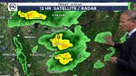
SALT LAKE CITY — After enduring the record-breaking heat of this year's drought, constrained irrigation times and closed boat ramps at many of Utah's reservoirs, residents will get some chilly relief next week as a cold and wet storm moves in.
In other words, pull out the winter coat and prepare yourself for freezing temperatures and mountain snowfall.
The storm should put a smile on the faces of the ski industry and Utah's water watchers, who are anxiously hoping for a cool, wet fall and a glorious snowpack to follow.
"Tuesday will have a high of 43," said David Church, a meteorologist with the National Weather Service in Salt Lake City. "It will certainly be a very wintery feel for us. ... Virtually all of the Wasatch Front will be below freezing Tuesday night into Wednesday."
He added that in some areas there is a possibility of a hard freeze of 28 degrees, which will affect Utah's agricultural operations and mark the end of the growing season.
Friday evening's colder, wetter weather caused UDOT to close the higher elevation area of Guardsman Pass, the narrow pass that crosses from Park City to Big Cottonwood Canyon.
UDOT tweeted the closure is temporary. Guardsman Pass is expected to reopen on Sunday, weather conditions permitting.
🚧 #RoadClosureAlert 🚧
— UDOT Cottonwood Canyons (@UDOTcottonwoods) October 9, 2021
👋 #GuardsmanPass is now temporarily closed at #SR190 gate & #SR224 gate due to weather conditions. Be prepared for ❄️ tonight in upper canyon & safe travels.
Est. reopening is Sunday 10/11, dependent on conditions. #TravelWise@UDOTTRAFFIC@UtahDOTpic.twitter.com/WJunRCAUpQ
The October storm is good news as ski resorts and backcountry regions prep for what is hoped to be an active, wet winter.
Friday, residents should expect widespread precipitation via valley rain and perhaps a dusting of snow at extremely high elevations. But Church said it is next week's storm that will deliver the goods, with anywhere from 4 to 7 inches of snow in the mountains.
"If it comes in cold and wet enough, we could see over a foot of snow in the Cottonwoods (canyons) and at higher elevations," he said, adding some bench areas could also see some snow.
The wet pattern will certainly bring some measure of badly needed relief from a drought state water officials say is the worst on record in Utah since record keeping began in the 1870s.
In the latest Climate and Water Report released by the Utah office of the Natural Resources Conservation Service, the state's water deficit is detailed.
"If we combine the statewide precipitation deficit from the end of this water year with last year's, we get roughly 13 inches of additional moisture (above and beyond what we normally receive) that will be needed to get us back to 'normal'. For context, the average annual statewide precipitation is 32.1 inches, so our current deficit is roughly 40% of what Utah normally gets in a year," the report noted.
Church said an extremely dry fall led to the lowest on record levels for soil moisture. The soil basically stole the spring runoff from rivers and reservoirs, soaking all that moisture in.
While the models show Utah may see a drier than normal, and warmer than normal fall, this storm is bringing hope that the predictions are wrong.
"Any rain or snow we get at this point is helpful. Anything we can do to avoid those conditions we had last year is what we want, and so far we are on the right track," Church said.
Winter conditions can be expected Friday night into Saturday across the higher terrain of Utah, in particular the western Uinta Mountains. Hunters, hikers and others with outdoor plans above 8500 feet should be prepared for winter conditions! #utwxpic.twitter.com/mkbvCu00zU
— NWS Salt Lake City (@NWSSaltLakeCity) October 7, 2021
The National Weather Service of Salt Lake City issued a snow advisory for the Uinta Mountains above 8,500 feet. They say as much as 12 inches could fall by Saturday night.
The Wasatch Front will see a high Friday of 64 degrees, dropping to 54 on Saturday. It will get even colder next week as a second storm moves in.
More rain is expected on Monday and Tuesday with highs reaching only 49 degrees. Lows will be in the mid-30s in the valleys with a possibility of snow, and even colder at higher elevations.
Contributing: Heather Kelly, Matt Brooks