Estimated read time: 4-5 minutes
This archived news story is available only for your personal, non-commercial use. Information in the story may be outdated or superseded by additional information. Reading or replaying the story in its archived form does not constitute a republication of the story.
ECHO — A big rig is sinking a drill deep into the soil — with an aim of 150 feet — and a lubricant foam is flying everywhere.
Soon, the nearby ground is covered with the milky-white stuff as a four-man crew comes up with the prize: a handful of dirt and rock.
The drilling is part of seismic upgrades at Echo Reservoir that will be made over the next year or so. Initial sampling of soils helped the U.S. Bureau of Reclamation understand the type of materials that were underneath the water and how they would react in the event of an earthquake.
"It's kind of like taking an X-ray or a CAT scan and from that you develop a prescription on how to fix it," said Barry Wirth, a spokesman with the federal agency.
Over the years, the bureau has conducted extensive seismic studies on dams in Utah and has set about to make improvements that, while costly and time-consuming, are necessary. Those improvements are not only for the dams' structural integrity, but critical for public safety and to ensure continued storage of water.
"Many of these were built years and years ago before we had the knowledge and understanding of the level of earthquake potential in Utah," Wirth said. "They were built before a lot of the engineering solutions to seismic events existed. That is one of the reasons we are on such an ardent schedule to review facilities because we are going back and applying state of the art technology to bring them up to seismic standards."
Water immediately downstream from a dam saturates the soil. Soggy soils do not stand up well in earthquakes, which sap the strength and stiffness of soil in a process called liquefaction. When that happens, the dam could slump.
In many cases, crews excavate the liquefied materials and replace them with strong, more stable rocks and dirt. Earthen berms are built to help buttress the dam, shoring it up to better withstand temblors.
The improvements being made to Echo will require lowering the water level 15 feet by mid-July of 2012, said Curt Pledger, manager of the bureau's Provo area office.
Water districts such as Weber Basin and others will steadily tap the water supply at Echo to make the drop happen by that time frame.
"Instead of taking a little bit out of all the reservoirs, they'll pull heavy on Echo and keep water in the upper reservoirs," Pledger said.
Seismic upgrades have already been made to Deer Creek and Pineview and to the spillways at Hyrum and Scofield reservoirs. Pineview, in Weber County, which was built over a three-year period beginning in 1934, was reinforced with an earthen berm and also had seismic upgrades made to its spillway.
Sampling to begin at Willard Bay
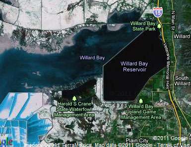
Crews will begin sampling soils next week at Willard Bay, a water storage reservoir north of Ogden that abuts the Great Salt Lake and is a popular boating destination.
Tage Flint, general manager of the Weber Basin Water Conservancy District, said the district and the bureau began a feasibility study to determine the potential impacts of raising the level of the dam by three to four feet.
The additional capacity would allow the district to capture some of its water rights to the Ogden and Weber rivers in high run-off years, boosting water storage to meet increasing population demands in the years to come.
That study, however, has been put on hold after the district learned that the AV Watkins Dam that creates the fresh water bay is on the priority list for a seismic evaluation.
The 46-year-old dam on the shore of the Great Salt Lake is somewhat of an anomaly in Utah, with an odd rough-rectangle shape that is 14.5 miles long. A five-mile stretch of the dam has been classified as "high hazard," not because it is at imminent risk of failure, but rather because there are people, houses and other infrastructure that could be at risk should it fail.
That stretch of the dam runs parallel to I-15 in Box Elder County, where houses and farms dot the landscape.
Pledger said it will take a number of months for analysts in Denver to determine the seismic health of the structure, with results tentatively due in October of this year.
Such improvements, he added, can take just a few years to complete or up to a decade depending on the complexity of the work and budget constraints.
"Dams with the highest priority get the most money and the most attention."
Email:aodonoghue@ksl.com