Estimated read time: 2-3 minutes
This archived news story is available only for your personal, non-commercial use. Information in the story may be outdated or superseded by additional information. Reading or replaying the story in its archived form does not constitute a republication of the story.
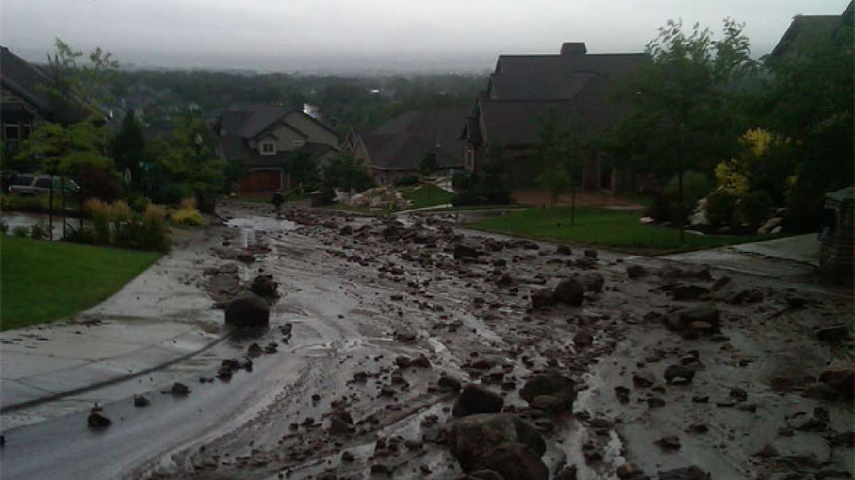
SALT LAKE CITY — With moisture-laden soil across the state receiving fresh bursts of precipitation over the weekend and Monday, it's not just floods that loom as a threat for Utahns, but mudslides as well.
"It's not too soon to say there are potential problem areas," said Rich Giraud, senior geologist with the Utah Geologic Survey's geologic hazards program.
April is typically the month along the Wasatch Front for slide activity, but Giraud said there have already been some problems reported, with slides in North Salt Lake and on transportation corridors such as I-80 at Parleys Summit.
Where precipitation has been above normal — which is most of the state — is where geologists will assess the potential hazards.
- Move out of the path of the landslide or debris flow and stay away from the area.
- If escape is not possible, curl into a tight ball and protect your head.
- Check for injured persons near the slide.
- Watch for flooding, which may occur after a landslide or debris flow.
- Look for and report broken utility lines to appropriate authorities.
- Check building foundations, chimneys and surrounding land for damage.
"In Davis County, there is enhanced potential, and while Provo is not as high, it is an area where we certainly expect a potential for landslides," Giraud said.
Giraud said slight ground movement has already been detected at historic trouble spots such as Mountain Green and Cedar Hills in Utah County, where a 2005 slide took out part of a condo unit. Giraud is also keeping an eye on the Sherwood Hills area in Provo, which has had troublesome landslide activity in the past.
Geologists have taken precipitation totals from other years in which landslides were particularly active and will be looking for patterns to emerge.
Active landslide years along the Wasatch Front have been 1997-98 and the 2004-05, years that coincidentally were similar in precipitation totals.
Armed with that historical knowledge, the Utah Geological Survey is coordinating with local cities and counties to determine what infrastructure may be at risk — from above-ground structures such as homes and streets to underground utilities that could be impacted.
Even smaller mudslides can present severe challenges to culinary water or storm sewer lines, and the amount of muck deposited requires fast-responding public utility departments.
Jeff Niermeyer, director of Salt Lake City's Department of Public Utilities, said the city is keeping a close eye on a slide area at the mouth of City Creek Canyon, which has been historically active for close to three decades.
"Every time we get one of these springtime sort of events, we go out there and keep an eye on it to see if we have any movement going on."
A wet April will compound the threat of the problem, which should ease by the end of that month because of vegetation growth.
"At that time we generally get some consumptive use of water by plants after they have been dormant. During that time, all the water is just percolating down and raising the water table up," Giraud said.
As plants begin to grow once again on hillsides, thirsty, growing roots help to dry out the soil, making it less susceptible to slides.
E-mail:aodonoghue@ksl.com


