Estimated read time: 4-5 minutes
This archived news story is available only for your personal, non-commercial use. Information in the story may be outdated or superseded by additional information. Reading or replaying the story in its archived form does not constitute a republication of the story.
- Utah's recent storm brought significant snowfall, with some resorts receiving about 2 feet of new snow.
- The storm delivered much-needed water, improving snowpack levels and potentially easing drought conditions.
- No additional storms are forecast, with a cool and dry Thanksgiving weekend expected.
SALT LAKE CITY — Utah's mountains received a much-needed jolt from an atmospheric river that passed through the state before Thanksgiving. The rain and snow were welcomed after a relatively slow start to the water year.
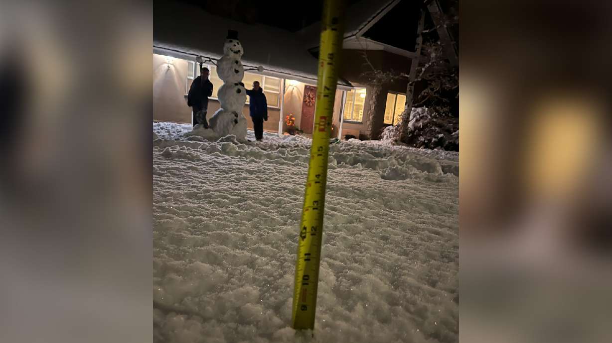
The latest storm, which arrived on Monday, slammed central and south-central Utah the hardest, dropping about 2 feet of snow at Eagle Point Resort, officials at the Beaver resort reported on Wednesday. The National Weather Service reported that Big Flat, a mountain site east of Beaver, received 4.3 inches of precipitation, showing off how water-heavy the snow was.
"They were the big winners," said KSL meteorologist Matt Johnson, adding that other areas also piled on the snow. "This was a good storm ... The water content in this was great."
Storm totals
This storm was the biggest to hit Utah so far this season. Brighton Resort in Big Cottonwood Canyon, Deer Valley Resort in Park City and Snowbasin Resort in Ogden Canyon all reported near or more than 1½ feet of fresh powder, while several others ended up with at least a foot of new snow.
Northern Utah's mountains weren't as fortunate, where some resorts received about 5 to 7 inches.
Eagle Point Resort officials said they believed they could have gotten another foot had cooler temperatures prevailed earlier in the system. Nevertheless, they were thrilled with the outcome before their scheduled mid-December opening date.
"(The) snow is very dense and is exactly what we need for a good base," a post on the resort's Instagram account says.
Close to 2 FEET measured down at Eagle Point. Photo does a justice 👍 #utwx
— Matthew Johnson (@KSL_Matt) November 27, 2024
📍: Tushar Mountains, UT
📸: @SkiEaglePointpic.twitter.com/bPzjsPneM0
Johnson said there might be some lingering showers or flurries in the mountains on Wednesday, potentially padding the totals, but most of the storm is clearing out. The National Weather Service canceled most of its winter storm warnings Wednesday morning, slightly earlier than expected.
More importantly, the storm brought plenty of water with it. The weather service reported that many high-elevation sites across central and southern Utah ended up with over 3 inches of precipitation, while one Beaver site led all valley communities with 1.76 inches of precipitation.
Parts of northern Utah also came away with plenty of water. North Ogden received 1.31 inches of precipitation, while a site near Ben Lomond Peak received 2.7 inches of precipitation. Parts of the Cottonwood Canyons also wound up with over 1.5 inches of new water.
Johnson said some communities missed out because of the storm's dynamics. For example, Salt Lake City only received 0.15 inches of precipitation from the system because the storm's south and southwest trajectory created shadowing in parts of Tooele and Salt Lake counties.
"When that wind gets over the Oquirrhs, we get a lot of sinking air that really prevents rains and snow from happening," he explained. "That's one of the tricks of the trade here in Utah, living with complex topography and terrain."
Either way, the precipitation built on another storm that delivered nearly a foot in parts of the state and 0.28 inches of precipitation in places like Salt Lake City.
An important boost
Both storms will likely show up in the U.S. Drought Monitor at some point, chipping away at the state's dry conditions following a hot and dry summer and early fall. Over 97% of the state remained abnormally dry, including 20% in drought, entering the week, according to the monitor.
"Since we've had all these small little storms, this was really big to get something that's a little more substantial," Johnson said. "It's going to strengthen the snowpack (and) put down a nice layer right before the cold months come. ... This is really good news."
The water-heavy snow from the past week gave Utah's snowpack — a measure of water within the state's mountain snow — a nice bump. It rose to 2.7 inches of snow water equivalent by Wednesday morning, almost doubling over the past week, according to Natural Resources Conservation Service data.
Not surprisingly, the Beaver snowpack basin won big. It gained 3.3 inches since Monday, bumping its season total to 5.1 inches so far.
Utah's statewide level is now 130% of the median for this point in the season, but there's plenty of season left to go. It's nearly one-fifth of the median peak for the entire season, which normally peaks in early April.
Quieting down
Additional storms aren't in the immediate forecast. Johnson said Utah's active pattern is quieting down, as Thanksgiving and the rest of the week are forecast to be cool and dry to wrap up meteorological fall.
"It would've been nice to follow it up with more storms, but after this, it's quiet for at least the next seven days," he said.
Full seven-day forecasts for areas across Utah can be found online, at the KSL Weather Center.


