'%3e%3cpath%20d='M34.1406%205.85938C30.3906%202.10547%2025.3047%200%2020%200C14.6953%200%209.60938%202.10547%205.85938%205.85938C2.10938%209.61328%200%2014.6953%200%2020C0%2025.3047%202.10547%2030.3906%205.85938%2034.1406C9.61328%2037.8906%2014.6953%2040%2020%2040C25.3047%2040%2030.3906%2037.8945%2034.1406%2034.1406C37.8906%2030.3906%2040%2025.3047%2040%2020C40%2014.6953%2037.8945%209.60938%2034.1406%205.85938ZM37.0117%2023.543H31.1602V13.5391H27.6328V19.9414C28.1211%2020.6914%2028.3711%2021.582%2028.3711%2022.5625V22.625C28.3711%2023.668%2028.1172%2024.6055%2027.6328%2025.4297V26.6094H36.082C33.4883%2032.9375%2027.2891%2037.3789%2020.0039%2037.3789C10.3711%2037.3789%202.62109%2029.6289%202.62109%2020C2.62109%2010.3711%2010.3711%202.62109%2020%202.62109C29.6289%202.62109%2037.3789%2010.3711%2037.3789%2020C37.3789%2021.1484%2037.2617%2022.2656%2037.0508%2023.3477C37.0391%2023.4141%2037.0234%2023.4766%2037.0117%2023.543Z'%20fill='white'/%3e%3cpath%20d='M22.3086%2018.5352C20.4336%2018.125%2019.9531%2017.8398%2019.9766%2017.1836V17.1406C19.9766%2016.6992%2020.3477%2016.2148%2021.4023%2016.2148C22.582%2016.2148%2023.8867%2016.6797%2025.0781%2017.4766L26.8516%2015.0195C25.4453%2013.8906%2023.707%2013.3398%2021.5547%2013.3398C18.5195%2013.3398%2016.4375%2015%2016.4063%2017.4766V17.5352C16.3633%2020.2617%2018.5859%2020.9805%2021.293%2021.6016C23.0391%2021.9766%2023.5703%2022.3164%2023.5703%2022.9609L23.5469%2022.9766C23.5469%2023.3906%2023.2578%2023.7031%2022.7852%2023.8359C22.5742%2023.9062%2022.1289%2023.9727%2021.5156%2023.9727C20.7617%2023.9727%2019.7539%2023.8633%2018.6328%2023.4844C18.0898%2023.2891%2017.4727%2023.0039%2016.8047%2022.6133L20.1406%2026.625C20.2813%2026.6602%2021.0977%2026.8516%2021.7734%2026.8516C25.0039%2026.8516%2027.0859%2025.2461%2027.1094%2022.6328V22.5703C27.1602%2020.1133%2025.2148%2019.1719%2022.3086%2018.5352Z'%20fill='white'/%3e%3cpath%20d='M5.24219%2013.5664V26.6133H8.75391V23.7578L10.2969%2021.9531L14.2031%2026.6133H18.3867L12.3555%2019.5195L17.4023%2013.5664H13.4531L8.75391%2019.0586V13.5664H5.24219Z'%20fill='white'/%3e%3c/g%3e%3cdefs%3e%3cclipPath%20id='clip0_97_2430'%3e%3crect%20width='40'%20height='40'%20fill='white'/%3e%3c/clipPath%3e%3c/defs%3e%3c/svg%3e)


Estimated read time: 2-3 minutes
This archived news story is available only for your personal, non-commercial use. Information in the story may be outdated or superseded by additional information. Reading or replaying the story in its archived form does not constitute a republication of the story.
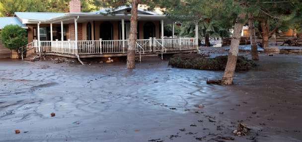
SALT LAKE CITY — A longtime hydrologist expressed optimism Monday about the potential for the county to avoid any further runoff and flooding issues. However, the risk still exists, particularly along Big and Little Cottonwood creeks with an upcoming thunderstorm threat.
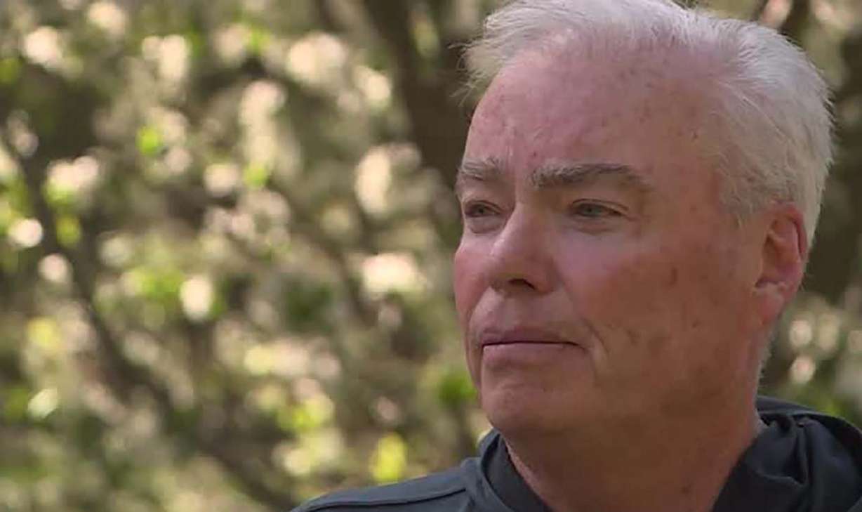
Brian McInerney, a hydrologic consultant with Salt Lake City Public Utilities, told KSL the moderate weather in recent weeks had been ideal in a year with record snowpack.
"You couldn't have scripted a better weather scenario to bring down 200% of median river flows that we see right now," McInerney said.
He said most of the significant creeks in Salt Lake County appear to be trending in a positive direction.
"Emigration (Creek) is roughly out of snow to produce any large, damaging peak flows," McInerney said. "Red Butte is out of snow to produce any big flows. City Creek is mostly out of the woods unless we get a big rain event."
But he said the situation is different for Big and Little Cottonwood creeks.
"If we get hot weather with bright sunshine for, say a week to 10 days, we could produce some flooding in both of those," McInerney said.
He noted, however, that the current forecast calls for continued moderate temperatures with clouds and the potential for thunderstorms Thursday through the following Wednesday.
According to McInerney, a significant thunderstorm that hits over the Cottonwood canyons could also prove problematic.
"If we get a rain event that puts down an inch to maybe an inch-and-a-half of rain, now we're up to 4 inches of water coming out of the canyon at once, and those channels can't handle that."
However, if the creeks avoid problems in the next two weeks, McInerney said he is hopeful for the future.
"At that point, you have to ask yourself do we have enough snow to produce damaging flows? And I don't think so," McInerney said. "I think we'll be close to melting out enough snow that we won't have the damaging peak flows."