'%3e%3cpath%20d='M34.1406%205.85938C30.3906%202.10547%2025.3047%200%2020%200C14.6953%200%209.60938%202.10547%205.85938%205.85938C2.10938%209.61328%200%2014.6953%200%2020C0%2025.3047%202.10547%2030.3906%205.85938%2034.1406C9.61328%2037.8906%2014.6953%2040%2020%2040C25.3047%2040%2030.3906%2037.8945%2034.1406%2034.1406C37.8906%2030.3906%2040%2025.3047%2040%2020C40%2014.6953%2037.8945%209.60938%2034.1406%205.85938ZM37.0117%2023.543H31.1602V13.5391H27.6328V19.9414C28.1211%2020.6914%2028.3711%2021.582%2028.3711%2022.5625V22.625C28.3711%2023.668%2028.1172%2024.6055%2027.6328%2025.4297V26.6094H36.082C33.4883%2032.9375%2027.2891%2037.3789%2020.0039%2037.3789C10.3711%2037.3789%202.62109%2029.6289%202.62109%2020C2.62109%2010.3711%2010.3711%202.62109%2020%202.62109C29.6289%202.62109%2037.3789%2010.3711%2037.3789%2020C37.3789%2021.1484%2037.2617%2022.2656%2037.0508%2023.3477C37.0391%2023.4141%2037.0234%2023.4766%2037.0117%2023.543Z'%20fill='white'/%3e%3cpath%20d='M22.3086%2018.5352C20.4336%2018.125%2019.9531%2017.8398%2019.9766%2017.1836V17.1406C19.9766%2016.6992%2020.3477%2016.2148%2021.4023%2016.2148C22.582%2016.2148%2023.8867%2016.6797%2025.0781%2017.4766L26.8516%2015.0195C25.4453%2013.8906%2023.707%2013.3398%2021.5547%2013.3398C18.5195%2013.3398%2016.4375%2015%2016.4063%2017.4766V17.5352C16.3633%2020.2617%2018.5859%2020.9805%2021.293%2021.6016C23.0391%2021.9766%2023.5703%2022.3164%2023.5703%2022.9609L23.5469%2022.9766C23.5469%2023.3906%2023.2578%2023.7031%2022.7852%2023.8359C22.5742%2023.9062%2022.1289%2023.9727%2021.5156%2023.9727C20.7617%2023.9727%2019.7539%2023.8633%2018.6328%2023.4844C18.0898%2023.2891%2017.4727%2023.0039%2016.8047%2022.6133L20.1406%2026.625C20.2813%2026.6602%2021.0977%2026.8516%2021.7734%2026.8516C25.0039%2026.8516%2027.0859%2025.2461%2027.1094%2022.6328V22.5703C27.1602%2020.1133%2025.2148%2019.1719%2022.3086%2018.5352Z'%20fill='white'/%3e%3cpath%20d='M5.24219%2013.5664V26.6133H8.75391V23.7578L10.2969%2021.9531L14.2031%2026.6133H18.3867L12.3555%2019.5195L17.4023%2013.5664H13.4531L8.75391%2019.0586V13.5664H5.24219Z'%20fill='white'/%3e%3c/g%3e%3cdefs%3e%3cclipPath%20id='clip0_97_2430'%3e%3crect%20width='40'%20height='40'%20fill='white'/%3e%3c/clipPath%3e%3c/defs%3e%3c/svg%3e)


Estimated read time: 7-8 minutes
This archived news story is available only for your personal, non-commercial use. Information in the story may be outdated or superseded by additional information. Reading or replaying the story in its archived form does not constitute a republication of the story.
SALT LAKE CITY — Extensively dry conditions across the West have already resulted in a rash of fires in Arizona and New Mexico at the tail end of meteorological spring. However, even with strong optimism for good monsoonal moisture, Jim Wallmann is concerned with what that means for summer and early fall.
"Everything is lining up for another above-normal fire season and we're preparing as such," said Wallmann, a meteorologist with the National Interagency Fire Center in Boise. He spoke during a webinar hosted by the National Integrated Drought Information System on Thursday.
Fires in the West aren't new, but they have been a growing concern as they begin to increase in size and intensity. Last year, there were a half-dozen fires that resulted in at least $1 billion in damage apiece across the entire region, according to the National Oceanic and Atmospheric Administration's Center for Environmental Information.
Some of these fires also produced smoke that ended up traveling across the country. One of the waves from a California fire was strong enough to make air quality measured in Salt Lake City among the worst of any city in the world for a few days last summer.
A pair of bad winter scenarios
Drought conditions across the West date back to spring 2020. Dan McEvoy, a researcher at the Desert Research Institute in Nevada, points out that the span between May 2020 and April 2022 is the second-driest span not just in Utah's history but also in Arizona, California, Nevada and New Mexico. It is the fifth-driest time span for Colorado, and among the driest in Idado, Montana and Wyoming, as well.
Unfortunately for the West, dry conditions didn't really improve over the winter as they should. There were significant storms in October and December that hoisted snowpack levels all across the region heading into 2022 but then everything quieted down, McEvoy said.
McEvoy says the snowpack collection near Truckee, California, in the Sierra Nevada explains a lot of what happened over the winter. The area by Lake Tahoe entered the new year well above average only to drop below average by the start of February and end up below average by the time it melted early.
Utah's statewide snowpack followed this model, too. It entered January at 126% of normal before falling below normal in early Feburary; it ended up peaking at 88% of normal about two weeks ahead of when it typically should begin to melt, according to Natural Resources Conservation Service data.
Parts of the Southwest had a different story this past winter. The San Juan Basin primarily in northwest New Mexico ended the snow collection season near-normal ahead of peak time, but a mixture of hot and dry conditions with dust buildup beginning in April melted the entire snowpack by mid-May.
"This basin melted out just about a month early, so that's not good for water supply in drought conditions," McEvoy said.
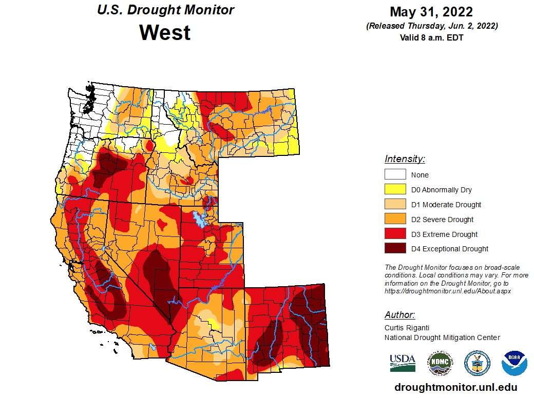
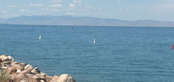
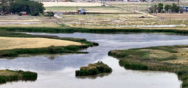
Both scenarios led to conditions today. The U.S. Drought Monitor lists that about three-fourths of the West is experiencing severe drought. The West is defined by the organization as the nine most western states in the continental U.S. It doesn't include Colorado or Wyoming, though both states are also quite dry right now.
The agency currently lists just over 11% of the West as in exceptional drought, which is the worst category. Most of this is in New Mexico, where 46% of the state is listed in the worst category; however, there are also large pockets of exceptional drought in parts of Arizona, California, Nevada and Oregon. Another 32% of the region is listed in extreme drought, including 71% of Utah.
Only 7.4% of the entire region isn't listed as in drought or even exceptionally dry. Those pockets are in the region's northwest corner, containing parts of Idaho, Montana, Oregon and Washington.
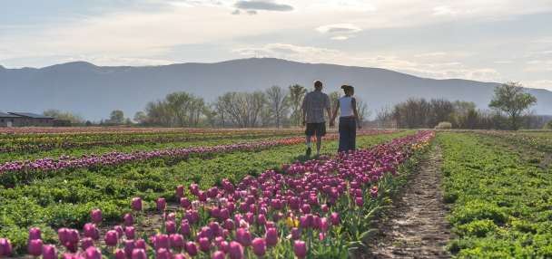
These dry conditions mean lower reservoir levels this summer and increasing fire risk for most parts of the West.
Projecting an active fire season
New Mexico is currently at the heart of where wildfires are happening. There are five Type I or Type II National Interagency Fire Center management teams deployed in the state, which is by far the most of any state at the moment, Wallmann said. The Hermans Peak Fire, which has burned over 315,000 acres since May 6, and the Black Fire, which has burned another 250,000 acres since May 13, are the largest priorities in the state.
Large fires in Arizona also filled Utah skies with smoke in April and the two states are at the highest level of fire preparedness at the moment, which is much higher than the rest of the country as a whole.
The National Interagency Fire Center's outlook calls for this to continue in June, but the above-normal threat extends into southern Utah as well as parts of California, Colorado, Oregon and Wyoming among Western states.
Wallmann said there are "very dry" conditions in all of these areas at moment. In fact, the quickly drying conditions are why new fire restrictions went into place for counties in southeast and southwest Utah on Thursday morning.
Fire restrictions went into effect for southeastern Utah, southwestern Utah, and northern Arizona this morning! Learn more on the Utah Fire Information website: https://t.co/B1gVjU7iCP. pic.twitter.com/YkM3zoBXMe
— Utah Fire Info (@UtahWildfire) June 2, 2022
"This is a forecast of potential and what the fuels are going to be like. It doesn't necessarily say that the fire activity is going to be above-normal," he explained, though the conditions are prime for large fires.
The situation is expected to improve in July with the return of monsoonal storms, which are forecast to ease risks in southern Utah as well as Arizona, Nevada and New Mexico. Wallmann explained that historic La Nina activity is at the center of the growing optimism that there will be monsoons this year.
"A lot of the modeling tools that are also used are showing at least a near-normal if not an above-normal monsoon," he said. "That's why we have a little bit higher confidence that this monsoon season will be (productive)."
That doesn't mean there won't be fires in those areas, but most fires that do happen are small and contained quickly during years of good monsoons, he added.
New above-normal fire risks emerge in northern Utah, as well as in the Pacific Northwest, beginning in July, though.
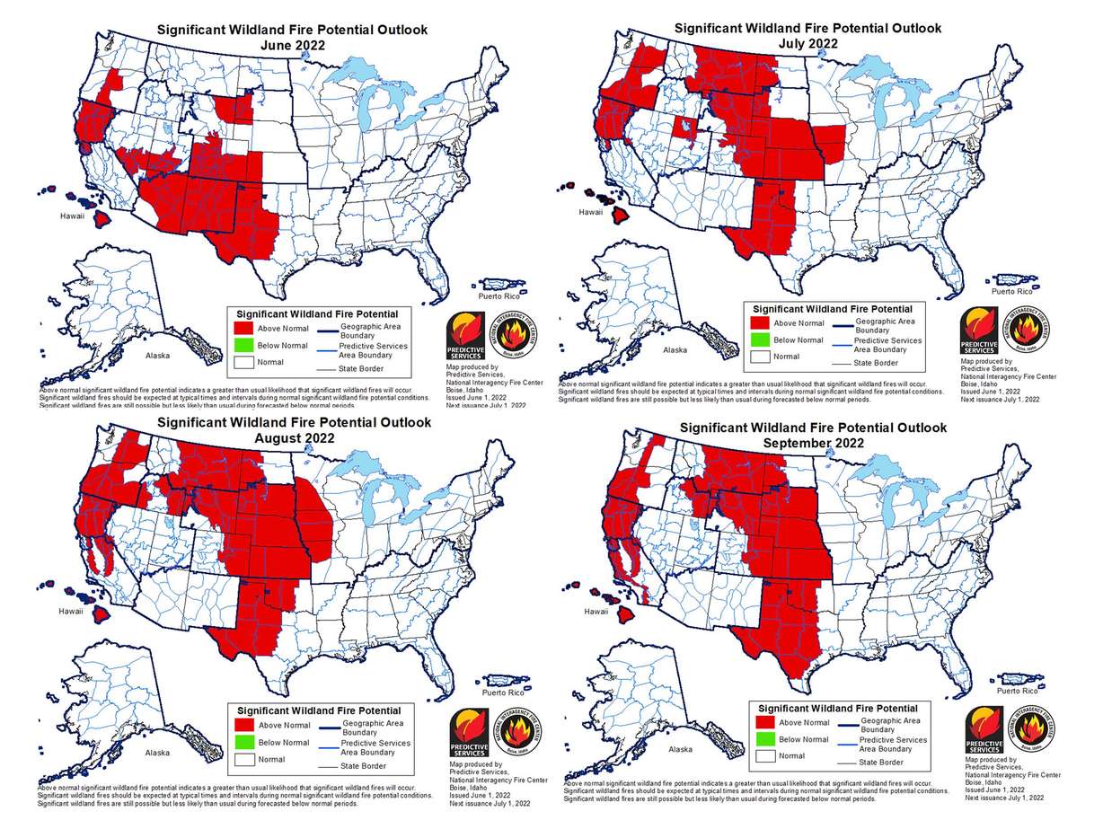
The Southwest states, as well as Nevada and Utah, are listed as having normal fire risks in August and September. However, above-normal risks remain across the Pacific Coast, Idaho and the eastern parts of the West. This means states like Utah may still deal with second-hand impacts of fires in the late summer and early fall.
Wallmann warns there could also be a "second peak" in the Southwest in early fall depending on when the peak of the monsoon season is. He adds it's also unclear right now what below-normal reservoir levels mean in terms of having the materials to fight fires this season.
The importance of preparing
The above-normal fire activity risks already in play and forecast to grow in the coming months are why it's important for residents in the most susceptible areas to begin preparing, said Christina Restaino, an assistant professor and natural resources specialist at the University of Nevada-Extension.
She recommends that homeowners start with a defensible space around the outside of their homes, which is a barrier of at least 5 feet between a home and anything combustible.
"I think that's the easiest thing that you can do quickly," she said.
She also recommends residents have a 1/8th-inch noncombustible screen over all of their home's vents, and that families come up with evacuation plans in advance so they can quickly and safely leave their home in case of an emergency. It also doesn't hurt for homeowners to check how much their insurance covers in case a person's home is damaged or destroyed.
There are many steps people can take to help avoid disaster and many steps to avoid starting a fire in the first place. More tips can be found at utahfiresense.org.