Estimated read time: 7-8 minutes
This archived news story is available only for your personal, non-commercial use. Information in the story may be outdated or superseded by additional information. Reading or replaying the story in its archived form does not constitute a republication of the story.
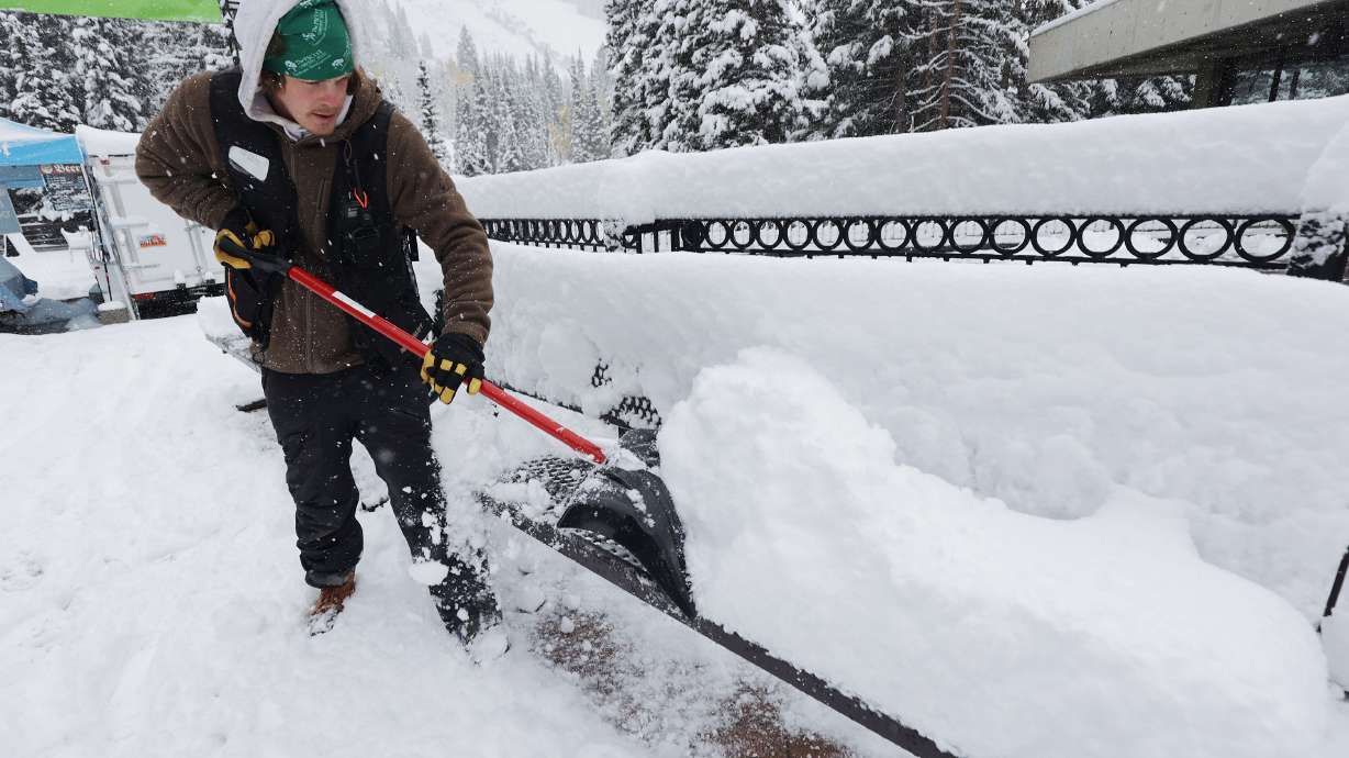
SALT LAKE CITY — It may be spring, but at least one last dose of winter is projected to come Utah's way this week.
The National Weather Service issued a winter storm warning for the northern Utah mountains where a storm with the potential of delivering 1 to 2 feet of snow to start the workweek. The agency upgraded it from a winter storm watch, which it had originally issued Sunday.
In addition, federal meteorologists issued a winter weather advisory for Wasatch Plateau/Book Cliffs and central Utah mountain ranges, where close to a foot of snow is possible. The storm is forecast to bring snow to the valleys, as well.
"It's a big-time kind of spring storm," said KSL meteorologist Kevin Eubank.
The snow is the result of a trough system coming in from the Pacific Northwest Monday, Eubank explained. While there, it produced the first measurable snow in April recorded at Portland International Airport since records began there in 1940.
Strong winds are expected Monday prior to its arrival. The weather service issued a high wind warning for parts of south-central Utah, where gusts up to 65 mph are forecast Monday afternoon through early Tuesday. Wind advisories will be in effect for many other parts of the state Monday.
Precipitation is forecast to arrive Monday afternoon, providing valley rain and mountain snow at first. But that changes overnight and into Tuesday, as rain shifts to snow with the arrival of the colder part of the storm.
"By Tuesday, (it's) all snow, all the way down the I-15 corridor, all the way to eastern Utah," Eubank said. "Then, a secondary little push comes down Tuesday afternoon and evening, and that keeps stuff going — even lake effect snow going all the way through Wednesday morning."
How much snow is forecast
The winter storm warning goes into effect at noon Monday and continues through 3 a.m. Wednesday for the Wasatch and West Uinta mountain ranges. It includes communities like Alta, Brighton and Mantua, as well as places along the Mirror Lake Highway.
The heaviest snow is expected in the upper Cottonwood Canyons, where "locally higher amounts" are projected than the 1 to 2 feet of snow, the warning states. Five to 10 inches is forecast for areas within a winter weather advisory, such as Cove Fort, Fish Lake, Joes Valley and Scofield.
Rain and snow will build into northern Utah Monday afternoon. Conditions will be warm enough for valley rain into the evening, but that will transition to snow late evening. Temperatures will be cold enough for mountain snow throughout. Here is forecast accumulation. #utwx#wywxpic.twitter.com/xGb97rz17A
— NWS Salt Lake City (@NWSSaltLakeCity) April 10, 2022
Most valleys along the I-15 corridor — from Logan to Cedar City — are expected to receive snow accumulation. While earlier models indicated the possibility of 3 to 6 inches in the Wasatch Front valleys, updated forecast models now project a stronger likelihood of 1 to 4 inches throughout the duration of the storm.
Bench areas in the valleys and the Wasatch Back, such as Park City or Heber City, may receive anywhere from 3 to 8 inches of snow.
Travel impact
The National Weather Service says drivers should expect "winter driving conditions" on all mountain passes from central through northern Utah Monday evening through Wednesday morning. It will likely lead to traction requirements throughout the time the storm is dumping snow.
"If you must travel, keep an extra flashlight, food and water in your vehicle in case of an emergency," the agency advises.
The Utah Department of Transportation issued a road weather alert Monday morning to prepare drivers on what to expect through at least Tuesday evening. Strong wind gusts are expected early ahead of the rain and snow, the alert states.
It also advises that "brief road slush" is expected Monday evening and into the middle of the night across portions of the Wasatch Front; however, it likely won't stick long because of air and pavement temperatures. As for the higher passes, "significant" road snow is expected overnight into Tuesday morning.
"Periods of road snow/slush can also be expected along I-15 from Scipio Summit to Cedar City as well as portions of the U.S. Highway 89 valley late overnight into early Tuesday morning," UDOT advises. "Interior valley routes including Cache Valley and the U.S. Highway 89 valley in southern Utah will also experience light road snow/slush (Monday night)."
Snow may impact travel Tuesday, as well. The colder air may present "lingering road snow/ice impacts" through Wednesday morning.
The alert adds these highways or freeways will be most impacted by the storm:
- Interstate 15: From Scipio Summit to Cedar City
- Interstate 70: Clear Creek/Fish Creek Summit to Fremont Junction
- Interstate 84: Weber Canyon to the Utah-Wyoming border
- U.S. Highway 6: Soldiers Summit to Helper
- U.S. Highway 40: Mayflower Summit to Pinion Ridge
- U.S. Highway 89: Logan Summit/Canyon through Cache Valley; Thistle/U.S. 6 Junction to Junction; Long Valley Junction area
- U.S. Highway 189: Provo Canyon
- U.S. Highway 191: Utah-Wyoming border to U.S. 191 Summit; Monticello area
- State Route 20: Entire route
- State Route 143: Entire route
- State Route 153: Entire route
- State Route 190: Big Cottonwood Canyon
- State Route 210: Little Cottonwood Canyon
Snowpack boost
While there may be travel headaches from the return to winter driving, the storm is immensely beneficial given the dry start to 2022. As of Monday morning, the melting statewide snowpack is at 8.6 inches of water, 3.4 inches below this year's March 22 peak and about 64% of average at this point of the year. Snowmelt from the snowpack accounts for about 95% of the state's water supply.
After a strong December, what went wrong? The National Centers for Environmental Information on Friday updated its data through March, offering a look at climate data from the first quarter of the year. While March was wetter than either January or February, in terms of normal precipitation totals, it didn't do much in terms of chipping away at precipitation deficits from the first two months.
Last month ended up as Utah's 32nd driest March dating back to 1895, according to the federal agency. It lists the state's first quarter of the year as the fourth driest on record in 128 years. It was the 35th warmest March, helping the snowpack melt a bit earlier than usual — the peak collection date is typically in early April.
The storm helps at least some of the state's snowpack regions. It's too early to know how much water it will bring, as the formula for snow water equivalent varies. However, the forecast offers the potential of adding an inch or two of water in some snowpack collection areas this week.
"Remember, the benefit at the end of the day is going to be all that new snow in the mountains, which is definitely going to help with the snowpack (in regard to) water amounts in the reservoirs," said KSL meteorologist Grant Weyman.
Colder temperatures
Temperatures will also plummet again. High temperatures will reach close to 60 Monday across the Wasatch Front; however, they are forecast to only top out in the mid-to-upper 30s Tuesday and Wednesday. Lows are expected to fall near or below the freezing point Tuesday through Thursday morning. High temperatures will return to the 50s again to close out the workweek.
These may impact "vulnerable" fruit trees, plants and other early agriculture, the weather service tweeted.
In St. George, highs will fall from the 70s to the upper 50s and low 60s Tuesday and Wednesday before returning to near 70 by the end of the workweek.
Full seven-day forecasts for areas across Utah can be found online, at the KSL Weather Center.


