Estimated read time: 5-6 minutes
This archived news story is available only for your personal, non-commercial use. Information in the story may be outdated or superseded by additional information. Reading or replaying the story in its archived form does not constitute a republication of the story.
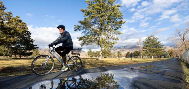
SALT LAKE CITY — 2022 is picking up right where 2021 left off, at least in northern and central Utah.
The National Weather Service issued a series of winter storm warnings and winter weather advisories on Tuesday that cover mountain areas in northern Utah, where up to another 3 feet of snow could fall through Thursday.
Several inches of snow is also expected in the Cache Valley and Wasatch backcountry communities, while the Wasatch Front should receive snow, as well.
The return of snow
The storm system is making its way from the west but not covering the entire state as some December storms did. Weather service hydrologists told KSL.com last week that a new system over the Pacific Ocean was emerging, changing storm patterns coming into the West.
KSL meteorologist Kristen Van Dyke said northern Utah areas are expected to receive some snow flurries off and on Tuesday. The storm is expected to dip into Salt Lake County by evening, she said.
"Another system comes in (Wednesday) and that can bring in more accumulating snow during the morning hours (Wednesday) continuing into the afternoon and maybe even (Wednesday) night," she said. "For the Wasatch Front, we could be looking at a mix of rain and snow. And then Thursday we'll see things quiet down a little bit, once we get through Thursday morning."
Most of the snow is expected in the mountains throughout the duration of the storm system. Wasatch and Western Uinta mountains areas, including Alta, Brighton, Logan Summit, Mantua and the Mirror Lake Highway, are included in a winter storm warning issued Tuesday afternoon.
The mountains are expected to receive anywhere between 18 inches and 36 inches of snow between Tuesday and Thursday evening. The warning will remain in place through 5 p.m. Thursday. The areas were initially listed in a winter weather advisory with a forecast of 1 to 2 feet.
Winter driving conditions, including snow-covered roads and greatly reduced visibility, can be expected," the weather service wrote in the alert. "Areas of blowing snow may reduce visibility to near zero at times."
The forecasted storms tack onto a productive December for those high-elevation areas. For instance, the weather service station at Alta collected over 8.5 feet of new snow last month. The Wasatch Mountain snowpack rose from about one-third of normal in early December to a range of 107% to 117% of normal, as of Tuesday.
Meanwhile, an advisory in the Cache Valley and Wasatch backcountry, such as Garden City, Heber City, Huntsville, Logan, Park City, Smithfield and Woodruff, lists 4 to 8 inches of snow through early Thursday, with some higher averages closer to Huntsville and the Ogden Valley.
The National Weather Service also tweeted a snow model Tuesday morning showing that Logan may end up with up to 1 foot of snow by Thursday, while Park City may also receive over 1 foot of snow.
A series of storm systems will bring periods of rain and snow to northern Utah and southwest Wyoming through Thursday. The snow could result in significant impacts for the Wednesday morning commute. Here's our latest snow forecast. #utwx#wywxpic.twitter.com/2Sn3hTa685
— NWS Salt Lake City (@NWSSaltLakeCity) January 4, 2022
Another advisory was added Tuesday afternoon for parts of central Utah which were initially not forecast to receive as much snow. The alert, which goes into effect at 11 p.m. and remains in place through 5 p.m. Thursday, states 8 to 16 inches are expected in areas like Cove Fort, Fish Lake, Joes Valley and Scofield.
Winter driving conditions, including snow-covered roads and low visibility, are expected at times Tuesday and Wednesday throughout northern Utah, according to the weather service.
The weather service's model lists 1 to 8 inches of snow from Brigham City to Provo through Thursday, with the highest totals expected in and around Ogden, Davis County and Provo.
Road Weather Alert: Periods of heavy mountain road snow expected for northern Utah mountain routes, valid 3PM Tuesday through 12 PM Thursday. For more info visit: https://t.co/4P1gO1U0Gg@UtahTrucking#utwx#utsnowpic.twitter.com/Fq5RN7x5MC
— UDOT Traffic (@UDOTTRAFFIC) January 4, 2022
The Utah Department of Transportation issued a road weather alert for most parts of the state from Parleys Summit north Tuesday. Roads are expected to remain slippery in those areas Wednesday into Thursday.
"By 2-3 a.m. Wednesday, snowfall rates will begin to pick up quite a bit along routes from the Cottonwoods northward. The heavier rates will fill in along all northern mountain routes through the morning and into the early afternoon," the alert states.
"Rates will begin to decrease mid to late afternoon Wednesday with lighter snow continuing into Wednesday night," the UDOT alert continues. "Snow will largely taper off Thursday morning with the exception of summits/passes possibly seeing snow into the early afternoon Thursday. Regardless, all major impacts will end by noon."
The agency urges drivers to slow down and use caution, especially on high-elevation roads. I-15 and U.S. 89 from the Utah-Idaho border to Brigham City, I-80 from Parleys Canyon to the Utah-Wyoming border and the entire route of I-84 in Utah are expected to be impacted the most in addition to the mountain routes like Big and Little Cottonwood Canyons.
Windy weather
Wind is another component of the forecast over the next few days. The weather service issued high wind warnings and watches for parts of southwest Wyoming, including Flaming Gorge; however, some strong gusts are also expected in parts of Utah.
Gusts up to and over 45 mph are expected across northeast Utah, including Randolph. Wind gusts are also expected to exceed 30 mph in areas like Park City and Duchesne between Tuesday morning and Wednesday evening.
Van Dyke said there will be some strong gusts along the Wasatch Front but nowhere near the possibilities in northeastern Utah and southwestern Wyoming.
"We'll see some gusty winds along the Wasatch Front but the areas (in northeast Utah) could see gusts in excess of 55 and 60 mph while (the Wasatch Front) stays more in the 25 to 30 mph range for most of the day," she said.
Full seven-day forecasts for areas across Utah can be found at the KSL Weather Center.