Estimated read time: 4-5 minutes
This archived news story is available only for your personal, non-commercial use. Information in the story may be outdated or superseded by additional information. Reading or replaying the story in its archived form does not constitute a republication of the story.
SALT LAKE CITY — The National Weather Service on Monday issued a series of flash flood watches for most of central and southern Utah, including Cedar City, Moab, St. George and the state's national parks as remnants of Hurricane Nora and monsoon moisture move north into the state beginning Tuesday.
Rain is also expected throughout most of Utah this week as a result of the moisture pattern.
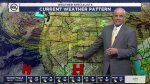
"This is going to impact the entire state, although the core impacts and the heaviest rainfall will come over central and eastern Utah," said KSL meteorologist Kevin Eubank.
The rain coming into Utah is the result of a "surge of monsoon moisture along with remnant moisture from Nora," according to meteorologists from the national weather service. They added that the storms are "capable of locally heavy rainfall as well as areas of widespread light to moderate rainfall."
Nora became a Category 1 hurricane over the weekend before it slammed into Mexico and weakened to a tropical storm. Reuters reported Sunday that a boy was killed after a hotel partially collapsed in the resort town of Puerto Vallarta.
Eubank explains that a high-pressure ridge currently over Arizona is picking up the storm and help move it north in the U.S. As that system moves, it'll help the remnants of Nora reach the Beehive State.
"The interesting thing about this is that high is critical and its location is critical," he said. "If it were to stay right where it is, we wouldn't see a whole lot. The good news is that it's going to move a bit and will open to seeing cloud cover and pretty decent precipitation."
The rain is expected to begin in southwestern Utah on Tuesday afternoon before extended rain from Nora arrives throughout most of central and southern Utah Wednesday.
"It kind of curls from Provo over to the Uinta Basin, not bringing a whole lot to the Wasatch Front," Eubank added.
The weather service's Salt Lake City and Grand Junction offices issued a series of alerts that cover southern Utah that go into effect beginning Tuesday afternoon in some areas of the state.
"Thunderstorms and embedded areas of locally heavier rainfall will be capable of producing flash flooding, especially over slot canyons, normally dry washes, urban areas and burn scars," the agency wrote.
☂️🌧️This is a no b-rain-er...it's gonna rain! A surge in moisture arrives tomorrow afternoon across southern Utah and into central and northern Utah by the evening. Stay weather aware for the latest if you have plans outdoors. #UTwxpic.twitter.com/k5O1SC75O4
— NWS Salt Lake City (@NWSSaltLakeCity) August 30, 2021
The first flash flood watch covers southwest Utah, including the communities of Alton, Bullfrog, Bryce Canyon, Cedar City, Circleville, Escalante, Hurricane, Kanab, Panguitch, St. George and Torrey. It remains in effect in those areas through Wednesday evening.
The second flash flood watch goes into effect late Tuesday night and also remains in place through Wednesday evening. The alert covers communities like Emery, Green River, Hanksville and Price, as well as places like Goblin Valley and the San Rafael Swell.
The third flash flood watch covers southeast Utah, including Blanding, Bluff, Moab and Monticello. The flash flood watch there goes into effect Wednesday morning and remains in effect through Wednesday evening.
Barring locally heavy pockets of rain, southern Utah communities like Cedar City, St. George and Moab are all forecast to receive at least a half-inch of rain from the storm, Eubank said. He added Provo is expected to receive a quarter of an inch of rain while Salt Lake City through Logan is still expected to receive some rain between Tuesday morning and Thursday night.
Meanwhile, the storm is expected to also clear out the poor air quality in northern Utah. Eubank pointed out that the storm's "strong southernly flow" is expected to push out the smoke coming in from California. Utah's air quality is forecast to improve beginning late afternoon Tuesday as the winds shift.
The storm system is forecast to clear out before the Labor Day weekend. Sunny weather with temperatures topping out in the upper-80s is currently forecast for the Wasatch Front for the holiday weekend; temperatures are expected to return to the mid-90s with mostly sunny conditions in St. George, as well.
Full forecasts for areas across Utah can be found at the KSL Weather Center.


