'%3e%3cpath%20d='M34.1406%205.85938C30.3906%202.10547%2025.3047%200%2020%200C14.6953%200%209.60938%202.10547%205.85938%205.85938C2.10938%209.61328%200%2014.6953%200%2020C0%2025.3047%202.10547%2030.3906%205.85938%2034.1406C9.61328%2037.8906%2014.6953%2040%2020%2040C25.3047%2040%2030.3906%2037.8945%2034.1406%2034.1406C37.8906%2030.3906%2040%2025.3047%2040%2020C40%2014.6953%2037.8945%209.60938%2034.1406%205.85938ZM37.0117%2023.543H31.1602V13.5391H27.6328V19.9414C28.1211%2020.6914%2028.3711%2021.582%2028.3711%2022.5625V22.625C28.3711%2023.668%2028.1172%2024.6055%2027.6328%2025.4297V26.6094H36.082C33.4883%2032.9375%2027.2891%2037.3789%2020.0039%2037.3789C10.3711%2037.3789%202.62109%2029.6289%202.62109%2020C2.62109%2010.3711%2010.3711%202.62109%2020%202.62109C29.6289%202.62109%2037.3789%2010.3711%2037.3789%2020C37.3789%2021.1484%2037.2617%2022.2656%2037.0508%2023.3477C37.0391%2023.4141%2037.0234%2023.4766%2037.0117%2023.543Z'%20fill='white'/%3e%3cpath%20d='M22.3086%2018.5352C20.4336%2018.125%2019.9531%2017.8398%2019.9766%2017.1836V17.1406C19.9766%2016.6992%2020.3477%2016.2148%2021.4023%2016.2148C22.582%2016.2148%2023.8867%2016.6797%2025.0781%2017.4766L26.8516%2015.0195C25.4453%2013.8906%2023.707%2013.3398%2021.5547%2013.3398C18.5195%2013.3398%2016.4375%2015%2016.4063%2017.4766V17.5352C16.3633%2020.2617%2018.5859%2020.9805%2021.293%2021.6016C23.0391%2021.9766%2023.5703%2022.3164%2023.5703%2022.9609L23.5469%2022.9766C23.5469%2023.3906%2023.2578%2023.7031%2022.7852%2023.8359C22.5742%2023.9062%2022.1289%2023.9727%2021.5156%2023.9727C20.7617%2023.9727%2019.7539%2023.8633%2018.6328%2023.4844C18.0898%2023.2891%2017.4727%2023.0039%2016.8047%2022.6133L20.1406%2026.625C20.2813%2026.6602%2021.0977%2026.8516%2021.7734%2026.8516C25.0039%2026.8516%2027.0859%2025.2461%2027.1094%2022.6328V22.5703C27.1602%2020.1133%2025.2148%2019.1719%2022.3086%2018.5352Z'%20fill='white'/%3e%3cpath%20d='M5.24219%2013.5664V26.6133H8.75391V23.7578L10.2969%2021.9531L14.2031%2026.6133H18.3867L12.3555%2019.5195L17.4023%2013.5664H13.4531L8.75391%2019.0586V13.5664H5.24219Z'%20fill='white'/%3e%3c/g%3e%3cdefs%3e%3cclipPath%20id='clip0_97_2430'%3e%3crect%20width='40'%20height='40'%20fill='white'/%3e%3c/clipPath%3e%3c/defs%3e%3c/svg%3e)

Estimated read time: 2-3 minutes
This archived news story is available only for your personal, non-commercial use. Information in the story may be outdated or superseded by additional information. Reading or replaying the story in its archived form does not constitute a republication of the story.
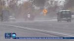
SALT LAKE CITY — Snow flurries fell over much of the state Wednesday, snarling traffic in some places.
A winter weather advisory, issued by the National Weather Service, is expected to continue late in the day Thursday, promising slight accumulations for Utah's ski resorts, benches and more in the valleys throughout the state.
Officials expanded the advisory into the Uinta Basin of eastern Utah overnight Wednesday, as the storm front shifted across the state, toward southwestern Wyoming. Northerly winds were expected to increase snowfall throughout the night.
KSL meteorologist Len Randolph called the storm an "epic event," saying it would be over by Friday morning. He said temperatures in the teens and 20s may elicit black ice conditions on some roadways Friday morning, and urged caution from drivers.
Southern Utah, Randolph said, would warm up to the mid-40s by the weekend, with northern Utah holding onto colder-than-normal temperatures for this time of year. He said thermometers would stay in the low- to mid-30s through Monday.
Utah Highway Patrol trooper Nolan Kerr said road conditions were much as they appeared, wet and slippery. The agency had responded to more than 80 slide-offs and crashes in Salt Lake and Utah counties by Wednesday afternoon and more were expected as wet spots turned to ice overnight.
Chains were required on semi trucks traveling Interstate 80 through Parley's Canyon.
Kerr cautioned drivers to "wear your seat belts and slow down," also letting emergency response vehicles safely pass, when applicable.
While it is difficult to forecast beyond Monday, Randolph believes that after the current storm passes, the weather will be clear through New Year's Day.
Avalanche conditions
Meanwhile, avalanche conditions along the Wasatch Front are mostly moderate. But that could change quickly depending on how much snow falls Wednesday morning.
Avalanche danger is higher in central Utah, southwest of Price. Currently, the Manti-Skyline Mountains have a weak underlying snowpack, making conditions very dangerous.
According to the Utah Avalanche Center, several avalanches were triggered in that area a few days ago, mostly in flat terrain. No one was injured. But it showed that avalanches have the potential to break wide and deep.
More snow is expected for Thursday. Randolf said the storm is expected to bring the mountains 6 to 12 more inches of snow, the benches might get 2 to 8 inches and the valleys, up to 4 inches more, as Utah's infamous lake effect takes hold.