Estimated read time: 2-3 minutes
This archived news story is available only for your personal, non-commercial use. Information in the story may be outdated or superseded by additional information. Reading or replaying the story in its archived form does not constitute a republication of the story.
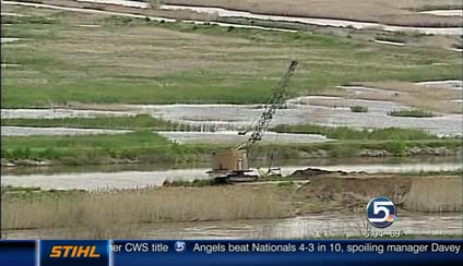
SALT LAKE CITY — The long, slow drama of Northern Utah’s spring flood season may finally be reaching a climax, and in anticipation on Monday Gov. Gary Herbert declared a state of emergency throughout Utah.
Related:

Flood Watch 2011 River Flow Tracker
Check levels of creeks and rivers near you with our exclusive KSL Flood Watch 2011 River Flow Tracker.The declaration was issued "as a result of springtime flooding reaching its apex,” according to a statement issued by the Governor’s Office, and it “opens the door for state resources to be deployed to local communities affected by the disaster.”
The declaration will allow local officials in areas affected by flooding to get help more quickly from agencies such as the Utah National Guard and the Federal Emergency Management Agency, said Utah Division of Emergency Management spokesman Joe Dougherty.
“The main reason is just to deal with the problems we’ve already had,” Dougherty added.
Related:
Flood concerns prompt evacuation of 2 homes in Providence
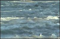
Two homes in the Cache County city of Providence were evacuated as a precaution due to flooding concerns.Recent above-normal high temperatures are forecast to continue at least into next week, and the pace of snowmelt is accelerating, according to the National Weather Service’s Salt Lake office.
“With the hot temperatures we anticipate rivers and streams picking it up and exceeding their banks and flooding in multiple areas,” NWS hydrologist Brian McInerney said in a Monday morning briefing.
Monday’s 90-degree high was four degrees above normal; Tuesday’s forecast 97 degrees would be 10 above normal; and Wednesday’s 93, six above normal, McInerney noted.
KSL.com is forecasting a drop to 81 degrees Thursday, quickly returning to the mid-90s by the weekend.
The high temps are making for a nail-biting finale to the 2011 flood season. The snowpack’s melt rate will soon rise above three to four inches per day in some areas, McInerney said.
The threat of flooding is increased. But on the positive side, the relief of flood season's end may be at hand.
“Oh, man, we are really hoping so — we can’t wait for flooding to be over,” Dougherty said. “Unfortunately, Mother Nature doesn’t always play nice.”
State agencies such as the National Guard, the Division of Natural Resources, and the Department of Transportation have already been helping in flooded areas. The declaration would allow such help to escalate if needed, he said.
The NWS is predicting when the current river level rises will peak:
- Logan River is predicted to peak Tuesday and Wednesday nights.
- Weber River above Oakley: Wednesday afternoon.
- Little Cottonwood Creek: Wednesday night.
- Bear River: Wednesday night.
- Duchesne River: Friday afternoon.
- Other Wasatch Front: Tuesday and Wednesday nights.
Email:lbrubaker@desnews.com


