Estimated read time: 2-3 minutes
This archived news story is available only for your personal, non-commercial use. Information in the story may be outdated or superseded by additional information. Reading or replaying the story in its archived form does not constitute a republication of the story.
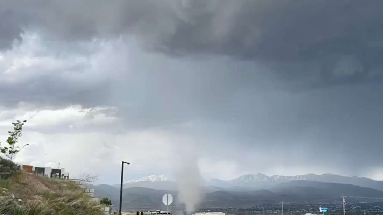
HERRIMAN — No, that wasn't a tornado that formed near the Point of the Mountain Thursday afternoon.
The National Weather Service confirmed that a landspout developed around the Herriman and Bluffdale area just before 2 p.m., based on photos and videos that meteorologists reviewed. A landspout is similar to a tornado, but instead of a rotation forming in the clouds and reaching the ground during a storm pattern, the rotation begins on the ground and extends upward to clouds above it, the agency explained in a social media post.
A landspout has been reported this afternoon from Herriman and Bluffdale this afternoon based on multiple photos and videos reports. You may ask what the difference is between a landspout and a cold air funnel...learn more below. #UTwxhttps://t.co/hc6hIyl0gnpic.twitter.com/g7dGGu2S7o
— NWS Salt Lake City (@NWSSaltLakeCity) June 1, 2023
The agency added that they are different to forecast because any rotation is "small, shallow and short-lived" and they are typically "much weaker" than a standard tornado produced in a supercell. KSL meteorologist Kevin Eubank explains that both look similar — and landspouts are technically in the tornado family — but landspouts are weaker because there's not enough force to create the wind speeds associated with strong tornadoes.
That said, a landspout can do some damage when it forms.
"Because you've got rotation and wind, you can take down fences, you can flip trampolines, you can throw things into houses, you can take siding and shingles, but it's generally not a damage-creating type of storm," he said. "The damage is significantly less, if any, with a landspout."
With the many storms and a few funnel clouds produced over the past few weeks, he believes many people are "hypersensitive" to cloud activity at the moment. That's why he thinks many residents believed it was a tornado at first.
He also points out that landspouts are "pretty common," especially when compared to a supercell-produced tornado. Utah only averages about two or three tornadoes every year.
It's also possible that more funnel clouds and landspouts form over the next week or two, or beyond. The current forecast calls for a similar pattern of convective thunderstorms through at least the next 10 days, which produces a potential of landspouts and tornadoes.
"It's going to be interesting. This is a very end-of-summeresque pattern," Eubank said. "(Once) the heat starts going and (storms) start bubbling and boiling, and those are recipes for severe weather."


