Estimated read time: 5-6 minutes
This archived news story is available only for your personal, non-commercial use. Information in the story may be outdated or superseded by additional information. Reading or replaying the story in its archived form does not constitute a republication of the story.
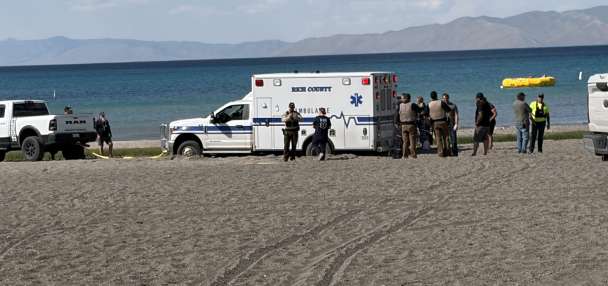
RANDOLPH, Rich County — A number of ranchers along the Bear River have been devastated by recent extreme flooding, according to reports from the Utah Department of Agriculture and Food.
It's the latest in a statewide series of flooding impacts caused by a record-breaking year of snowfall and subsequent runoff. Department officials estimate that 20 to 30 ranches along the river have been impacted by flooding. Each rancher is expected to incur additional feed costs of $18,000-$25,000, transportation costs of $2,500-$5,000 and additional costs to divert water to create high ground where cattle can stand.
"This is the worst spring I've ever heard of," said rancher Tracy Hatch, whose family has owned of Hatch Land and Livestock in Randolph since 1891.
"We are not just a bunch of dumb ranchers that don't take care of animals. These are people that it's their livelihood, that have lived with them," Hatch added. "I have calves that were born during that really cold snap in April that we got in the barn and we took care of and we tried our hardest to save them. Now the effects are showing, like a lot of them have frozen joints and their legs are gonna start falling off. It's just it's a sad, sad deal. For me personally, it's not the finances as much as I'm just tired of seeing the death and destruction."
Hatch said ranchers are starting to "see the light at the end of the tunnel" and that he's been lucky compared to most. However, he still estimates he'll lose $150,000 this year.
"We've suffered in drought so many years that it's good to see it get some moisture and improve things, but it can be hell on the other end too — and there's no other way to say it," Hart said. "A lot of people between the snow and the cold, cold weather we had in the late April, there's a lot of people that are probably going to have 20-25% death loss on their calves, which is just horrendous. We've never experienced anything like that before."
A number of cattle have been evacuated to avoid the rising waters. The Department of Agriculture and Food does not yet have an estimate of how many cattle have died because of the flooding.
Matt Kennedy of Kennedy Ranch said moving the ranch's 600 mother cows and their calves to higher ground was chaos. The evacuation also means the cattle are concentrated in a smaller area, which Kennedy said leads to the spread of disease among the cattle.
"The cows are wanting to go to summer pasture, so you open the gate to move them and the cows take off," he said. "Our fences are pretty good, so we can hold them until the mothers find their babies again, but a lot of people don't, so there's been cattlemen on the highways because they get through the barbed wire fences."
Kennedy Ranch has had to incur additional costs for snow removal and additional hay as well as double its normal death loss — but Kennedy is confident the ranch will get through it.
"We're facing challenges that we normally never face, but we adapt like anybody else. My grandma says we're pioneer stock, so we're meant to handle difficult things, and we're doing that," Kennedy said. "But the markets look pretty good, so if they hold strong, it'll be OK. Eat beef! Help us out and go get a hamburger."
Officials are working closely with the ranchers and the Department of Emergency Management to address the situation. More information on additional resources is expected to be released by Friday.
"After many difficult years of drought and an extremely hard winter, these ranchers are now experiencing some of the worst flooding ever seen in Rich County," Craig Buttars, the department's commissioner, said in a statement. "Our department is working to do everything we can to help these ranchers and set up resources for others who may experience hardships due to flooding."
Storms to ease some flooding risks
The flooding is the result of a warmup that began last weekend, resulting in multiple creeks, streams and rivers flowing beyond outlined flood stages; some even reached record streamflow levels this week. Utah's record snowpack has dropped 6.9 inches over the past seven days, or about two-thirds of the runoff since the statewide figure peaked at 30 inches on April 8.
But some relief is on the way, at least for this weekend.
A low-pressure system over California is moving into the region, pushing out a high-pressure ridge that had set up over Utah, causing temperatures to soar into the upper 80s across the Wasatch Front earlier this week, said KSL meteorologist Matt Johnson. It brought in some scattered showers across the state Thursday, which may continue over the next few days.
It's also helping bring temperatures down back into the mid-60s along the Wasatch Front and upper 50s in the northern Utah valleys through Sunday. Alex DeSmet, lead meteorologist at the National Weather Service, says snowmelt will continue over the next few days, but it likely won't be as extreme as the past week, so there may be fewer flood warnings and watches over the next few days.
"It's going to slow down that mid and high-elevation snowpack and, as a result, it'll slow down the amount of water released from the snowpack into rivers, creeks and streams," he said. "They will still remain high because the snowmelt is not going to stop entirely but it will slow down from what we've seen the last few days."
Even with as much that has melted so far, the statewide snowpack remains at 19.6 inches, as of Thursday afternoon. The weather service issued a new hydrologic outlook to remind people that Utah's creeks, streams and rivers will "continue to experience elevated flows for the next several weeks" as the remaining snowpack melts.
The agency advises people to avoid any high-flowing waterway because it will remain "extremely dangerous, running high, fast and cold." DeSmet said these conditions — and flooding risks — will likely persist into June. Slightly warmer temperatures are also forecast to begin next week, which could speed up some of the remaining snowmelt.
"We're still (above 200%) or normal in terms of the snow-water equivalent that's locked up in the mountains, so there's still a long way to go," he said. "We've only melted a little bit of the high-elevation snowpack."

Photos
Most recent Utah weather stories
Related topics
 Sydnee Chapman Gonzalez