Estimated read time: 5-6 minutes
This archived news story is available only for your personal, non-commercial use. Information in the story may be outdated or superseded by additional information. Reading or replaying the story in its archived form does not constitute a republication of the story.
CEDAR CITY — Snowmelt flooding seen and felt across northern Utah and the Wasatch Front has been a top topic of conversation among Utahns as of late.
Utah Gov. Spencer Cox on Tuesday declared a state of emergency as the state's record snowpack continues to slowly melt away, resulting in flooding, avalanches and landslides over the past few weeks, including extensive damage in Kaysville and dozens of voluntary evacuations in Salt Lake City.
With all of that in mind, it may come as a surprise to hear that the top half of the Beehive State isn't even leading the state when it comes to snowpack runoff.
That distinction goes to southern Utah.
Snow water equivalent levels — the equivalent water depth if the snowpack was melted down — range from 198% higher there than median levels all the way up to 379% higher, according to National Resource Conservation Service data.
Comparatively, the highest percentage above the median in northern Utah and the Wasatch Front is a still lofty 252%.
Different populations, different problems
With even more snowpack runoff happening in southern Utah, one could easily assume that the flood dangers in the region are greater than up north.
However, Erich Mueller, a hydrology professor at Southern Utah University, told KSL.com that isn't the case.
"When we think about the principal stream that drains into Cedar City, which is Coal Creek, most of the water that comes out ... is from snowmelt," Mueller said. "Alternatively, the biggest floods are from monsoon thunderstorms in July, August, September."
With significant snowpack in the region, Mueller said that he expects high snowmelt runoff, though not nearly as high as what could be seen in the event of monsoonal flooding.
"We're not really anticipating the type of flooding due to the snowmelt like they're seeing up in the Wasatch Front," Mueller said.
This is the case for a few reasons. A primary one is that much of the population along the Wasatch Front is situated closer to the snowpack than, say, Cedar City.

"Up north ... you've got snow down to lower elevations, you've got narrow canyons with a lot of snowpack that sort of empty out right into subdivisions and communities," Mueller said. "In Cedar City, the creek could handle a much larger flood than is likely to be generated by the snowmelt."
Mueller clarified that things are a bit different when looking at the St. George area with the Virgin River and the Santa Clara River. There, the biggest floods happen from monsoons or if the snowpack sees heavy rainfall, something he called a "rain on snow" event.
"Really, the streams in southern Utah are more prone to flooding during that monsoon period and just the snowmelt alone isn't likely to lead to any significant or widespread flooding," Mueller said.
Even in 2005, when southern Utah saw more snow, Mueller said that the peak flood from Coal Creek wasn't big enough to cause any widespread issues and the biggest flood came from a rain-on-snow event.
One exception to this is the Sevier River to the east of Cedar City near the small town of Hatch.
"It's a river that ... it's sort of like a very flat flood plain next to the river so once it gets out of its banks, it could potentially flood out onto some farm fields and into some areas," Mueller said.
Snowmelt runoff benefits
With most of southern Utah's water coming from runoff, Mueller said that the high snowpack levels are "extremely important."
"The last two winters were really low snow years and we definitely need this water to replenish our water supply," he continued. "In Cedar City, we're actually in a closed basin, meaning that Coal Creek doesn't flow anywhere, it just flows into the basin here in Cedar Valley and essentially melts into the ground."
This melting is essential because it contributes to aquifer recharge and the replenishment of groundwater resources.
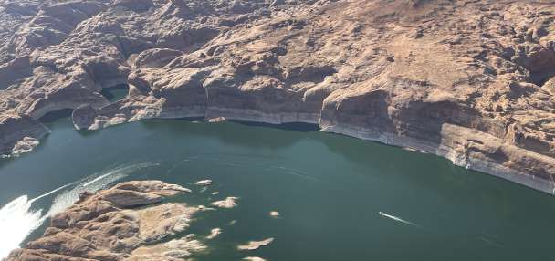
Other rivers in southern Utah feed into reservoirs — like Lake Powell — making this year's runoff notable in the sense that it could go a long way toward replenishing some of the worst-hit bodies of water for the first time in years.
The Colorado Basin River Forecast Center recently forecast that runoffs will be 177% of the average by Lake Powell. If the forecast is right, the reservoir, which hit an all-time low in February for the second-straight year, would receive about 11.3 million acre-feet worth of water.
Even though all the water wouldn't stay in the reservoir, which can hold up to about 26 million acre-feet of water, it would certainly help reverse some of its downward trends.
"The snowpack is definitely great news in terms of our overall water supply, our overall soil moisture and, you know, potentially helping to even replenish some of our aquifers," Mueller continued.
"If we can get past that rain-on-snow period, you know, the snowmelt is going to be pretty welcome here for the next couple months and hopefully, if it melts slowly, should be pretty minimal in terms of causing any flooding issues."
Contributing: Carter Williams


