Estimated read time: 4-5 minutes
This archived news story is available only for your personal, non-commercial use. Information in the story may be outdated or superseded by additional information. Reading or replaying the story in its archived form does not constitute a republication of the story.
SALT LAKE CITY — To find a time when the drought in Utah was as bad as it is today, look back to the Dust Bowl of the 1930s.
And before that?
"It would have been the 1630s. There was a really long, 20-year drought in the 1630s," said Darren Hess, assistant general manager of the Weber Basin Water Conservancy District.
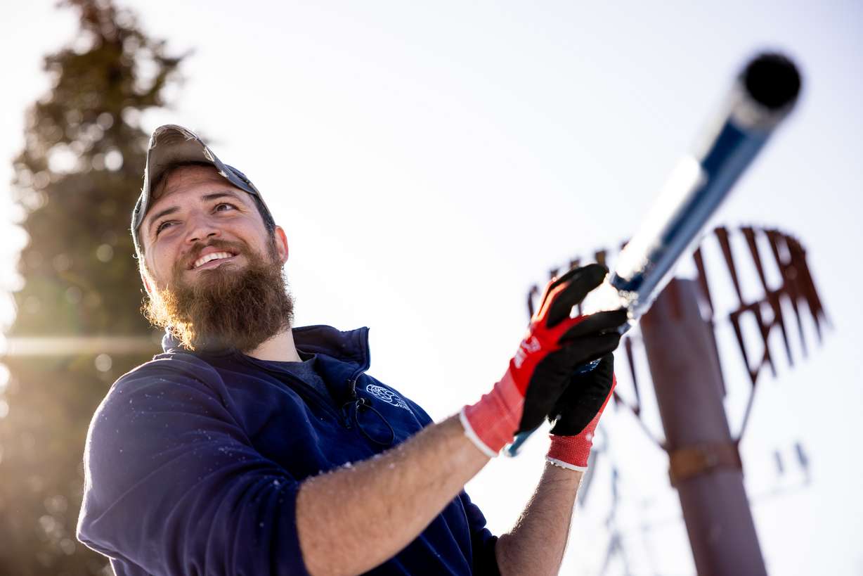
"It's going to take probably multiple years to get us back (to normal)," said Hess, who on Thursday joined officials with the Utah Snow Survey to give reporters a tour of one of Utah's newest SNOTEL sites.
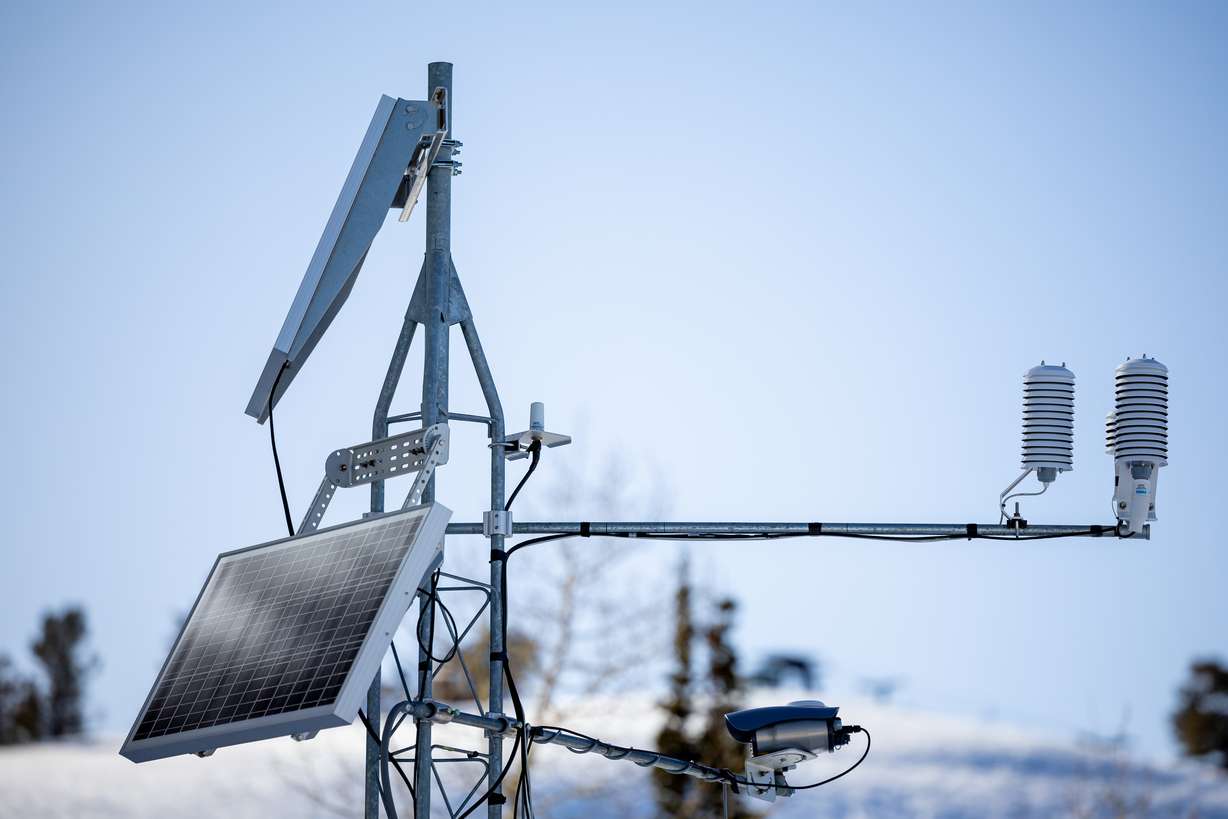
Short for "Snowpack Telemetry," the new site sits on a remote corner of northern Utah's Powder Mountain ski resort near the headwaters of both the Weber and Bear rivers. One of 137 SNOTEL sites in Utah, the station will provide scientists, and the public, with hourly data, tracking things like snow depth and soil moisture.
The ideal location for a SNOTEL site typically gets a lot of snow, is at a high elevation, and is sheltered from the wind on a north facing aspect where temperatures are cooler. The goal is to find an area that retains snow for as long as possible, which allows scientists to compare streamflow data with snowpack data.
The more snowpack data overlaps with streamflow data, "the more we can make a good correlation" between the two, said Jordan Clayton, the supervisor of the Utah Snow Survey.
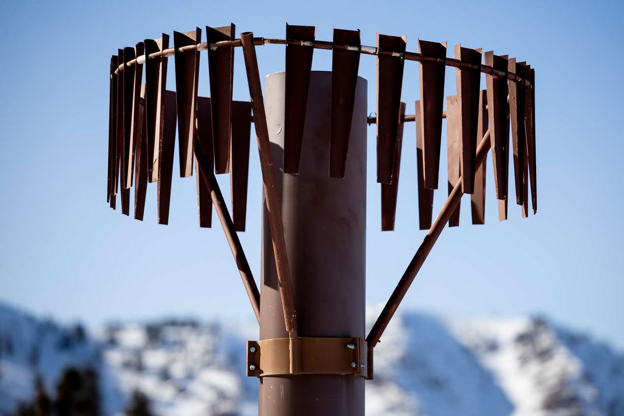
Using a "snow pillow" that measures snow water equivalent — the amount of liquid water contained in a snowpack — a tall precipitation can to catch rain and snow, and sensors that track soil moisture, air temperature and snow depth, scientists with the U.S. National Resource Conservation Service are able to gauge the health of Utah's snowpack.
Despite an exceptionally wet October, January's historically long dry spell whittled down what was initially a robust snowpack.
And as temperatures warm — the earliest 80-degree day on record is forecasted for this weekend — scientists don't expect the meager winter of 2021-22 to get any better.
"We're not in the best shape from a snowpack perspective this winter, but it's not as bad as it could be," said Clayton.
Currently, the state is at about 88% of its median snow water equivalent — the northern Utah-Ogden area is at about 75%.
Those percentages are generated using a 30-year median. Utah has a long history of snow science — although the first SNOTEL site was installed in 1978, the state has been sampling and tracking the snowpack since 1920, giving scientists like Clayton over 100 years of data to look back on.
But despite having a century's worth of data, scientists use a 30-year timeframe to account for climate change, meaning the temperature has warmed so much in the last 100 years that using all available data would be less accurate.
Hess says he and his staff at the water district look at the data from SNOTEL sites on a daily basis, giving them a preview of what to expect heading into the summer.
One of the more important measurements is soil moisture, a reliable indicator of how much water will flow into the state's rivers, lakes and reservoirs as the snow melts. Essentially, if the soil is too dry, it will soak up all the water.
The soil moisture sensors at the SNOTEL site "give us a good picture for where the water is going when it leaves the snowpack, how saturated the soils are and what percentage of that snowpack water we're actually going to get downstream," said Clayton.
And last year, despite the winter ending with a snowpack around 75% to 80% of normal, poor soil moisture devastated Utah's reservoirs. The Weber Basin Water Conservancy District was able to store 7,000 acre feet of water, a measly 3% of the annual average, said Hess.
"There was just hardly anything in the soil, as far as moisture is concerned," he said. "The runoff all soaked into the soil, did not make it to our rivers and our streams, and did not replenish our reservoirs."
This year the outlook is a little better, with the district estimating 80% of the water will be able to go to water right holders.
Still, the district will likely need to cut water use. Hess said to expect a 60% restriction for outdoor irrigation, a 40% restriction for agriculture and a 10% restriction for drinking water. Those curtailments are based on the district's drought contingency plan.
About 97% of the state is in severe or extreme drought — that's better than the "exceptional" rating that plagued the state during the last water year, but "it's still pretty severe out there," said Clayton. "It's definitely not a time to start pumping water we don't need to."