Estimated read time: 3-4 minutes
This archived news story is available only for your personal, non-commercial use. Information in the story may be outdated or superseded by additional information. Reading or replaying the story in its archived form does not constitute a republication of the story.
SALT LAKE CITY — As bad as the 2021 water year has been, it officially won't go down as the worst in Salt Lake City history.
Per National Weather Service data, its station at the Salt Lake City International Airport recorded a third of an inch of rain — a new daily record, actually — from a pair of strong thunderstorms that moved over the Wasatch Front Thursday evening. The rain from the storms pushed the city's precipitation total to 8.4 inches since the start of the water year on Oct. 1, 2020.
Incredible storm! The corner of 300 E and 200 S. Lots of flooding downtown. Please be safe! pic.twitter.com/O4z6mOcl7o
— Spencer Cox (@SpencerJCox) July 23, 2021
With the new total, the 2021 water year finally moved past the 1934 water year, which retains the dubious title of the driest water year on record in the weather service's 147-year-old history of collecting the city's weather information. That year, which also still holds the record as the hottest in Utah history, ended up with just 8.16 inches of precipitation between Oct. 1, 1933, and Sept. 30, 1934.
In fact, 2021 also won't end up the second-driest either. It also surpassed the 1979 water year, which finished just 0.03 inches below the 1934 record.
The rains also broke a dry stretch that blanketed the first half of the meteorological summer. Prior to Wednesday, the Salt Lake City weather station had recorded just 0.11 inches of rain since June 1. The station received 0.39 inches of rain Wednesday and Thursday alone.
Driest Water Years in Salt Lake City History (1874 to 2020):
- 1934: 8.16 inches
- 1979: 8.19 inches
- 1931: 9.27 inches
- 1966: 9.53 inches
- 1988: 9.94 inches
- 1874: 10.04 inches
- 1879: 10.22 inches
- 1960: 10.43 inches
- 2018: 10.50 inches
- 1910: 10.55 inches
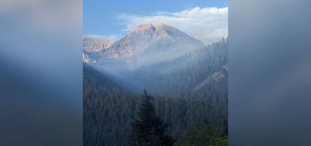
Thursday's storms offered some positive signs as Utah's drought has only worsened this month. They arrived the same day that the U.S. Drought Monitor released its weekly drought update that listed 69.7% of Utah in its "exceptional" drought category. That is a jump from 65.4% the previous week.
The report also listed 99.4% of Utah in at least "extreme" drought category, which is a jump from 98.7% the previous week. Most of Salt Lake County is listed within the exceptional drought category with the eastern edge in extreme drought. All parts of Utah are listed in at least severe drought status.
A part of the reason conditions worsened is that monsoonal rains across the Southwest U.S. last week "provided limited drought relief," according to Brad Rippey, an analyst for the U.S. Department of Agriculture, in a synopsis of conditions in the West that accompanied the latest drought map.
While the Thursday rains help, especially in avoiding unwanted history, it will still take a while for it to make a difference. It's worth pointing out that Salt Lake City remains 5.32 inches below normal this late in the water year and 2.65 inches below normal for the calendar year.
The short-term bad news is the forecast calls for hot and dry conditions, such as possible 100-degree heat, to return for the Pioneer Day weekend. However, storms could return to the Wasatch Front by the end of the month as moisture patterns move back into place, said KSL meteorologist Kevin Eubank.
The city is just four 100-degree days from tying another unwanted record, which is the most 100-degree days in a year (21).
Full forecasts for areas across Utah can be found at the KSL Weather Center.