Estimated read time: 3-4 minutes
This archived news story is available only for your personal, non-commercial use. Information in the story may be outdated or superseded by additional information. Reading or replaying the story in its archived form does not constitute a republication of the story.
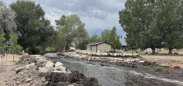
SALT LAKE CITY — The National Weather Service issued multiple winter weather advisories for a wide swath of southern and central Utah in relation to a storm system that is expected to provide plenty of snow for mountains in those regions Monday and into the early hours Tuesday morning.
Northbound U.S. Highway 40 was closed near Heber City at 5:15 p.m. Monday but was expected to reopen by 6 p.m., according to Utah Department of Transportation officials.
UDOT also announced that chains are required for semitrucks traveling on I-15 between Beaver and Cove Fort but by 8:20 p.m. chains were no longer required. Chains were still required on state Route 14 between the U.S. Highway 89 Junction and Cedar City, as well as eastbound on state Route 20 near Iron County.
This latest storm is moving north from southern California through Arizona into Utah before it moves east toward the Central Rocky Mountains. It could produce as much as 1 1/2 feet of snow near Brian Head and the Tushar Mountains in southern-central Utah, while just a brushing of snow is expected in northern Utah and most of the Wasatch Front, according to a projection by the National Weather Servic in Salt Lake City.
The weather service reported a new maximum snowfall as of 5:00 p.m. Monday evening at 10 inches near Escalante in Garfield County.
We have a new maximum snowfall measurement for this storm (so far). Our Escalante, UT COOP Observer came in with 10 inches as of 5pm this evening. #utwx
— NWS Salt Lake City (@NWSSaltLakeCity) December 29, 2020
The National Weather Service's advisories range from as far north as Utah County and the Wasatch backcountry to as far south as Cedar City and Capitol Reef National Park. The agency warns the storm could make travel on I-15 and other roadways across the impacted areas difficult Monday.
"Plan on slippery road conditions with snow-covered roads at times. Hazardous driving conditions could impact travel especially on rural routes … through early Tuesday morning," the agency wrote. "Slow down and use caution while traveling."
Some areas of Utah already received snow overnight, particularly in southern Utah locations like Monticello and Bryce Canyon.
"There's plenty more coming for Monticello, the southern part of the state, the central valleys, the southern mountains all expecting most of the snow out of this latest storm," said KSL meteorologist Grant Weyman. "The reason for that is it's coming from the south this time around."
The storm was expected to work its way up through the southern portion of the Wasatch Front and the Wasatch backcountry by early Monday afternoon with snow continuing into the evening.
In a snow accumulation model, the National Weather Service forecast the highest snow accumulation for the southern and central mountain ranges. Brian Head is expected to receive 12 to 18 inches of snow, while the Tushar Mountains could receive 14 to 18 inches. The Pavant Mountains in central Utah are projected to receive anywhere from 10 to 14 inches of snow.
Update on storm system
Winter Weather Advisories added for portions of Uinta mountains and Uinta basin.
Heaviest snow accumulations across portions of southern and central Utah through Tuesday morning.#utwxpic.twitter.com/TIHeZPpOZw— NWS Salt Lake City (@NWSSaltLakeCity) December 28, 2020
Meanwhile, 4 to 6 inches of snow were anticipated in communities like Cedar City in southwest Utah and Monticello in southeast Utah. Arches National Park, Delta, Green River, Hanksville, Manti, Milford and Richfield in southern and central Utah were all forecast to receive a few inches of snow throughout Monday.
For areas closer to the Wasatch Front, Provo was forecast to receive 3 to 4 inches while Nephi and Price could see 6 to 8 inches of snow by the end of the storm. It is also forecast to produce decent powder for the ski resorts in the area. Alta, for example, is projected to receive 3 to 7 inches of snow; the mountains east of Park City are expected to receive as much as a foot of snow.
Parts of the state north of Utah County and not covered by the winter weather advisories — like Salt Lake City, Davis and Weber counties, and the Cache Valley — may deal with scattered snow flurries Monday afternoon with less than 1 inch of accumulation forecast by the weather service.
Monday's storm won't be the final snow of 2020. Another storm is expected to roll into Utah by New Year's Eve, Weyman said. Full forecasts for Utah regions can be found at the KSL Weather Center.