Estimated read time: 3-4 minutes
This archived news story is available only for your personal, non-commercial use. Information in the story may be outdated or superseded by additional information. Reading or replaying the story in its archived form does not constitute a republication of the story.
SALT LAKE CITY — A quick-moving winter storm brought some wet weather to northern Utah valleys Tuesday afternoon.
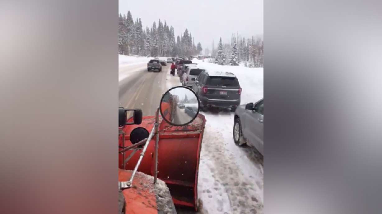
Snowy weather moved into the Salt Lake Valley around 1 p.m.; as of 5:40 p.m., chains or 4-wheel drive were required for all vehicles traveling through both Big Cottonwood and Little Cottonwood canyons, according to the Utah Department of Transportation.
Snow could fall at a rate up to 2-3 inches per hour later Tuesday afternoon, as skiers and snowboarders travel back down the canyons for the day, UDOT said. Heading down earlier is recommended to avoid traffic backups, the agency added.
We have a #weatherupdate that rates of snow could be 2-3 inches/hour for the downhill commute. Consider heading down earlier rather than later this afternoon. https://t.co/4TUzqTunlS
— UDOT Cottonwood Canyons (@UDOTcottonwoods) January 14, 2020
Utah Transit Authority buses were using snow routes as of 5:10 p.m.
Multiple buses were also delayed after having to pull over and wait out harsher conditions.
North Ogden Canyon Road, also known as the North Ogden Divide, closed in both directions for about two hours Tuesday, according to Weber County Sheriff's Lt. Cortney Ryan. The road runs through North Ogden Canyon between North Ogden and Eden in Weber County.
A semitruck tried to make it up the snowy, icy canyon but couldn't, so the driver pulled over, Ryan said. A pickup truck that was headed downhill lost control and hit the stopped semitruck.
There were no injuries in the crash and the canyon remained closed until Tuesday afternoon, when authorities finished clearing some snow from the area, according to UDOT.
Valleys saw rain to begin with, which gradually turned to snow. But the snow won’t stick much to the roads. Valleys were forecast to see up to an inch of accumulation, and KSL Weather meteorologist Grant Weyman said the storm was expected to clear up by 5 or 6 p.m.
Here is the expected snowfall tonight through Tuesday night. #utwxpic.twitter.com/WTACdCEkxa
— NWS Salt Lake City (@NWSSaltLakeCity) January 14, 2020
Areas in Cache and Rich counties will see the biggest impacts from Tuesday’s storm, according to the National Weather Service in Salt Lake City.
Logan will see 1-2 inches, but Garden City is expected to get between 6 and 8 inches, the weather service said. Randolph is expected to see 3-4 inches.
The mountains will continue to see snowy weather through the day into early Wednesday, Weyman said. Mountains will get another 6-12 inches of snow from this storm.
State Route 210 in Little Cottonwood Canyon will close to uphill traffic Wednesday from 5:30 a.m. to about 8 a.m. while crews work on avalanche control, according to UDOT.
#RoadUpdate: Good morning #CottonwoodCanyons travelers. Crews were up this morning doing activities such as this and the road surfaces are looking good. It’s cold up there so make sure you’re prepared to #DriveWinterSafe. @UDOTTRAFFICpic.twitter.com/WiH93axAV0
— UDOT Cottonwood Canyons (@UDOTcottonwoods) January 14, 2020
Later in the week, another quick winter storm is expected to move into the Wasatch Front. It should bring more snow to the valleys and mountains late Thursday into Friday, Weyman said, and will be out before the weekend.
“It’s been kind of ideal for the valleys,” Weyman said. “There hasn’t been a ton to shovel, but we’ve really been piling it up in the mountains; so, kind of an ideal thing.”
The full weather forecast is available at ksl.com/weather.
Get traffic updates on KSL NewsRadio and at www.ksl.com/news/traffic. UDOT provides traffic updates at udottraffic.udot.gov.
Contributing: Lauren Bennett, KSL.com


