'%3e%3cpath%20d='M34.1406%205.85938C30.3906%202.10547%2025.3047%200%2020%200C14.6953%200%209.60938%202.10547%205.85938%205.85938C2.10938%209.61328%200%2014.6953%200%2020C0%2025.3047%202.10547%2030.3906%205.85938%2034.1406C9.61328%2037.8906%2014.6953%2040%2020%2040C25.3047%2040%2030.3906%2037.8945%2034.1406%2034.1406C37.8906%2030.3906%2040%2025.3047%2040%2020C40%2014.6953%2037.8945%209.60938%2034.1406%205.85938ZM37.0117%2023.543H31.1602V13.5391H27.6328V19.9414C28.1211%2020.6914%2028.3711%2021.582%2028.3711%2022.5625V22.625C28.3711%2023.668%2028.1172%2024.6055%2027.6328%2025.4297V26.6094H36.082C33.4883%2032.9375%2027.2891%2037.3789%2020.0039%2037.3789C10.3711%2037.3789%202.62109%2029.6289%202.62109%2020C2.62109%2010.3711%2010.3711%202.62109%2020%202.62109C29.6289%202.62109%2037.3789%2010.3711%2037.3789%2020C37.3789%2021.1484%2037.2617%2022.2656%2037.0508%2023.3477C37.0391%2023.4141%2037.0234%2023.4766%2037.0117%2023.543Z'%20fill='white'/%3e%3cpath%20d='M22.3086%2018.5352C20.4336%2018.125%2019.9531%2017.8398%2019.9766%2017.1836V17.1406C19.9766%2016.6992%2020.3477%2016.2148%2021.4023%2016.2148C22.582%2016.2148%2023.8867%2016.6797%2025.0781%2017.4766L26.8516%2015.0195C25.4453%2013.8906%2023.707%2013.3398%2021.5547%2013.3398C18.5195%2013.3398%2016.4375%2015%2016.4063%2017.4766V17.5352C16.3633%2020.2617%2018.5859%2020.9805%2021.293%2021.6016C23.0391%2021.9766%2023.5703%2022.3164%2023.5703%2022.9609L23.5469%2022.9766C23.5469%2023.3906%2023.2578%2023.7031%2022.7852%2023.8359C22.5742%2023.9062%2022.1289%2023.9727%2021.5156%2023.9727C20.7617%2023.9727%2019.7539%2023.8633%2018.6328%2023.4844C18.0898%2023.2891%2017.4727%2023.0039%2016.8047%2022.6133L20.1406%2026.625C20.2813%2026.6602%2021.0977%2026.8516%2021.7734%2026.8516C25.0039%2026.8516%2027.0859%2025.2461%2027.1094%2022.6328V22.5703C27.1602%2020.1133%2025.2148%2019.1719%2022.3086%2018.5352Z'%20fill='white'/%3e%3cpath%20d='M5.24219%2013.5664V26.6133H8.75391V23.7578L10.2969%2021.9531L14.2031%2026.6133H18.3867L12.3555%2019.5195L17.4023%2013.5664H13.4531L8.75391%2019.0586V13.5664H5.24219Z'%20fill='white'/%3e%3c/g%3e%3cdefs%3e%3cclipPath%20id='clip0_97_2430'%3e%3crect%20width='40'%20height='40'%20fill='white'/%3e%3c/clipPath%3e%3c/defs%3e%3c/svg%3e)


This archived news story is available only for your personal, non-commercial use. Information in the story may be outdated or superseded by additional information. Reading or replaying the story in its archived form does not constitute a republication of the story.
- A planned power outage will affect parts of southern Utah as a wildfire nears utility lines.
- Garkane Energy and fire crews are conducting controlled burns to protect infrastructure.
- Over 1,300 firefighters are assigned to battling the state's three active fires, with more "critical fire weather" possible this week.
PANGUITCH — A scheduled power outage is planned for parts of southern Utah while firefighters continue to battle a wildfire burning southwest of Bryce Canyon.
Garkane Energy is scheduled to conduct a power outage from 8:30 a.m. to 8 p.m. on Wednesday, as crews seek to gain ground on the France Canyon Fire, members of the Great Basin Complex Incident Management Team said Tuesday. Garkane Energy also alerted customers of the upcoming outage, adding that the lightning-caused fire has gotten "dangerously close" to its lines in recent days.
"We are working closely with fire crews and the (U.S. Forest Service) to do a controlled burn under the power lines to protect the poles and conductors," the company wrote in a social media post. "This area is rugged and has no road access, so we're trying to get ahead of it and avoid serious damage."
It was originally supposed to begin at 10 a.m., but the project was moved up because of "changing weather conditions."
The planned outage is expected to impact the communities of Duck Creek, Cedar Mountain, Hatch, Paststown and some areas surrounding Panguitch but not the city itself. Garkane officials said some communities may be without power most of the day, while other communities could experience shorter outages or flickering lights due to shifts in energy loads.
"We know outages are frustrating, but this step is necessary to protect the system and avoid a much longer outage if the fire damages the line," the company added.
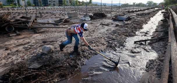
The France Canyon Fire has now burned over 25,000 acres since June 11 and remains 10% contained. Federal firefighters reported that efforts to protect the Kings Creek Campground, west of Tropic Reservoir, were successful after the fire threatened the area on Sunday. No campground damage was reported as crews reassessed the area on Monday.
Meanwhile, there were a few updates on the Forsyth Fire also burning in southern Utah, which has now scorched 8,229 acres in the Pine Valley area in northwestern Washington County. The fire remains 0% contained, and hundreds of people in the Pine Valley and Grass Valley communities remain under evacuation orders.
Firefighters returned to the southwestern edge of the fire on Monday to extinguish hotspots near structures in the Pine Valley area, according to a different Great Basin Complex Incident Management Team update. A similar type of work is expected on Tuesday, especially in the Lloyd Canyon area southwest of Pine Valley, officials added.
"Resources are also working to protect Pine Valley Recreation Area campgrounds, laying hose lines and reducing fire activity," the agency reported.
Over 1,200 firefighting personnel are currently assigned to battle the state's two largest active fires.
The Bridge Creek Fire, Utah's other active fire, burning near Lake Powell by the Utah-Arizona border, also remains 0% contained. It has burned close to 2,300 acres, according to Utah Fire Info.
Over 120 personnel were dispatched to battle the fire this week, according to the Navajo Division of Emergency Management. The agency stated that some temporary restrictions may be implemented at the reservoir as aircraft use water to combat the fire.
Weather outlook
Smoke from the fires could also end up in the Wasatch Front on Tuesday, but a shift in winds is expected to push smoke to the east by Wednesday, said KSL meteorologist Matt Johnson. "Critical fire weather" could return by the end of this week with warm, dry and breezy conditions expected toward the second half of the week, the Great Basin Complex Incident Management Team warns.
However, long-range models offer hope that some firefighting relief is on the way.
Utah has a growing chance of above-normal precipitation arriving during the first week of July, with the southern part of the state having the greatest odds from a monsoon setup, according to the National Weather Service's Climate Prediction Center. Early KSL Weather models also project that storms in New Mexico and Colorado could drift toward Utah by the second half of next week.
"It can definitely be in the cards that we get in on some of that monsoonal moisture by sometime next week," Johnson said. "We'd like to hold out hope for next week."