Estimated read time: 4-5 minutes
This archived news story is available only for your personal, non-commercial use. Information in the story may be outdated or superseded by additional information. Reading or replaying the story in its archived form does not constitute a republication of the story.
- Salt Lake City is planning a new 400 South trail to improve east-west connectivity.
- The $8.1-million project will feature a multiuse path, enhancing safety and access.
- Construction begins next year, aiming to integrate with existing bike routes and TRAX stations.
SALT LAKE CITY — 400 South serves as a vital link in Utah's capital city.
It's one of the few roads on the west side that travels over the railroad tracks and around I-15 — both of which divide Salt Lake City's east and west sides — tying the neighborhood to downtown and, farther east, the University of Utah.
It also offers drivers freeway access, but all the traffic it generates can also be intimidating for others without a motor vehicle.
"It's a route that I avoid," said Mike Christensen, chairman of the Salt Lake City Planning Commission but also a resident of the Jordan Meadows neighborhood. He relies heavily on his electric bicycle to commute to the city.
Vehicular traffic, he explains, is too heavy to feel safe using bike paths, while a narrow pedestrian path is often blocked by junk dumped around it. It's why he usually gambles on other routes periodically blocked by trains — sometimes for hours — to travel east.
Salt Lake City transportation planners are aware of these challenges, which is why they're now working on a new multipurpose trail that seeks to improve the safety and connectivity between the east and west sides. The $8.1 million project includes a flashy new design for the south side of the 400 South Viaduct bridge that will help it stand out in the city.
Most of its design is complete, but planners are going through some final steps before construction next year.
Improving an east-west link
Salt Lake City's 400 South Viaduct Trail emerged from ideas to improve access, particularly for west-side residents traveling by foot, bike or another form of active transportation.
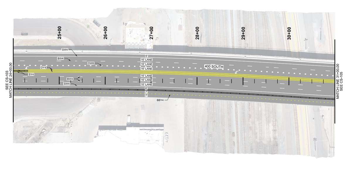
The design it settled on, in partnership with the Utah Department of Transportation, would run along the south side of 400 South from about 900 West to 200 West.
The path will be a "combo" between a two-way bikeway and a multiuse trail. Protective barriers will run between the path and roadway at points, said Mary Sizemore, transportation project manager for Salt Lake City. No vehicle lanes will be impacted.

It's much shorter than trails like the 9 Line Trail at 900 South, but it would get people safely past the freeway and railroad. It'll also link up to the existing protected bike lanes on 200 West and more lanes coming to 300 West downtown. More traditional bike lanes exist along 900 West in Poplar Grove.
"You won't have to stop for trains," Sizemore said. "It's one of our few comfortable biking facilities where you can cross the east-west divide without being stopped by a train.
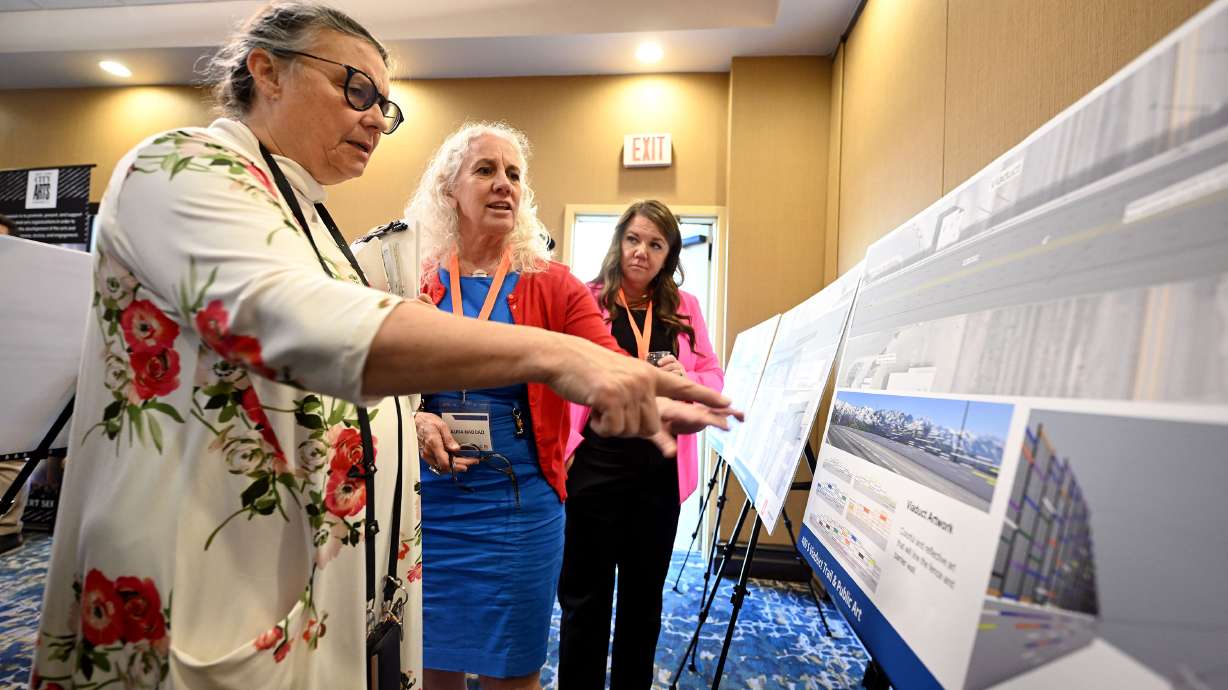
She added that the project design is about 70% complete, taking into account resident and business feedback, but the city is piecing together final designs. The city held another open house about the project on Wednesday to showcase the proposed design, seeking final input about potential issues before it moves forward with construction.
Construction is expected to begin as early as the spring of next year and could wrap up by the end of the year. The city received a state grant that will help pay for a large chunk of the project.
"We're excited to get the protected bikeway network extended into Poplar Grove and connect the city a lot better," Sizemore said. "It's another piece of the puzzle in our protected bikeway network."


The Salt Lake City Arts Council is also involved in the project, helping add an art installation tied to the south end of the 400 South Viaduct bridge. The proposed design almost looks like a peacock, but the color palette draws inspiration from local natural gems like the Jordan River, Great Salt Lake and Wasatch Mountains.
The plan is to use reflective material to help illuminate the pathway better at night without needing to build lights that would drive up the cost.
Future connections
The project is out in front of a major study Salt Lake City is conducting to address east-west transportation needs. 400 South is already on the verge of major changes, though.
Utah Transit Authority planners are working to finalize a recommendation for the agency's TechLink TRAX Study, which has major implications for the roadway.
In a presentation to city leaders earlier this month, they said are leaning toward a plan to extend the light rail line along 400 South from Main Street to 400 West. From there, one line would travel north through downtown before ending up at Salt Lake City International Airport, while the other would travel south through the emerging Granary District before heading to Daybreak in South Jordan.
The new path could ultimately link to new stations, offering a safer first- and last-mile route for west-side residents using TRAX. Sizemore adds that the path can also offer a transportation alternative once construction begins.
Christensen is thrilled to see these changes. He came to Wednesday's open house as a resident, leaving with optimism about it. He believes it will make the east-west barrier easier to cross on foot or on bike.
"I'm glad that they've thought about how this would connect with existing bike routes," he said. "It guarantees it's going to get used because it's connecting infrastructure."


