Estimated read time: 6-7 minutes
This archived news story is available only for your personal, non-commercial use. Information in the story may be outdated or superseded by additional information. Reading or replaying the story in its archived form does not constitute a republication of the story.
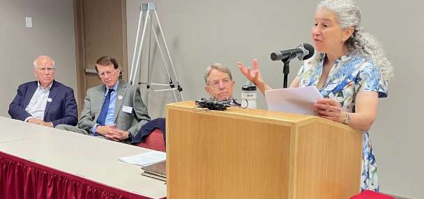
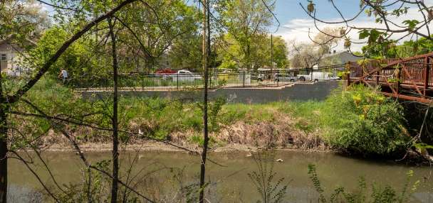
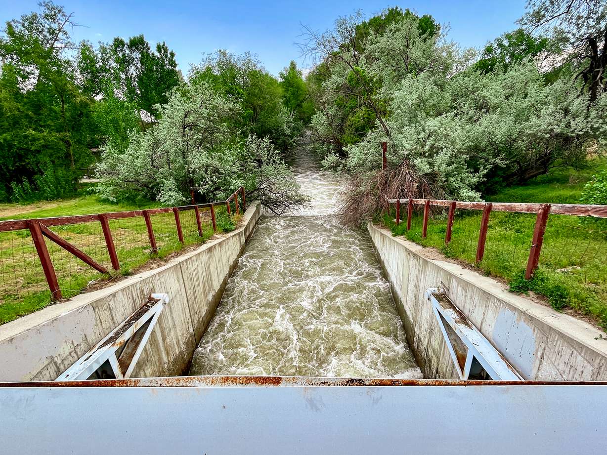
MURRAY — Salt Lake County Mayor Jenny Wilson stands at the top of a tiny dam at Wheeler Historic Farm, peering down at Little Cottonwood Creek roaring underneath her as it passes through the structure's spillway.
The county built this dam after severe flooding impacted the region in the 1980s, making it one of a few retention basins that it operates across the valley for springs like the one Utah is facing right now.
"This is the fastest I've seen it ever. I've never seen this," Murray City Councilman Garry Hrechkosy leans in to tell Wilson during a tour of the facility on a warm, cloudy Monday afternoon. She nods in agreement, though it's difficult to have conservation at this part of the farm with the sound of water rushing below.
Moments later, Kade Moncur, Salt Lake County's director of flooding control and engineering, points over to the eastern side of the pond to explain to the group of local and county officials that this section of the park could experience flooding in the coming days and weeks if the water levels get any higher.
The retention pond will likely begin to fill up if the creek raises about another foot or so, helping prevent some of the possible flooding downstream in the valley. That could happen sometime over the next few weeks if the right conditions emerge in the forecast.
"Predicting the future is not easy but I feel like if it can stay below flood stage ... we're going to just be passing the water down the system," he told KSL.com. "It'll still be dangerous. You don't want anybody getting in it and you don't want pets or small children by it."
There's a similar level of cautious optimism when it comes to other creeks in the county, which will continue to flow at high rates.
While nearly three-fourths of Utah's record 30-inch statewide snowpack has melted since early April, there is plenty of water left in the mountains above Salt Lake County right now. That includes more than 50 inches of snowpack left at the Natural Resources Conservation Service's Snowbird site, an area that feeds Little Cottonwood Creek as it melts.
This ongoing flooding concern is why Salt Lake County officials are moving their emergency flood command center operations to Wheeler Historic Farm. They set up a mobile center at the "heart" of the valley so officials can be closer to the county's next big flood threats, Wilson said.
County officials say several in Salt Lake County could be active through at least mid-June. County officials plan to keep having teams work 12-hour shifts day and night to keep a vigilant eye on streamflows and any possible obstructions that could cause flooding.

"We're recognizing that — even with this Memorial Day weekend — going into the month of June, (it) can be very active times within this flood emergency that was declared about a month ago," Wilson said. "Therefore, we wanted to have a centralized staging location. … There will be a lot more activity here in the coming weeks."
It's not the first time the county has turned to the farm or other areas for meetings, but this is the first time they've set up an operation quite like this. Scott Baird, the Salt Lake County public works director, said the center will offer a place to hold meetings and have storage space for equipment that can be "quickly deployed" if needed.
Salt Lake's ongoing flood potential
Salt Lake County's lower-elevation watersheds, like Emigration Creek, are already "starting to reach their peak," according to Baird. However, the county's high watersheds, like Big and Little Cottonwood creeks, will continue to have flood risks as long as there is snow in the mountains.
Moncur says that the current weather pattern has been ideal for snowmelt conditions, though. The warm afternoons have helped speed up snowmelt in the daytime while the cool evenings calm the process down during the overnight hours, which is when the water typically reaches its highest flow of the day.
If we can keep about an inch of melt per day, then we can stay at a manageable level," Moncur adds. "If it's higher than that — 2 or 3 inches per day, then we could have a problem.
–Kade Moncur, Salt Lake County director of flooding control and engineering
This pattern is in the current seven-day forecast. The National Weather Service's Colorado Basin River Forecast Center does not list any of the county's rivers as reaching flood stage this week, but it does forecast Big Cottonwood Creek near the mouth of the canyon to surpass its "action stage" in the coming days and get close to its flood stage by June 1. It also projects Little Cottonwood Canyon and Jordan River will reach close to their action stages over the next week, too.
But if the temperatures start reaching the upper 80s or low 90s while there is still snow in the mountains or there are more mostly sunny days, it could cause more severe flooding concerns, Baird says. Scattered showers aren't too much of a concern, but a large countywide storm could also pose problems.
"If we can keep about an inch of melt per day, then we can stay at a manageable level," Moncur adds. "If it's higher than that — 2 or 3 inches per day, then we could have a problem."
Any sort of debris is a big variable, too. Flooding can begin when a creek or stream becomes obstructed by any sort of blockage. This is typically caused by tree branches or other natural factors, but it can also be caused by culverts, pipes or by large items littered near the river.
About 40 Salt Lake City homes were even voluntarily evacuated when a large piece of metal clogged a flood control culvert near Wasatch Hollow Park last month, which has been the worst flooding incident in the county so far.
Crews are keeping an eye on any potential buildups to avoid this from happening again.
When will the flooding risk end?
Flooding is expected to remain a concern in the county through at least mid-to-late June as the remaining snowpack melts, so crews will continue to monitor for debris buildings until then. County parks officials tweeted Monday that Creekside Park in Sandy and Ben Franklin (Scott Avenue) Park in Millcreek are also retention basins, which could experience some flooding.
County officials are also still advertising their "Runoff Ready" campaign, which offers residents links to floodplains, where they can find sandbags and any information needed to be safe around the high streamflows.
Wilson said she's aware of how long — and stressful — the snowmelt process has been but she does believe there is an end in sight.
"I look forward to the day that we can actually say this emergency is over," she said. "This (emergency) will have an end date and my personal hope is that it's by the Fourth of July."