Estimated read time: Less than a minute
This archived news story is available only for your personal, non-commercial use. Information in the story may be outdated or superseded by additional information. Reading or replaying the story in its archived form does not constitute a republication of the story.
SALT LAKE CITY — A hard freeze warning was placed into effect by the National Weather Service from 9 p.m. Monday until 10 a.m. on Tuesday for parts of northern Utah after a day of gusting winds.
The National Weather Service explained in a tweet that the hard freeze warning comes after clearing conditions and winds that are causing temperatures to be cooler. Temperatures in Salt Lake City are expected to be around 30 degrees overnight.
Cooler temperatures can cause complications for the growing season, which has already begun in some parts of northern Utah, the weather service said.
Clearing conditions and lighter winds will lead to a chilly night. With parts of Utah considered in the growing season, a Hard Freeze Warning is in effect from 9 p.m. Monday - 10 a.m. Tuesday for parts of northern Utah, including the Cache Valley. #utwxpic.twitter.com/Wd0dW5uWPd
— NWS Salt Lake City (@NWSSaltLakeCity) April 19, 2021
Salt Lake City and other parts of Utah experienced wind gusts of at least 30 mph beginning at 11 a.m. on Monday. The weather service said that the Salt Lake City International Airport reported gusts of 50 mph but expected them to taper off later in the evening.
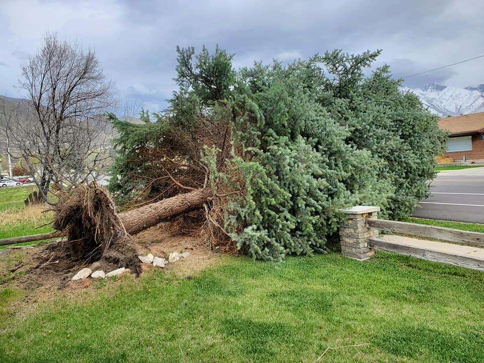
The strong gusts of wind downed a tree on Park Boulevard in Ogden and another in Springville.
The weather service had estimated the gusts to die down by 6 p.m.