'%3e%3cpath%20d='M34.1406%205.85938C30.3906%202.10547%2025.3047%200%2020%200C14.6953%200%209.60938%202.10547%205.85938%205.85938C2.10938%209.61328%200%2014.6953%200%2020C0%2025.3047%202.10547%2030.3906%205.85938%2034.1406C9.61328%2037.8906%2014.6953%2040%2020%2040C25.3047%2040%2030.3906%2037.8945%2034.1406%2034.1406C37.8906%2030.3906%2040%2025.3047%2040%2020C40%2014.6953%2037.8945%209.60938%2034.1406%205.85938ZM37.0117%2023.543H31.1602V13.5391H27.6328V19.9414C28.1211%2020.6914%2028.3711%2021.582%2028.3711%2022.5625V22.625C28.3711%2023.668%2028.1172%2024.6055%2027.6328%2025.4297V26.6094H36.082C33.4883%2032.9375%2027.2891%2037.3789%2020.0039%2037.3789C10.3711%2037.3789%202.62109%2029.6289%202.62109%2020C2.62109%2010.3711%2010.3711%202.62109%2020%202.62109C29.6289%202.62109%2037.3789%2010.3711%2037.3789%2020C37.3789%2021.1484%2037.2617%2022.2656%2037.0508%2023.3477C37.0391%2023.4141%2037.0234%2023.4766%2037.0117%2023.543Z'%20fill='white'/%3e%3cpath%20d='M22.3086%2018.5352C20.4336%2018.125%2019.9531%2017.8398%2019.9766%2017.1836V17.1406C19.9766%2016.6992%2020.3477%2016.2148%2021.4023%2016.2148C22.582%2016.2148%2023.8867%2016.6797%2025.0781%2017.4766L26.8516%2015.0195C25.4453%2013.8906%2023.707%2013.3398%2021.5547%2013.3398C18.5195%2013.3398%2016.4375%2015%2016.4063%2017.4766V17.5352C16.3633%2020.2617%2018.5859%2020.9805%2021.293%2021.6016C23.0391%2021.9766%2023.5703%2022.3164%2023.5703%2022.9609L23.5469%2022.9766C23.5469%2023.3906%2023.2578%2023.7031%2022.7852%2023.8359C22.5742%2023.9062%2022.1289%2023.9727%2021.5156%2023.9727C20.7617%2023.9727%2019.7539%2023.8633%2018.6328%2023.4844C18.0898%2023.2891%2017.4727%2023.0039%2016.8047%2022.6133L20.1406%2026.625C20.2813%2026.6602%2021.0977%2026.8516%2021.7734%2026.8516C25.0039%2026.8516%2027.0859%2025.2461%2027.1094%2022.6328V22.5703C27.1602%2020.1133%2025.2148%2019.1719%2022.3086%2018.5352Z'%20fill='white'/%3e%3cpath%20d='M5.24219%2013.5664V26.6133H8.75391V23.7578L10.2969%2021.9531L14.2031%2026.6133H18.3867L12.3555%2019.5195L17.4023%2013.5664H13.4531L8.75391%2019.0586V13.5664H5.24219Z'%20fill='white'/%3e%3c/g%3e%3cdefs%3e%3cclipPath%20id='clip0_97_2430'%3e%3crect%20width='40'%20height='40'%20fill='white'/%3e%3c/clipPath%3e%3c/defs%3e%3c/svg%3e)


Estimated read time: 5-6 minutes
This archived news story is available only for your personal, non-commercial use. Information in the story may be outdated or superseded by additional information. Reading or replaying the story in its archived form does not constitute a republication of the story.
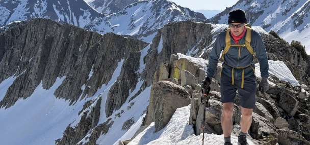
SALT LAKE CITY — While snowfall records have fallen left and right at Utah's resorts, this week's storms are also helping valley communities experience their snowiest snow seasons in decades.
Salt Lake City, for example, has reached 14.5 inches of snow over the first four days of April — the most snow it has received in April since 1984. It also catapulted the city's snowfall total this season up to 87 inches — the first time it has surpassed 80 inches since 1996, according to the National Weather Service.
The agency confirmed that another 0.3 inches had fallen at the official city site by 11:30 a.m. Wednesday, pushing the snowfall total this snow season up to 87.3 inches, which is the 11th-snowiest season since snowfall records were first kept in 1885. The city needs another inch to break into the 10 snowiest winters over the past 138 years, though it likely won't get there this week.
A high-pressure system is forecast to move in, putting a pause to the snowy action and warming up temperatures back to normal for essentially the first time this year. Meteorologists say the warmup could lead to some flooding risks this weekend but most of the mountain snowpack will remain intact.
What made Salt Lake's winter so memorable?
This year is rising up the charts because of all the late-season snow over the past few weeks. The 2022-23 season's snowfall had moved into 33rd place all-time since 1885 on March 27. But it has received over 16 inches of snow since then, helping jump all the way up to 11th by noon Wednesday.
This year probably won't come anywhere near the record, as it remains about 2½ feet below the record set during the 1951-52 season. If that season sounds familiar, this year's statewide mountain snowpack surpassed the estimated 1952 snowpack record on Tuesday.
Salt Lake City's Top 10 snowiest winters (since 1885)
- 1951-1952: 117.3 inches
- 1973-1974: 100.8 inches
- 1916-1917: 105.6 inches
- 1921-1922: 101.5 inches
- 1992-1993: 98.7 inches
- 1983-1984: 98 inches
- 1943-1944: 91.3 inches
- 1968-1969: 89.2 inches
- 1919-1920: 88.5 inches
- 1948-1949: 88.2 inches
Source: National Weather Service
Even if it doesn't break the record or land in the top 10, this year's snowfall has certainly been memorable, as a result of many atmospheric rivers that arrived in Utah through a jet stream that carried storms into the state over the past few months.
There also weren't really any midwinter breaks typically caused by high-pressure ridges that set up either over Utah or California, National Weather Service lead meteorologist Monica Traphagan says. These systems are the ones that block massive storms from arriving in the state.
For example, there was a stretch from Jan. 8 to Feb. 14, 2022, when Utah's snowpack only gained 0.2 inches of water. The closest that the 2023 snowpack has gotten to that is an 18-day lull in November and a few days of calm activity sprinkled in throughout the past few months.
"What's been unique about this winter is that lack of California ridge," she said. "When you don't have a ridge blocking the West Coast, you have trough after trough coming in from the Pacific Northwest or California, depending on the system in question."
At the same time, this year is off to an abnormally cold start because of the lack of storm interruptions. The first two months put Utah on pace for its 35th-coldest year on record, according to National Centers for Environmental Information data. Its March data is expected to be released in the next few days.
Weather service data notes that Salt Lake City's temperature remained 6.4 degrees below normal in March, though. The below-normal temperatures meant storms brought more valley snow instead of the rain that was more common in recent history. That's been especially true with the late March and early April snow.
Add it all together, and the 2022-23 season blew away all the mountain and valley expectations.
"There's no way this winter could be considered average or something to expect by any means of the spectrum," Traphagan said. "Most likely, it's going to always be an outlier of things, when you're breaking records and such."
Weekend warmup on the way
The pattern of storms and below-normal temperatures is forecast to come to an end this weekend, though. KSL meteorologist Matt Johnson explains that a high-pressure system begins to move into the state Thursday, gradually raising temperatures over the next few days.
The current forecast calls for highs in Salt Lake City to rise up to the mid-40s on Thursday to the mid-60s by the weekend, and 70s by the start of next week. Long-range forecasts indicate a higher probability for storms to return by the end of next week.
Revisiting this: A 30° rise in 5 days for the Salt Lake Valley is expected into the weekend. With lots valley snow and low foothill snow loading from this storm, we'll have to watch carefully. #utwx ☀️
— Matthew Johnson (@KSL_Matt) April 5, 2023
GOOD NEWS: High pressure doesn't stick around too long. https://t.co/gZrYPrCrvopic.twitter.com/IADnNPt6Fj
Such a sudden shift in the forecast has communities preparing for flooding. Utah Gov. Spencer Cox also declared this month "Flood Safety Month" ahead of the impending snowmelt.
However, Traphagan says the forecast doesn't mean widespread flooding right away. While 70 degrees is a 30-degree warmup from Wednesday, she points out it is only about 10 degrees warmer than the normal high for the second week of April. It's going to melt the low-elevation snow received over the past few days, which could cause some high-flowing streams and local ponding in poor drainage areas.
Do you have questions about the upcoming warming trend and snowmelt? We have answers. ⬇
TL;DR: Flooding is not expected for most areas, though some rivers/streams may be running high, swift, and cold. Slot canyons may become inundated. #utwx#wywxpic.twitter.com/5y4RX9rrPO— NWS Salt Lake City (@NWSSaltLakeCity) April 5, 2023
A little more flooding is possible in southern Utah, particularly in canyons and streams that carry snowmelt.
It's still too early to know about northern Utah flooding because the forecast doesn't hit the region's snow basins too hard, Traphagan said. The highs in areas like Alta are forecast to reach the 40s and 50s but also return to the freezing point overnight, potentially offering the gradual snowmelt conditions needed to reduce flooding severity as the snowmelt season begins.
"For northern Utah, it's still a wait-and-see-type approach," she said. "So far the warming that we'll see is within acceptable levels and the water will behave itself."