
- Utah's recent storm brought over 1½ feet of snow to parts of Utah's mountains.
- Salt Lake City received 0.7 inches, almost one-fifth of its total all of last year.
- Another storm is expected between Thursday and Saturday, prompting a winter storm warning.
SALT LAKE CITY — Utah's latest storm produced more than 1½ feet of snow in parts of Utah's mountains, while also delivering the first valley snow across the Wasatch Front.
More is coming to close out the workweek, too.
The National Weather Service on Thursday elevated its winter weather advisories for the Wasatch Mountains into a winter storm warning, where 1-2 feet of additional snow is possible over the next few days.
Advisories remain in place for the Uinta and southern Utah mountain ranges, as well as Wasatch Back communities like Heber City, Huntsville and Park City for the next round.
Winter hits the valleys
The incoming storm follows Utah's biggest storm of the season thus far.
Alta Ski Area and Snowbird Resort in Little Cottonwood Canyon were the big winners, collecting 19 inches and 18 inches of new snow, respectively, helping them remain on track to open next week, while Brighton Resort in Big Cottonwood Canyon also received more than a foot of snow.
Many other resorts tallied at least 8 inches of new snow.
Salt Lake City officially received 0.7 inches of snow out of 0.97 inches of precipitation throughout the day on Tuesday — a full 40 days within the calendar year before its first measurable snowfall last year.
Last year produced the city's lowest season total since records were first established in 1874, with Utah's capital city collecting just 3.7 inches of snowfall all season.
"It's not a huge storm for Utah standards, but, considering last year, we're happy to see this," said KSL meteorologist Matt Johnson.
Tuesday night's snowfall ranged from a trace to as much as 6 inches along the Wasatch Front and northern Utah, with bench areas receiving the highest totals.
The storm outproduced storm projections across the state, dropping as much as 1.42 inches of water in Enterprise, Washington County, while multiple cities across both southwest Utah and the Wasatch Front ended up with over an inch of precipitation.
Another round arrives
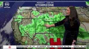
A large low-pressure system from the Pacific Northwest remained over California Thursday morning. It's going to shift around and impact Utah as it moves east, KSL meteorologist Kristen Van Dyke explained.
Some initial storms ahead of the main system arrived in northwest Utah Thursday morning. Scattered showers are possible across most of Utah throughout the day, with rain in valleys and snow in the mountains.
Storms will become more widespread by Thursday night and Friday morning, before the brunt of what's left targets Utah's northern half. A rain-snow mix is possible along the Wasatch Front, with some snow possible in bench areas Friday morning, Van Dyke said.
Valley snow is possible Friday evening, with a potential for lake-effect snow targeting mostly the mountains Saturday morning before the system clears out.
Warning issued
It prompted a winter storm warning for the Wasatch Mountains, where 1-2 feet is possible between Thursday and Saturday. The highest totals are expected in the upper Cottonwood Canyons, as well as the mountains near the Utah-Idaho border, per the weather service.
Traction laws might be enacted along some mountain passes.
"Winter driving conditions are expected. Roads, and especially bridges and overpasses, will likely become slick and hazardous," the agency's warning states.
Its updated advisories state that:
- Another 4 to 12 inches of snow might fall in the Uinta Mountains.
- The southern mountains could end up with 3 to 7 inches of snow, with upwards of 12 inches near Brian Head.
- Wasatch Back communities could end up with 4 to 8 inches of snow, with the higher totals closer to Park City and lesser totals near low terrain in Heber City.
The models also suggest that a trace to 2 inches of snow is possible across many valley locations.
Northern valleys could end up with another 0.25 to 0.75 inches of precipitation altogether, with slightly lower totals in valleys across central and southern Utah.
Weekend conditions will be chilly but dry across the state, before potentially more moisture begins next week.
Full seven-day forecasts for areas across Utah are available at the KSL Weather Center or on the KSL Weather app.