'%3e%3cpath%20d='M34.1406%205.85938C30.3906%202.10547%2025.3047%200%2020%200C14.6953%200%209.60938%202.10547%205.85938%205.85938C2.10938%209.61328%200%2014.6953%200%2020C0%2025.3047%202.10547%2030.3906%205.85938%2034.1406C9.61328%2037.8906%2014.6953%2040%2020%2040C25.3047%2040%2030.3906%2037.8945%2034.1406%2034.1406C37.8906%2030.3906%2040%2025.3047%2040%2020C40%2014.6953%2037.8945%209.60938%2034.1406%205.85938ZM37.0117%2023.543H31.1602V13.5391H27.6328V19.9414C28.1211%2020.6914%2028.3711%2021.582%2028.3711%2022.5625V22.625C28.3711%2023.668%2028.1172%2024.6055%2027.6328%2025.4297V26.6094H36.082C33.4883%2032.9375%2027.2891%2037.3789%2020.0039%2037.3789C10.3711%2037.3789%202.62109%2029.6289%202.62109%2020C2.62109%2010.3711%2010.3711%202.62109%2020%202.62109C29.6289%202.62109%2037.3789%2010.3711%2037.3789%2020C37.3789%2021.1484%2037.2617%2022.2656%2037.0508%2023.3477C37.0391%2023.4141%2037.0234%2023.4766%2037.0117%2023.543Z'%20fill='white'/%3e%3cpath%20d='M22.3086%2018.5352C20.4336%2018.125%2019.9531%2017.8398%2019.9766%2017.1836V17.1406C19.9766%2016.6992%2020.3477%2016.2148%2021.4023%2016.2148C22.582%2016.2148%2023.8867%2016.6797%2025.0781%2017.4766L26.8516%2015.0195C25.4453%2013.8906%2023.707%2013.3398%2021.5547%2013.3398C18.5195%2013.3398%2016.4375%2015%2016.4063%2017.4766V17.5352C16.3633%2020.2617%2018.5859%2020.9805%2021.293%2021.6016C23.0391%2021.9766%2023.5703%2022.3164%2023.5703%2022.9609L23.5469%2022.9766C23.5469%2023.3906%2023.2578%2023.7031%2022.7852%2023.8359C22.5742%2023.9062%2022.1289%2023.9727%2021.5156%2023.9727C20.7617%2023.9727%2019.7539%2023.8633%2018.6328%2023.4844C18.0898%2023.2891%2017.4727%2023.0039%2016.8047%2022.6133L20.1406%2026.625C20.2813%2026.6602%2021.0977%2026.8516%2021.7734%2026.8516C25.0039%2026.8516%2027.0859%2025.2461%2027.1094%2022.6328V22.5703C27.1602%2020.1133%2025.2148%2019.1719%2022.3086%2018.5352Z'%20fill='white'/%3e%3cpath%20d='M5.24219%2013.5664V26.6133H8.75391V23.7578L10.2969%2021.9531L14.2031%2026.6133H18.3867L12.3555%2019.5195L17.4023%2013.5664H13.4531L8.75391%2019.0586V13.5664H5.24219Z'%20fill='white'/%3e%3c/g%3e%3cdefs%3e%3cclipPath%20id='clip0_97_2430'%3e%3crect%20width='40'%20height='40'%20fill='white'/%3e%3c/clipPath%3e%3c/defs%3e%3c/svg%3e)




- Meteorologists predict a strong El Niño for the 2026-27 ski season.
- El Niño typically benefits southern ski areas, but poses unpredictable weather challenges.
- NOAA reports a 69% chance of El Niño surpassing historical strength since 1950.
SALT LAKE CITY — As the opening of the ski season moves closer, the predicted Super El Niño continues to gain strength. But what it means for mountain resorts in Utah and the West remains cloudy.
While winters are often marked by La Niña or El Niño weather events, this winter is setting up to be unlike any pattern seen before, with some meteorologists suggesting it could be the strongest El Niño on record, according to OnTheSnow.
OnTheSnow meteorologists dug into the possibilities in a recent post.
What Super El Niño could mean for the ski season
An El Niño winter historically favors ski areas that are further south, benefiting resorts in California, Colorado, and often Utah.
"However, it can sometimes be a wild card, especially when you factor in warmer temperatures. The reality is that there have only been three other very strong El Niño events since 1950. It's hard to make long-term weather predictions as it is, and that much more when facing a strong weather event like this. So at this point it's hard to say," they wrote.
The meteorologists said long-range winter forecasts aren't always instructive, especially during the absence of La Niña and El Niño.
La Niña and El Niño weather patterns serve as a historical guide, allowing meteorologists to look at data and forecasts from past seasons to make informed predictions when those patterns reemerge. But long-range snow forecasts, even in La Niña and El Niño years, don't always match up with actual snowfall.
In 2023, California was predicted to have a warmer and drier ski season as a result of a La Niña event. Multiple California ski areas, though, broke their all-time snowfall records.
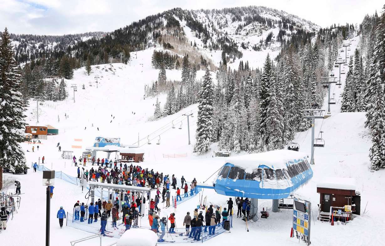
The rare "triple-dip" La Niña that continued into the 2022-23 ski season resulted in record-breaking snow for many Utah resorts, as well as other ski areas in the West. Alta exceeded 900 inches of snow for the first time in its history, recording 903″ of snow. A strong El Niño season that followed didn't have nearly the impact on the ski season, per OnTheSnow.
The 2025-26 season was a weak La Niña year, with historically low snowfall at many North American ski resorts.
What's the difference between El Niño and La Niña?
A La Niña event means that the sea surface temperatures, or SST, in the eastern tropical Pacific Ocean (around the equator) are below normal and that there's lower-than-normal air pressure over the western Pacific. El Niño is when the sea surface temperatures are above normal in the eastern tropical Pacific Ocean and there's higher-than-normal air pressure over the western Pacific, according OnTheSnow.
La Niña events and El Niño events oscillate every two to seven years and can immensely impact the ski season and the amount of snowfall that different mountain regions receive.
"El Niño is defined by warmer than normal (at least 0.5°C above normal) sea surface temperatures in the South Pacific Ocean near the Equator over a three-month period. When SSTs are at least 1.5°C above normal, it's considered a strong El Niño, and a super strong El Niño when SSTs are at least 2°C above normal," per OnTheSnow meteorologist Chris Tomer.
El Niño gaining strength
In August, the National Oceanic and Atmospheric Administration issued a statement that El Niño was strengthening, "with a greater than 90% chance of a very strong event during the Northern Hemisphere fall and winter 2026-27."
It reported that the sea surface temperature anomalies had already exceeded +2.0°C in the eastern equatorial Pacific, and that multiple models indicated that El Niño would continue to strengthen through the end of the year. The NOAA wrote that there was a "69% chance of a historic event that would exceed the strength of previous El Niño events dating back to 1950."
In a Sept. 10 update, the NOAA wrote that El Niño had strengthened further over the past few weeks, "with sea surface temperature anomalies exceeding +3.0°C in the eastern equatorial Pacific."