'%3e%3cpath%20d='M34.1406%205.85938C30.3906%202.10547%2025.3047%200%2020%200C14.6953%200%209.60938%202.10547%205.85938%205.85938C2.10938%209.61328%200%2014.6953%200%2020C0%2025.3047%202.10547%2030.3906%205.85938%2034.1406C9.61328%2037.8906%2014.6953%2040%2020%2040C25.3047%2040%2030.3906%2037.8945%2034.1406%2034.1406C37.8906%2030.3906%2040%2025.3047%2040%2020C40%2014.6953%2037.8945%209.60938%2034.1406%205.85938ZM37.0117%2023.543H31.1602V13.5391H27.6328V19.9414C28.1211%2020.6914%2028.3711%2021.582%2028.3711%2022.5625V22.625C28.3711%2023.668%2028.1172%2024.6055%2027.6328%2025.4297V26.6094H36.082C33.4883%2032.9375%2027.2891%2037.3789%2020.0039%2037.3789C10.3711%2037.3789%202.62109%2029.6289%202.62109%2020C2.62109%2010.3711%2010.3711%202.62109%2020%202.62109C29.6289%202.62109%2037.3789%2010.3711%2037.3789%2020C37.3789%2021.1484%2037.2617%2022.2656%2037.0508%2023.3477C37.0391%2023.4141%2037.0234%2023.4766%2037.0117%2023.543Z'%20fill='white'/%3e%3cpath%20d='M22.3086%2018.5352C20.4336%2018.125%2019.9531%2017.8398%2019.9766%2017.1836V17.1406C19.9766%2016.6992%2020.3477%2016.2148%2021.4023%2016.2148C22.582%2016.2148%2023.8867%2016.6797%2025.0781%2017.4766L26.8516%2015.0195C25.4453%2013.8906%2023.707%2013.3398%2021.5547%2013.3398C18.5195%2013.3398%2016.4375%2015%2016.4063%2017.4766V17.5352C16.3633%2020.2617%2018.5859%2020.9805%2021.293%2021.6016C23.0391%2021.9766%2023.5703%2022.3164%2023.5703%2022.9609L23.5469%2022.9766C23.5469%2023.3906%2023.2578%2023.7031%2022.7852%2023.8359C22.5742%2023.9062%2022.1289%2023.9727%2021.5156%2023.9727C20.7617%2023.9727%2019.7539%2023.8633%2018.6328%2023.4844C18.0898%2023.2891%2017.4727%2023.0039%2016.8047%2022.6133L20.1406%2026.625C20.2813%2026.6602%2021.0977%2026.8516%2021.7734%2026.8516C25.0039%2026.8516%2027.0859%2025.2461%2027.1094%2022.6328V22.5703C27.1602%2020.1133%2025.2148%2019.1719%2022.3086%2018.5352Z'%20fill='white'/%3e%3cpath%20d='M5.24219%2013.5664V26.6133H8.75391V23.7578L10.2969%2021.9531L14.2031%2026.6133H18.3867L12.3555%2019.5195L17.4023%2013.5664H13.4531L8.75391%2019.0586V13.5664H5.24219Z'%20fill='white'/%3e%3c/g%3e%3cdefs%3e%3cclipPath%20id='clip0_97_2430'%3e%3crect%20width='40'%20height='40'%20fill='white'/%3e%3c/clipPath%3e%3c/defs%3e%3c/svg%3e)




- Rachel's remnants could bring Utah's first significant mountain snow of the season.
- Up to 12 inches forecasted for Cottonwood Canyons; Uinta Mountains may see 2 feet.
- Rain increased soil moisture, aiding spring runoff; flash floods caused disruptions.
SALT LAKE CITY — The remnants of Tropical Storm Rachel have already delivered multiple inches of rain in many mountain locations, but leftover moisture is expected to provide the first meaningful snow of the new water year.
Upwards of a foot of snow is forecast for the top of the Cottonwood Canyons over the next few days, while even stronger totals are likely in the Uinta Mountains, according to KSL Weather and National Weather Service forecasting models.
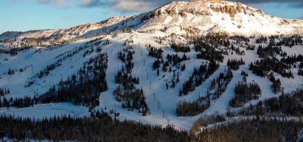
Some of Utah's resorts have already posted photos and videos showing their new snowfall.
Big water totals so far
Rachel's remnants delivered some big totals, as expected. Most mountain sites received at least an inch of rain, but places like the tops of the Cottonwood Canyons and Mount Timpanogos received closer to 5 inches of precipitation, KSL meteorologist Devan Masciulli said.
Some valley communities also received more than an inch of rain, including Brigham City, Centerville and New Harmony.
On the bright side, it caused a big spike in Utah's mountain soil moisture levels, which can improve snowpack runoff efficiency in the spring.
The statewide average spiked from normal for mid-October toward near record-high for the past 20 years that the Natural Resources Conservation Service has collected data.
It also created all sorts of mayhem across Utah on Sunday. Dozens of ultramarathon runners were rescued in Moab, while state Route 190 in Big Cottonwood Canyon was closed for hours due to flooding. The route reopened on Monday.
Flash flood warnings were also issued in southwest Utah, including Zion National Park, over the weekend. The Pine Valley area also received over 5 inches, prompting a warning because of its proximity to the Forsyth Fire burn scar.
Rain to snow
Rachel has left, but the storm's leftovers are still creating showers across the state. Meanwhile, a low-pressure system over Oregon on Monday is projected to slide into Nevada by the afternoon, helping boost showers and storms in Utah — with cooler air bringing snow to the mountains.
That low-pressure system will dominate Utah's weather over the next few days, Masciulli explained.
The slow-moving system is expected to move toward Utah on Tuesday, crossing through the state on Wednesday. As it does, the snow line will likely dive to approximately 9,000 feet to 8,000 feet elevation because of a cold front out in front of it.
Some additional moisture is possible on Thursday.
"The circulational low, specifically, will be moving over Utah, and that provides good lift for storms and showers to develop," Masciulli said. "When we have these cutoff low systems, they kind of take their time, so that's why we're keeping these showers and storms bands in the forecast (on Monday, Tuesday), and tapering off in the western half on Wednesday — and maybe lingering in northeast Utah on Thursday."
Approximately 2 to 6 inches of snow is expected across most of Utah's mountains between Monday and early Thursday, with central and southern Utah likely to have the higher end of that. However, 6 to 12 inches is possible across the top of the Cottonwood Canyons, and Uinta Mountains could end up with 1 to 2 feet of snow, as well.
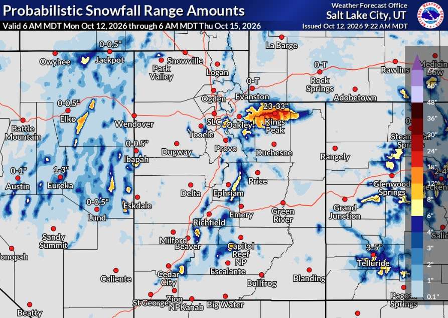
There is a possibility for more, should the right conditions form over the next few days, Masciulli added.
For instance, a National Weather Service model lists Alta as having a 58% chance of receiving 12 inches of snow by Thursday morning, but a 16% probability of receiving 18 inches. Brian Head Resort in Iron County has a 32% chance of getting 18 inches, even though it might get less than a foot of snow.
It's a solid start to the 2027 water year after last year's record-low snowpack.
"This is really good going into the colder season," Masciulli said. "Outside of the flash flooding, this has been a beneficial storm."
Full seven-day forecasts for areas across Utah can be found at the KSL Weather Center or on the KSL Weather app.