'%3e%3cpath%20d='M34.1406%205.85938C30.3906%202.10547%2025.3047%200%2020%200C14.6953%200%209.60938%202.10547%205.85938%205.85938C2.10938%209.61328%200%2014.6953%200%2020C0%2025.3047%202.10547%2030.3906%205.85938%2034.1406C9.61328%2037.8906%2014.6953%2040%2020%2040C25.3047%2040%2030.3906%2037.8945%2034.1406%2034.1406C37.8906%2030.3906%2040%2025.3047%2040%2020C40%2014.6953%2037.8945%209.60938%2034.1406%205.85938ZM37.0117%2023.543H31.1602V13.5391H27.6328V19.9414C28.1211%2020.6914%2028.3711%2021.582%2028.3711%2022.5625V22.625C28.3711%2023.668%2028.1172%2024.6055%2027.6328%2025.4297V26.6094H36.082C33.4883%2032.9375%2027.2891%2037.3789%2020.0039%2037.3789C10.3711%2037.3789%202.62109%2029.6289%202.62109%2020C2.62109%2010.3711%2010.3711%202.62109%2020%202.62109C29.6289%202.62109%2037.3789%2010.3711%2037.3789%2020C37.3789%2021.1484%2037.2617%2022.2656%2037.0508%2023.3477C37.0391%2023.4141%2037.0234%2023.4766%2037.0117%2023.543Z'%20fill='white'/%3e%3cpath%20d='M22.3086%2018.5352C20.4336%2018.125%2019.9531%2017.8398%2019.9766%2017.1836V17.1406C19.9766%2016.6992%2020.3477%2016.2148%2021.4023%2016.2148C22.582%2016.2148%2023.8867%2016.6797%2025.0781%2017.4766L26.8516%2015.0195C25.4453%2013.8906%2023.707%2013.3398%2021.5547%2013.3398C18.5195%2013.3398%2016.4375%2015%2016.4063%2017.4766V17.5352C16.3633%2020.2617%2018.5859%2020.9805%2021.293%2021.6016C23.0391%2021.9766%2023.5703%2022.3164%2023.5703%2022.9609L23.5469%2022.9766C23.5469%2023.3906%2023.2578%2023.7031%2022.7852%2023.8359C22.5742%2023.9062%2022.1289%2023.9727%2021.5156%2023.9727C20.7617%2023.9727%2019.7539%2023.8633%2018.6328%2023.4844C18.0898%2023.2891%2017.4727%2023.0039%2016.8047%2022.6133L20.1406%2026.625C20.2813%2026.6602%2021.0977%2026.8516%2021.7734%2026.8516C25.0039%2026.8516%2027.0859%2025.2461%2027.1094%2022.6328V22.5703C27.1602%2020.1133%2025.2148%2019.1719%2022.3086%2018.5352Z'%20fill='white'/%3e%3cpath%20d='M5.24219%2013.5664V26.6133H8.75391V23.7578L10.2969%2021.9531L14.2031%2026.6133H18.3867L12.3555%2019.5195L17.4023%2013.5664H13.4531L8.75391%2019.0586V13.5664H5.24219Z'%20fill='white'/%3e%3c/g%3e%3cdefs%3e%3cclipPath%20id='clip0_97_2430'%3e%3crect%20width='40'%20height='40'%20fill='white'/%3e%3c/clipPath%3e%3c/defs%3e%3c/svg%3e)




Estimated read time: 2-3 minutes
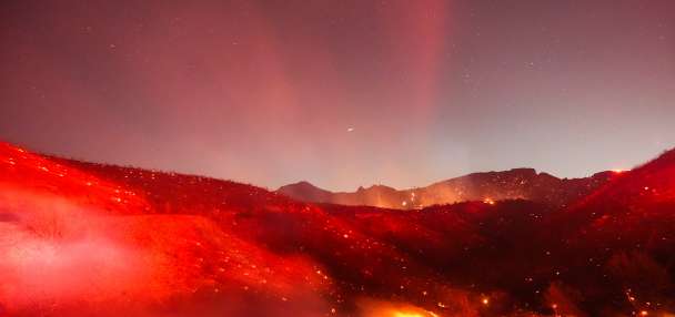
- The U.S. Forest Service plans controlled burns in Millcreek, Parleys and Lambs canyons.
- Operations will cover 114 acres to reduce wildfire risks, starting as early as Sunday.
- Residents may see smoke until operations are scheduled to end on Tuesday.
MILLCREEK — Federal foresters plan to carry out prescribed fire operations across more than 100 acres in three canyons between Salt Lake and Summit counties to reduce future wildfire threats.
The efforts seek to reduce overgrown vegetation across approximately 64 acres in Lambs Canyon, 25 acres in Millcreek Canyon and another 25 acres in Parleys Canyon in the Uinta-Wasatch-Cache National Forest.
Scheduled burns will begin on Sunday and last through Tuesday, barring weather concerns, the U.S. Forest Service said in a statement. Foresters believe that the work will help protect communities, infrastructure and natural resources from future wildfires.
The specific areas that will be targeted are:
- Millcreek Canyon Road (from the winter gate to Big Water Trailhead) in Millcreek Canyon.
- Lambs Canyon Road (south side) in Lambs Canyon.
- South of I-80 near Parleys Summit/Summit Park in Parleys Canyon.
All three areas may be closed to the public for several days during the operations. The agency says residents may see smoke during the prescribed burns, but they do not need to report it.
The Utah Division of Forestry, Fire and State Lands is assisting in some of the projects.
All three operations are the latest efforts in the area. The last major fire that ripped through Millcreek Canyon was almost 150 years ago, and the canyon has what's considered a "150-year fire return interval," Stuart Bedke, a zone fuels specialist for the Salt Lake Ranger District, explained in a U.S. Forest Service video two years ago.
The natural life cycle of trees, beetles and drought issues have all led to an increase in dead trees, which leads to increased fire risks, he added at the time. Thinning out problematic spots in it and neighboring canyons helps firefighters thwart the spread of the next big fire.
"The intent is to have connectivity, so that we have multiple options in each canyon, depending on where the fire starts, to catch it before it goes through the entire," he said.
This year's work comes as some of Utah's other forests were strongly impacted by one of the state's worst fire seasons on record. University of Utah researchers found that the number of forest and woodland acres lost to fire this year exceeds any other year in modern history, highlighting a growing threat at higher elevations.
Most of those fires were in central and southern Utah, with some in eastern Utah, but Phil Dennison, a University of Utah professor who specializes in wildfire-related impacts and led the research, said in August the risk could move to other regions as drought conditions continue to plague the state.
"My biggest concern is that ... we may be headed toward more fires at higher elevations, even in the Wasatch," he said at the time.