
- An atmospheric river may impact Utah's Halloween activities with scattered showers expected.
- Most rain will occur after Halloween with heavy rain and mountain snowfall toward the end of the weekend.
- Heavy rain could cause flooding in saturated area, weather service warns.
SALT LAKE CITY — Utah's wet weather pattern isn't over just yet, and it could affect some Halloween activities in the state.
However, the brunt of stormy activity is expected after the holiday, bringing a mix of valley rain and mountain snow.
Weather heading into Halloween
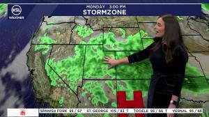
A low-pressure system arriving from the Pacific Northwest is forecast to blend with other stormy activity across the West over the next few days, which will help haul heavy tropical moisture in from the Pacific Ocean toward the Southwest.
Scattered showers and thunderstorms ahead of the primary system are forecast for most of Utah on Friday afternoon and evening, with the possibility of excessive rainfall across southern, central and eastern Utah.
The strongest odds for heavy rainfall are in the high-elevation parts of the southwest, such as the Pine Valley and Tushar Mountains, including Brian Head, said KSL meteorologist Devan Masciulli.
Some showers could make it to the Wasatch Front and northern Utah, as well, especially Friday night and Saturday morning.
Excessive rain probabilities lessen on Halloween, Saturday, but there will still be a chance, especially in southwest Utah. Some isolated pockets of rain are possible across the state, but likely not a lot over the afternoon and evening, she added.
Weather models hint that upwards of 0.75 inches is possible by Saturday night, with upwards of 0.25 inches in other parts of southwestern and eastern Utah. Lesser totals are expected in central and northern Utah.
High temperatures are forecast to reach the low to mid-60s across the Wasatch Front and northern Utah on Friday and Saturday, with temperatures dipping into the mid-50s by 9 p.m. each night. Temperatures are forecast to remain in the 60s closer to St. George during the afternoons and evenings.
A jacket might be helpful while trick-or-treating or other outdoor Halloween events either night, but it should be a generally dry Halloween evening for most Utahns, Masciulli said.
Wet start to November
The brunt of the moisture, this time more widespread across the state, is expected to arrive by early Sunday as the storm systems collide. The heaviest of that will be when the cold front arrives, which appears to be Sunday afternoon.
The cold front is projected to also drop snow levels from approximately 10,000 feet elevation to 9,000 feet and eventually 7,000 feet. It's expected to fall to as low as 6,500 feet elevation by Monday morning.
The bulk of the system will likely have moved east toward Colorado by Monday, but weather models hint that additional lake-effect showers may linger near the Wasatch Mountains.
Most communities across the state have the potential to receive at least 0.5 inches of precipitation total by Monday afternoon, with over an inch possible in parts of southern Utah and the Wasatch Front, KSL Weather models suggest.
Multiple inches of precipitation are likely in the mountains, especially in southern Utah.
Most mountain areas will likely receive 4-8 inches of snow, but the upper Cottonwood Canyons could end up with 8-16 inches and the Uintas could receive even higher totals, largely boosted by the cold front. Brian Head could also receive upwards of a foot because it's closest to the heavy moisture coming in from the Pacific Ocean.
While it's good for chipping away at drought, the downside is potential flooding.
Additional flooding is possible in southern Utah, including some of the areas that experienced it in southeastern Utah last week, said Erin Walter, a hydrologist for the National Weather Service's Grand Junction office.
"Additional rain on those saturated soils in flood-prone areas will be problematic heading into the weekend," she said.
Full seven-day forecasts for areas across Utah can be found at the KSL Weather Center or on the KSL Weather app.