Estimated read time: 4-5 minutes
This archived news story is available only for your personal, non-commercial use. Information in the story may be outdated or superseded by additional information. Reading or replaying the story in its archived form does not constitute a republication of the story.
SALT LAKE CITY -- The Utah Department of Transportation has temporarily banned high-profile vehicles from driving on Interstate 80 due to high winds. The closure extends from Wendover at the Utah-Nevada state line to milepost 99, near Lakepoint in Tooele County. UDOT did not say when it expects to lift the ban. High wind and winter storm warnings are in effect across Utah this weekend. Winds will continue to increase over western Utah valleys Saturday ahead of a front and spread into southern Utah, with some gusts over 65 mph expected. These will be the strongest winds of the season, according to the National Weather Service. "Winds will remain strong tonight with gusts up to 50 and 60 mph from the southwest, keeping temperatures on the mild side," said KSL meteorologist Devin Masciulli. "Expect rain first, then once the cold front passes, precipitation will quickly switch over to snow." The front will impact northern Utah between 8 a.m. and noon, the Wasatch Front from noon to 4 p.m., and central and southern Utah through the evening. https://twitter.com/NWSSaltLakeCity/status/1763910391590179192
SALT LAKE CITY (Friday, 4:03 p.m.) -- The National Weather Service issued a high wind and winter storm warning for Utahns this weekend as strong winds are forecasted along the Wasatch Front. Widespread gusts up to 65 mph are predicted across valleys of western Utah south of Interstate 80, and southern Utah. Stronger winds are expected in areas along exposed ridgelines. "The wind can have a lot of factors to where you end up for the day," said Aaron Ortiz, who drives trucks cross-country for a living. "When the wind hits you ... it yanks your steering wheel." On Saturday, the winds are going to yank the wheel a lot harder than on Friday, according to the Utah Highway Patrol. "Sixty-five mph gusts. That's something significant," said UHP Sgt. Chris Bishop. UHP is warning travelers who want to drive on I-80 to expect the worst. Troopers are particularly urging truckers and drivers of other high-profile vehicles to not travel on I-80. "With them, we're saying, 'Hey ... stay put,'" Bishop said. "Don't act like a sail and get yourself knocked over." Following the wind, rain and snowfall are predicted across northern mountains on Friday, with heavy snow expected for the rest of northern and central Utah starting Saturday evening. Lingering showers can be expected on Sunday. Due to road conditions, people all across the state are advised to reduce travel and slow down behind the wheel. Avoiding trucks, trailers, and overpasses is recommended when possible. Wind blowing rain and snow may limit drivers' visibility. The following routes will experience weather-related travel concerns this weekend, according to UDOT:
- I-15, ID border to Blackridge (south of Cedar City)
- I-80, Entire Route
- I-84, Entire route
- I-215, Entire Route
- I-70, Entire Route
- U.S. 89, Entire Route
- U.S. 6, Entire Route
- U.S. 40, Entire Route
- U.S. 191, Entire Route
- U.S. 50, Entire route
- S.R. 190 Big Cottonwood, Entire route
- S.R. 210 Little Cottonwood, Entire route
- S.R. 30, Entire route
- S.R. 31, Entire route
- S.R. 35, Francis to the closure gate
- S.R. 39, Entire route
- S.R. 150, Entire route
- S.R. 158, Entire route
- S.R. 158, Entire route
- S.R. 143, Entire route
- S.R. 14, Entire route
- S.R. 20, Summit
- S.R. 153, Entire route
Power impact
Rocky Mountain Power officials expect the weather to cause some outages, and have crews ready to respond and restore power. All downed wires and fallen trees should be avoided and reported. Customers can call 877-508-5088, use the Rocky Mountain Power app or text "out" to 759677 to receive updates during the restoration process.
Resort safety
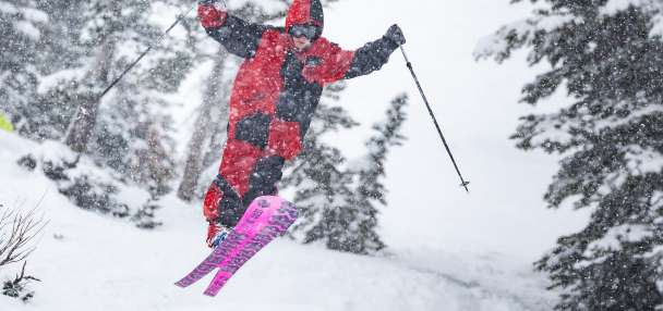
Although the storm will bring new snow, some ski resorts are closing lifts due to the intensity of the winds. Resorts include Powder Mountain, Snowbasin and Deer Valley. Little Cottonwood Canyon and Big Cottonwood Canyon had traction laws in effect Friday night. https://twitter.com/SnowbasinResort/status/1763582325915525453https://twitter.com/Deer_Valley/status/1763580606032785856 Powder Mountain announced the resort would be closed for night skiing on Friday and day skiing on Saturday. https://ksltv.com/626977/powder-mountain-announces-closure-friday-night-saturday-due-to-extreme-winds/ Brighton Resort announced night riding will be cancelled Saturday night due to extreme weather conditions. https://twitter.com/BrightonResort/status/1764003811977568501 Travel to these resorts may be restricted as snowfall continues. Cameras and updates on resort websites may provide live reports on conditions. Travelers are discouraged from weekend travel to Lake Tahoe ski resorts, as road and resort closures continue. If travel is necessary, officials advise emergency kits with extra food and blankets be kept on hand. The latest road conditions can be obtained by calling 511.