
Estimated read time: Less than a minute
This archived news story is available only for your personal, non-commercial use. Information in the story may be outdated or superseded by additional information. Reading or replaying the story in its archived form does not constitute a republication of the story.
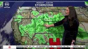
SALT LAKE CITY — Utahns were given a short break from the record-high temperatures on Thursday and Friday, but the forecast shows it will only last for the weekend. According to the KSL Weather team, the first storm front of the month will hit most areas of the state on Thursday and Friday, bringing rain to the valleys and snow to the mountains, like the Utah Mountains. Temperatures will be in the high 30s to low 50s during the passing storm.
Our second snow of the season in the Utah Mountains. Could be talking “snowliage” photo opportunities in the Cottonwoods 👀 🍁 ❄️ #utwxpic.twitter.com/wWiPEXM8Uy — Matthew Johnson (@KSL_Matt) October 17, 2024
On Saturday and Sunday, KSL Weather reports that the storm front will be mostly gone as the weather slowly climbs back into the 60s and low 40s. According to KSL Weather, the sun and 70-degree temperatures will return from Monday onwards, with lows in the high 40s. https://ksltv.com/695366/weather-wont-stop-some-from-preparing-for-a-hunt-in-duchesne-county/