

Estimated read time: 2-3 minutes
This archived news story is available only for your personal, non-commercial use. Information in the story may be outdated or superseded by additional information. Reading or replaying the story in its archived form does not constitute a republication of the story.
UPDATE (5:48 p.m.) — A flash flood warning was issued Sunday evening for portions of Grand and San Juan counties until 8:30 p.m. The warning was for northern San Juan County and southern Grand County. The San Juan County Facebook page stated: "Doppler radar indicated thunderstorms producing heavy rain across the Mill Creek and North Mill Creek drainages above Moab and Spanish Valley, UT." Roughly a half inch of rain has already fallen and another half inch is possible. "Flash flooding is ongoing or expected to begin shortly through Mill Creek and expected to reach Moab within an hour," the post further stated.
UPDATE (4:55 p.m.) — A severe thunderstorm rolled through the Helper area Sunday that produced roughly quarter-size and left many parts in flooding. In some spots, the hail caused property damage. [gallery ids="675109,675110,675111,675112"]
MOAB — The National Weather Service warned of strong to severe thunderstorms in eastern Utah Sunday and activated a flash flood watch, which is expected to be active from noon through Sunday evening. The weather alert came after the state saw devastating flooding in central Utah Monday and throughout the week. The main area under flood watch Sunday according to NWS is southeastern Utah. Thunderstorms were forecasted for the majority of eastern Utah.
A severe thunderstorm watch has been issued for parts of Colorado, Utah and Wyoming until 8 PM MDT pic.twitter.com/SPeoyMYPvC — NWS Salt Lake City (@NWSSaltLakeCity) August 25, 2024
Flood watch
NWS said the main cities included in the flood watch were:
- Blanding
- Goulding
- Bluff
- Tselakai Dezza
- Aneth
- Montezuma Creek
- Mexican Hat
- Halchita
- White Mesa
- Glen Canyon National Recreation Area
- Rainbow Bridge South Trailhead
- Moab
- Green River
- Castle Valley
- Monticello
- La Sal
- Eastland
- Spanish Valley
- Fry Canyon
- Canyonlands National Park
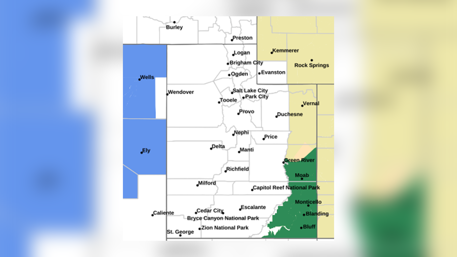
The flood warning said there may be rivers, creeks and streams that overflow due to excessive runoff from heavy rainfall. Poor drainage areas were said to be at risk in urban areas and extensive street flooding was possible. San Juan County advised residents in the area to take precautionary measures and to monitor forecasts closely.
Severe thunderstorm warning
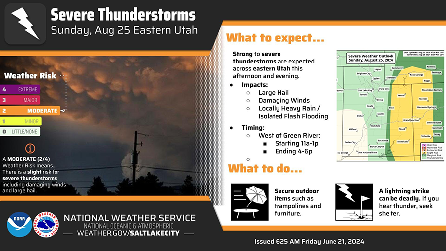
The NWS said there could be large hail, damaging winds and heavy rain all over eastern Utah starting midday. Storms would move east of the Green River after 4 to 6 p.m., it said. "The main hazard types will be damaging wind gusts, large hail and locally heavy rainfall," NWS said.